Old Maps of Collinwood, Tennessee for Genealogy
Trace your family roots with 17 historic maps of Collinwood. These high-res maps reveal old neighborhoods, homesites, landmarks, and streets — helping you uncover where your ancestors lived and how the area evolved over time.
- Explore historic neighborhoods: Identify where your relatives may have lived in the 1800s or 1900s.
- Compare maps over time: Trace the changes in streets, buildings, and landmarks for multi-generational research.
- Perfect for genealogy & ancestry research: Used by family historians and researchers to map out lineage and migration.
These maps are an incredible resource for exploring your personal connection to Collinwood's past.
Collinwood, TN maps
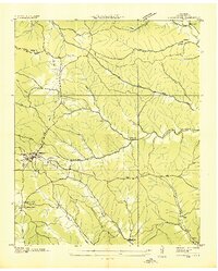
(17)- 1905 Map of Waynesboro
 1905 Waynesboro1905 Print · USGSWayne County and the Tennessee-Alabama borderlands are captured here at the start of the century, showing a network of river landings and old stage stands. Researchers can trace the Nathez Trace and locate historic community hubs like Martins Mills, Whittens Stand, and Clifton.2 unique versions available
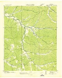
 - 1936 Map of Collinwood
 1936 Collinwood1936 Print · USGSCollinwood and the surrounding Wayne County hill country appear here during the mid-1930s as a landscape of rural schools and active rail lines. Genealogists and researchers can locate family-named sites like McGlamerys Stand and McCall Sch or trace the early paths of State Highway 13.
 - 1936 Map of Three Churches
 1936 Three Churches1936 Print · USGSWayne County during the mid-1930s was a landscape of remote creek-side communities and family homesteads. Genealogists can trace local heritage through landmarks like Three Churches, the Mill Dam at Victory, and schools like Memorial Sch.
 - 1951 Map of Three Churches, 1954 Print
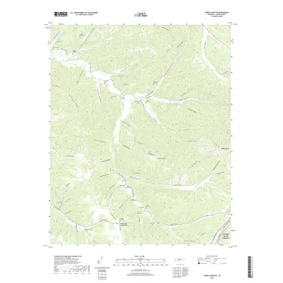
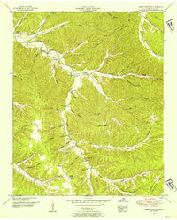 1951 Three Churches1954 Print · USGSWayne County in the early fifties shows a landscape of deep hollows and high ridges centered on the Three Churches community. Genealogists can locate legacy sites like Cromwell Crossroads, the Indian Creek School, and family plots at Copeland Cem.2 unique versions available
 - 1951 Map of Collinwood, 1956 Print
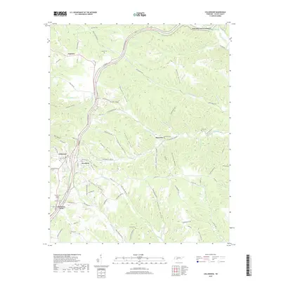
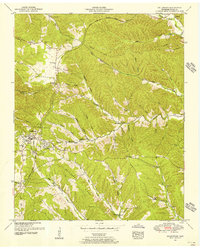 1951 Collinwood1956 Print · USGSCollinwood and the surrounding Wayne County timberlands appear in the early fifties during the modern development of the Natchez Trace Parkway. Genealogists can locate family sites at Risner Cem, McCall Sch, and the settlement of McGlamerys Stand.2 unique versions available
 - 1956 Map of Columbia, 1960 Print
 1956 Columbia1960 Print · USGSMiddle Tennessee in the mid-fifties presents a landscape of established river towns and critical rail hubs before the arrival of the modern interstate system. Researchers can trace the routes of the Louisville and Nashville railroad or locate historic landmarks like Stones River National Military Park and the Tennessee National Wildlife Refuge.6 unique versions available
 - 1985 Map of Lawrenceburg
 1985 Lawrenceburg1985 Print · USGSMiddle Tennessee and Northern Alabama are captured in the mid-1980s, showcasing a landscape of high ridges and winding river valleys. Genealogists and historians can trace rail lines like the Seaboard System Railroad or locate community landmarks such as Saint Marys Church and Three Churches.2 unique versions available
 - 2010 Map of Three Churches, 2010 Print
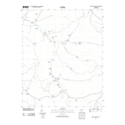 2010 Three Churches2010 Print · USGSCovers Collinwood, including Cromwell Crossroads, Wayne County, and other nearby areas
 - 2010 Map of Collinwood, 2010 Print
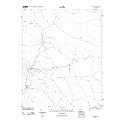 2010 Collinwood2010 Print · USGSCovers Collinwood, including Highland, Woodlawn, and other nearby areas
 - 2013 Map of Collinwood, 2013 Print
 2013 Collinwood2013 Print · USGSCovers Collinwood, including Highland, Woodlawn, and other nearby areas
 - 2013 Map of Three Churches, 2013 Print
 2013 Three Churches2013 Print · USGSCovers Collinwood, including Cromwell Crossroads, Wayne County, and other nearby areas
 - 2016 Map of Collinwood, 2016 Print
 2016 Collinwood2016 Print · USGSCovers Collinwood, including Highland, Woodlawn, and other nearby areas
 - 2016 Map of Three Churches, 2016 Print
 2016 Three Churches2016 Print · USGSCovers Collinwood, including Cromwell Crossroads, Wayne County, and other nearby areas
 - 2019 Map of Collinwood, 2019 Print
 2019 Collinwood2019 Print · USGSCovers Collinwood, including Highland, Woodlawn, and other nearby areas
 - 2019 Map of Three Churches, 2019 Print
 2019 Three Churches2019 Print · USGSCovers Collinwood, including Cromwell Crossroads, Wayne County, and other nearby areas
 - 2022 Map of Three Churches, 2022 Print
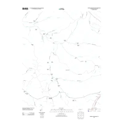
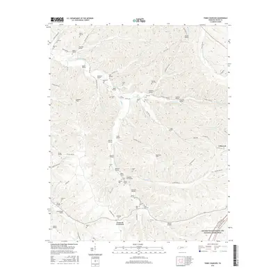
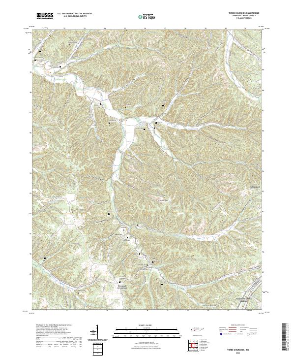 2022 Three Churches2022 Print · USGSWayne County, Tennessee, is mapped here in the modern era, showing a landscape of family-named ridges and deep hollows. Genealogists can trace family burial sites like Cypert-Copeland-Lay Cem and Downing-Byler Cem near the Natchez Trace Parkway.
 - 2022 Map of Collinwood, 2022 Print
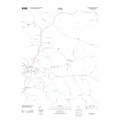
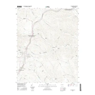
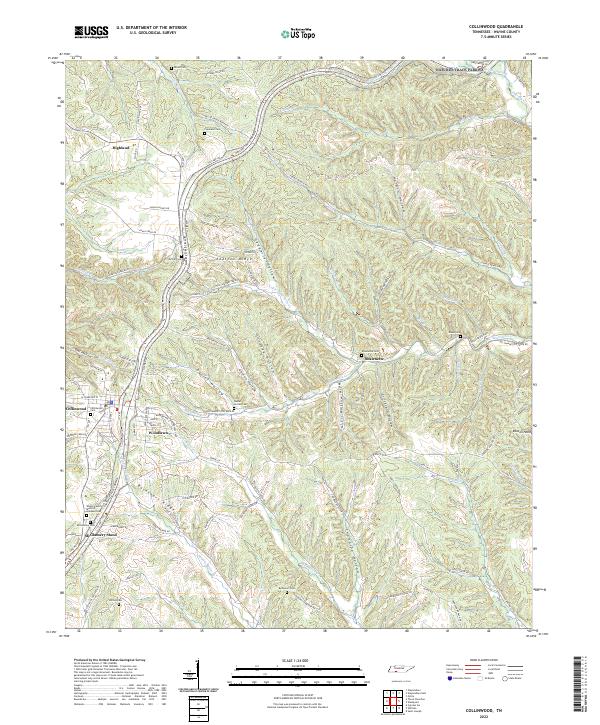 2022 Collinwood2022 Print · USGSWayne County in the early twenty-first century is defined by the historic corridor of the Natchez Trace Parkway and the town of Collinwood. Researchers can trace local lineage through a dozen rural burial grounds, including Shawnette Cem, Daniel Horton Cem, and McGlamery Cem.
End of results
Showing maps 1-17 of 17
Top cities near Collinwood
Top neighborhoods of Collinwood
Frequently asked questions
- What are the different types of historical maps available for Collinwood?
- What is the oldest map of Collinwood?
- Where can I purchase historical maps of Collinwood for my home or office?
- Where can I download high-res historical maps of Collinwood?
- Are there historical topographic maps available for Collinwood?
- Is there historical aerial imagery available for Collinwood?
- Where are historical maps of Collinwood sourced from?