Old Maps of Martin, Tennessee for Academic Research
Study the evolution of Martin with 15 high-resolution historic maps. Whether you're teaching, researching, or modeling changes in land use, these maps provide essential visual documentation of urban, environmental, and geographic change.
- Analyze long-term change: Track patterns in development, transportation, and natural features.
- Ideal for environmental or urban studies: Support academic projects with primary historical map data.
- Use in the classroom or lab: Educators and researchers rely on these maps to bring historical context to life.
These maps are a powerful tool for teaching, research, and visualizing how Martin has changed over the decades.
Martin, TN maps
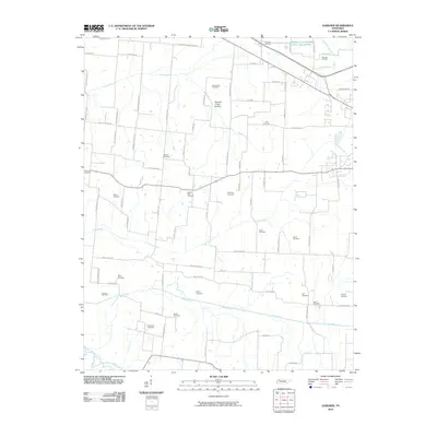
(15)- 1950 Map of Martin, 1952 Print
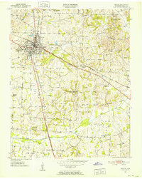 1950 Martin1952 Print · USGSWeakley County at mid-century reveals a landscape shaped by higher education and intersecting rail lines. Genealogists and historians can trace family roots through numerous sites like Bible Union Ch, Freemans Chapel, and the Old McClain Cem.4 unique versions available
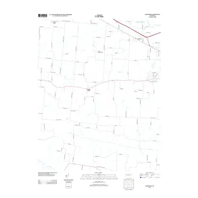
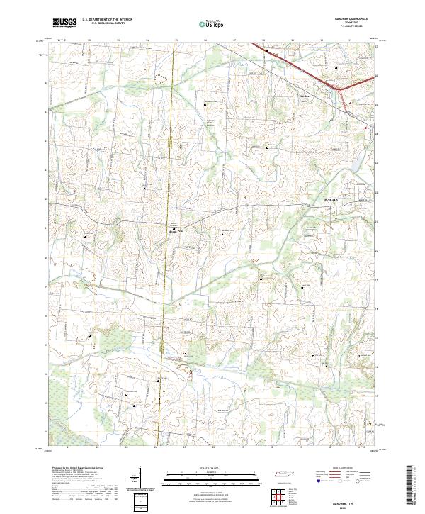
 - 1956 Map of Gardner
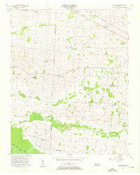 1956 Gardner1956 Print · USGSWeakley and Obion counties are captured here in the mid-fifties, showing a rural Tennessee landscape defined by family farmsteads and the Nashville Chattanooga and St Louis rail line. Researchers can locate numerous family-named landmarks such as Shaddtown Cem, McKinney Cem, and Alamo Ch.3 unique versions available
 - 1956 Map of Dyersburg, 1960 Print
 1956 Dyersburg1960 Print · USGSThe Four Rivers region comes alive in the mid-fifties, capturing the intricate borderlands of Tennessee, Kentucky, and Missouri. Genealogists and historians can trace the rail-and-river networks connecting Dyersburg, Caruthersville, and the shoreline of Reelfoot Lake.4 unique versions available
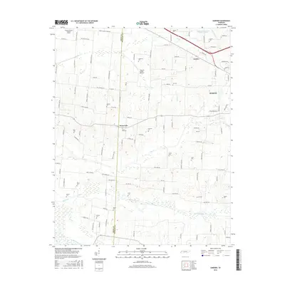
 - 1972 Map of Martin
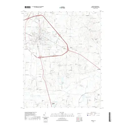
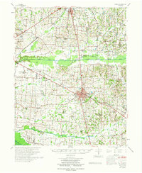 1972 Martin1972 Print · USGSWeakley and Obion Counties are captured here in the early 1970s as agricultural communities centered around the rail junction at Martin. Genealogists can trace family landmarks like Morris Slave Cem, Chestnut Glade Sch, and the Crockett Cem.
 - 1986 Map of McKenzie
 1986 McKenzie1986 Print · USGSWest Tennessee in the mid-eighties was a landscape defined by its deep river forks and the massive waters of Kentucky Lake. Researchers can trace the rail lines of the Louisville & Nashville RR and find local landmarks from Skullbone to the Paris Landing State Park.3 unique versions available
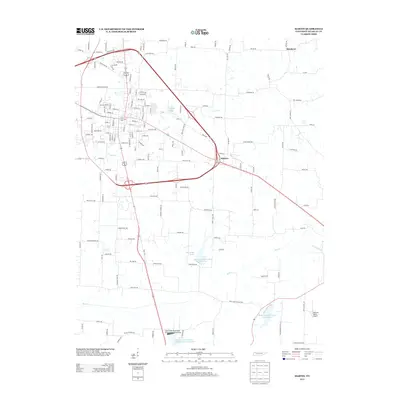
 - 2010 Map of Martin, 2010 Print
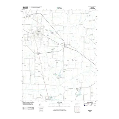 2010 Martin2010 Print · USGSCovers Martin, including Dresden, Ralston, and other nearby areas
 - 2010 Map of Gardner, 2010 Print
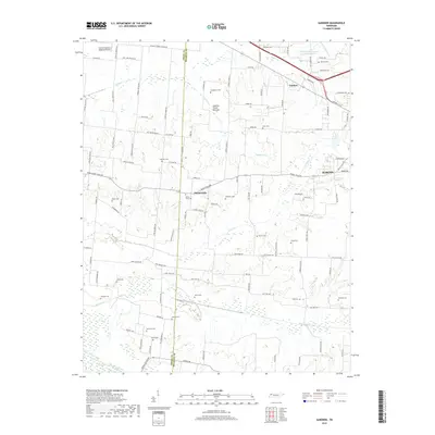
 2010 Gardner2010 Print · USGSCovers Martin, including Gardner, Mount Pelia, and other nearby areas
 - 2013 Map of Gardner, 2013 Print
 2013 Gardner2013 Print · USGSCovers Martin, including Gardner, Mount Pelia, and other nearby areas
 - 2013 Map of Martin, 2013 Print
 2013 Martin2013 Print · USGSCovers Martin, including Dresden, Ralston, and other nearby areas
 - 2016 Map of Gardner, 2016 Print
 2016 Gardner2016 Print · USGSCovers Martin, including Gardner, Mount Pelia, and other nearby areas
 - 2016 Map of Martin, 2016 Print
 2016 Martin2016 Print · USGSCovers Martin, including Dresden, Ralston, and other nearby areas
 - 2019 Map of Gardner, 2019 Print
 2019 Gardner2019 Print · USGSCovers Martin, including Gardner, Mount Pelia, and other nearby areas
 - 2019 Map of Martin, 2019 Print
 2019 Martin2019 Print · USGSCovers Martin, including Dresden, Ralston, and other nearby areas
 - 2022 Map of Gardner, 2022 Print
 2022 Gardner2022 Print · USGSThe borderlands of Obion and Weakley counties come into focus in this recent survey of rural Tennessee. Genealogists can trace family landmarks through more than a dozen local burial sites such as Callicott Cem, McKinney Cem, and Holland Cem near Mount Pelia.
 - 2022 Map of Martin, 2022 Print
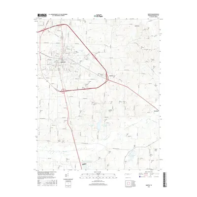
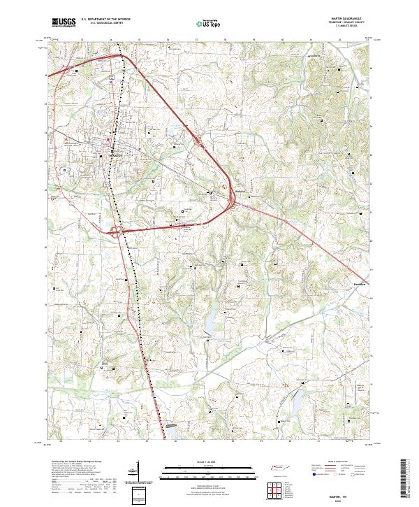 2022 Martin2022 Print · USGSWeakley County at the start of the 2020s shows a landscape where university life and rural heritage intersect. Genealogists can trace family lines through dozens of burial sites including Yellow Fever Cem, Old Salem Cem, and the Rice - Underwood Cem.
End of results
Showing maps 1-15 of 15
Top cities near Martin
- Union City historical maps
- Dresden historical maps
- Fulton historical maps
- South Fulton historical maps
- Greenfield historical maps
- Gleason historical maps
See more
Frequently asked questions
- What are the different types of historical maps available for Martin?
- What is the oldest map of Martin?
- Where can I purchase historical maps of Martin for my home or office?
- Where can I download high-res historical maps of Martin?
- Are there historical topographic maps available for Martin?
- Is there historical aerial imagery available for Martin?
- Where are historical maps of Martin sourced from?