Old Maps of Cassin, San Antonio
Explore 11 old maps of Cassin, spanning from 1953 to today. These high-resolution historic maps reveal how streets, neighborhoods, landmarks, and natural features evolved over time — perfect for genealogy, metal detecting, research, and local history exploration.
What you can do with these maps:
- See how Cassin changed over time: Compare historical maps to modern-day views to trace roads, homesites, rail lines & more.
- View detailed metadata: Each map includes creators, publishers, year, scale, and archive source.
- Overlay maps with satellite & LiDAR: Visualize the past alongside modern tools to explore terrain & human change.
- Trusted historical sources: Maps sourced from the USGS, Library of Congress, and other archives.
- Access maps your way: View online, download high-res files, or order prints for personal or research use.
Start exploring old maps of Cassin to uncover forgotten places, hidden landmarks, and the deep history beneath your feet.
Cassin, San Antonio maps
(11)- 1953 Map of Southton, 1959 Print
 1953 Southton1959 Print · USGSSouth of San Antonio in the early fifties, the landscape was a mix of historic missions, expanding airfields, and active oil production. Genealogists and historians can trace Southton, the Espada Mission & Cemetery, and the early layout of Brooks Air Force Base.
 - 1954 Map of San Antonio, 1964 Print
 1954 San Antonio1964 Print · USGSSan Antonio and the Texas Hill Country are captured here in the mid-fifties, showing a landscape defined by massive military air bases and the rising Canyon Reservoir. Trace family ties through historic rail towns like D'Hanis and Castroville or explore the Cold War footprint of Lackland AFB and Randolph AFB.3 unique versions available
 - 1957 Map of San Antonio
 1957 San Antonio1957 Print · USGSSan Antonio and the Texas Hill Country are shown here during the mid-fifties, capturing the region's expanding post-war military and transportation footprint. Genealogists and local historians can trace the early residential boundaries of Alamo Heights or locate rural landmarks like St Hedwig and Medina Lake.
 - 1967 Map of Southton, 1969 Print
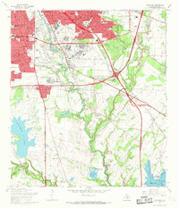 1967 Southton1969 Print · USGSSouth of San Antonio in the late sixties, this survey shows the historic mission corridor meeting modern aviation and industry. Trace family roots at San Jose Mission Cem or locate the old Cassin Siding along the Southern Pacific line.3 unique versions available
 - 1985 Map of San Antonio
 1985 San Antonio1985 Print · USGSSan Antonio and its surrounding hill country are captured in the mid-eighties during a period of significant suburban and military expansion. Genealogists and historians can trace the footprint of Kelly Air Force Base, old rail lines like the Missouri-Kansas-Texas, and smaller communities like Saspamco or Zuehl.3 unique versions available
 - 1992 Map of Southton
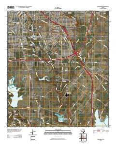
 1992 Southton1992 Print · USGSSouthern San Antonio in the early nineties reveals a landscape where colonial history meets modern aviation and industry. Genealogists can locate Mission San Jose, explore the community of Bergs Mill, or trace the Eckert Oil Field.
 - 2010 Map of Southton, 2010 Print
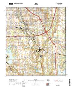
 2010 Southton2010 Print · USGSCovers Cassin, including San Antonio, Buena Vista, and other nearby areas
 - 2013 Map of Southton, 2013 Print
 2013 Southton2013 Print · USGSCovers Cassin, including San Antonio, Buena Vista, and other nearby areas
 - 2016 Map of Southton, 2016 Print
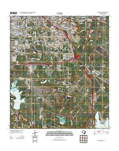
 2016 Southton2016 Print · USGSCovers Cassin, including San Antonio, Buena Vista, and other nearby areas
 - 2019 Map of Southton, 2019 Print
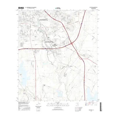
 2019 Southton2019 Print · USGSCovers Cassin, including San Antonio, Buena Vista, and other nearby areas
 - 2022 Map of Southton, 2022 Print
 2022 Southton2022 Print · USGSThe southern outskirts of San Antonio are revealed here in the early twenty-first century, where historic missions meet modern aviation. Genealogists can trace family names at San Juan Cem, Espada Cem, and Delgado Cem while exploring the area around Bergs Mill.
End of results
Showing maps 1-11 of 11
Top cities near Cassin
- San Antonio historical maps
- Schertz historical maps
- Converse historical maps
- Leon Valley historical maps
- Kirby historical maps
- Alamo Heights historical maps
See more
Frequently asked questions
- What are the different types of historical maps available for Cassin?
- What is the oldest map of Cassin?
- Where can I purchase historical maps of Cassin for my home or office?
- Where can I download high-res historical maps of Cassin?
- Are there historical topographic maps available for Cassin?
- Is there historical aerial imagery available for Cassin?
- Where are historical maps of Cassin sourced from?