Old Maps of Terrell Wells, San Antonio for Hiking & Exploration
Hike through history with 11 historic maps of Terrell Wells. Explore old trails, ghost towns, and forgotten backroads — perfect for outdoor adventurers and local explorers.
- Rediscover forgotten places: Map out old mining camps, roads, and footpaths that no longer exist on modern maps.
- Layer with modern tools: Combine with LiDAR or satellite views to plan hikes through historical terrain.
- Made for exploration: Popular among hikers, overlanders, and local history lovers.
Use these maps to find adventure and explore the hidden past of Terrell Wells.
Terrell Wells, San Antonio maps
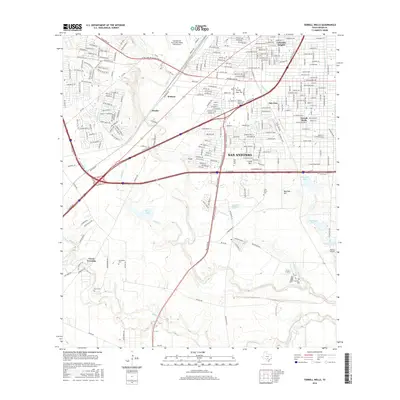
(11)- 1953 Map of Terrell Wells, 1959 Print
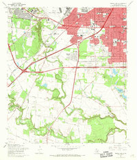
 1953 Terrell Wells1959 Print · USGSThe southwest San Antonio suburbs were undergoing rapid mid-century growth as military hubs expanded in the 1950s. Genealogists and historians can trace neighborhood schools like Colliers Sch and the development of Columbia Heights near the sprawling Lackland AFB.
 - 1954 Map of San Antonio, 1964 Print
 1954 San Antonio1964 Print · USGSSan Antonio and the Texas Hill Country are captured here in the mid-fifties, showing a landscape defined by massive military air bases and the rising Canyon Reservoir. Trace family ties through historic rail towns like D'Hanis and Castroville or explore the Cold War footprint of Lackland AFB and Randolph AFB.3 unique versions available
 - 1957 Map of San Antonio
 1957 San Antonio1957 Print · USGSSan Antonio and the Texas Hill Country are shown here during the mid-fifties, capturing the region's expanding post-war military and transportation footprint. Genealogists and local historians can trace the early residential boundaries of Alamo Heights or locate rural landmarks like St Hedwig and Medina Lake.
 - 1967 Map of Terrell Wells, 1969 Print
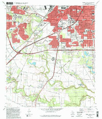
 1967 Terrell Wells1969 Print · USGSSouth of San Antonio in the late 1960s, this area shows the intersection of military expansion and urban residential growth. Researchers can trace local genealogy through Hernandez Cem or locate industrial sites like the Leon Creek Powerplant and Garza Crossing.3 unique versions available
 - 1985 Map of San Antonio
 1985 San Antonio1985 Print · USGSSan Antonio and its surrounding hill country are captured in the mid-eighties during a period of significant suburban and military expansion. Genealogists and historians can trace the footprint of Kelly Air Force Base, old rail lines like the Missouri-Kansas-Texas, and smaller communities like Saspamco or Zuehl.3 unique versions available
 - 1992 Map of Terrell Wells
 1992 Terrell Wells1992 Print · USGSSouth San Antonio's transition from military hubs to residential neighborhoods is captured here in the early nineties. Genealogists can trace family roots at Lona China Cem and Garza Crossing or locate early schools like St Clare Sch.2 unique versions available
 - 2010 Map of Terrell Wells, 2010 Print
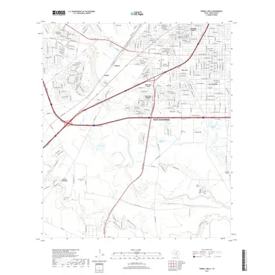
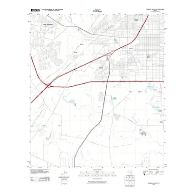 2010 Terrell Wells2010 Print · USGSCovers Terrell Wells, including San Antonio, Bexar County, and other nearby areas
 - 2013 Map of Terrell Wells, 2013 Print
 2013 Terrell Wells2013 Print · USGSCovers Terrell Wells, including San Antonio, Bexar County, and other nearby areas
 - 2016 Map of Terrell Wells, 2016 Print
 2016 Terrell Wells2016 Print · USGSCovers Terrell Wells, including San Antonio, Bexar County, and other nearby areas
 - 2019 Map of Terrell Wells, 2019 Print
 2019 Terrell Wells2019 Print · USGSCovers Terrell Wells, including San Antonio, Bexar County, and other nearby areas
 - 2023 Map of Terrell Wells, 2023 Print
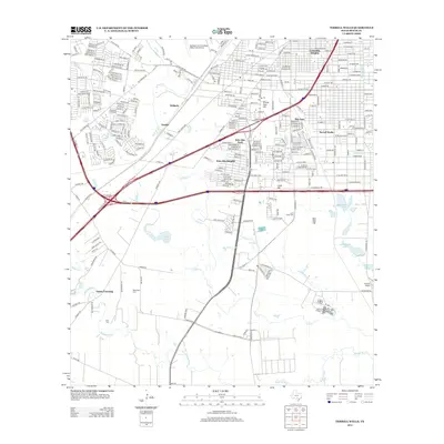
 2023 Terrell Wells2023 Print · USGSBexar County's south side at the start of the 2020s shows a landscape where historic local landmarks meet major military and academic institutions. Researchers can locate family sites like Lona China Cem and the Ruiz - Herrera Cem alongside the modern campus of Texas A and M University - San Antonio.
End of results
Showing maps 1-11 of 11
Frequently asked questions
- What are the different types of historical maps available for Terrell Wells?
- What is the oldest map of Terrell Wells?
- Where can I purchase historical maps of Terrell Wells for my home or office?
- Where can I download high-res historical maps of Terrell Wells?
- Are there historical topographic maps available for Terrell Wells?
- Is there historical aerial imagery available for Terrell Wells?
- Where are historical maps of Terrell Wells sourced from?