Old Maps of Cedar Shores, Texas
Explore 13 old maps of Cedar Shores, spanning from 1892 to today. These high-resolution historic maps reveal how streets, neighborhoods, landmarks, and natural features evolved over time — perfect for genealogy, metal detecting, research, and local history exploration.
What you can do with these maps:
- See how Cedar Shores changed over time: Compare historical maps to modern-day views to trace roads, homesites, rail lines & more.
- View detailed metadata: Each map includes creators, publishers, year, scale, and archive source.
- Overlay maps with satellite & LiDAR: Visualize the past alongside modern tools to explore terrain & human change.
- Trusted historical sources: Maps sourced from the USGS, Library of Congress, and other archives.
- Access maps your way: View online, download high-res files, or order prints for personal or research use.
Start exploring old maps of Cedar Shores to uncover forgotten places, hidden landmarks, and the deep history beneath your feet.
Cedar Shores, TX maps
(13)- 1892 Map of Waco
 1892 Waco1892 Print · USGSCentral Texas was rapidly expanding during the 1890s as a rail and river commerce hub. Genealogists and researchers can trace the early footprints of Waco and its surrounding communities like China Springs, Valley Mills, and West along five distinct railway lines.6 unique versions available
 - 1920 Map of Waco
 1920 Waco1920 Print · USGSWaco and its surrounding rail corridors are captured in high detail shortly after the first World War. Researchers can trace the legacy of Rifle Range Camp MacArthur and vanished river crossings like Greenwoods Ferry and Old Towash.
 - 1924 Map of Waco 2-b
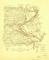 1924 Waco 2-b1924 Print · USGSBosque and Hill Counties appear here in the mid-twenties, centered on the winding Brazos River before later landscape changes. Researchers can trace rural life through numerous sites like Towash, Crackerbox School, and the White Ranch.
 - 1931 Map of Whitney
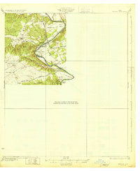 1931 Whitney1931 Print · USGSCentral Texas river life in the early twenties centers on the winding Brazos River before the era of modern dams. Genealogists can trace local school districts like Crackerbox Sch and river crossings such as Greenwade Bridge.2 unique versions available
 - 1954 Map of Waco, 1964 Print
 1954 Waco1964 Print · USGSCentral Texas during the mid-fifties shows a landscape defined by the expansion of Fort Hood Military Reservation and the Brazos river system. Trace the rail lines and early airfields like James Connally Air Force Base and settlements like Temple or McGregor.2 unique versions available
 - 1955 Map of Waco
 1955 Waco1955 Print · USGSCentral Texas at the peak of the Cold War reveals a landscape defined by military expansion and major water projects. Researchers can trace the footprints of Fort Hood, the waters of Lake Waco, and regional hubs like Temple or Mexia.
 - 1968 Map of Allen Bend, 1971 Print
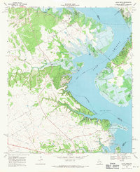 1968 Allen Bend1971 Print · USGSThe Brazos River valley transitions into a major reservoir in the late sixties as the waters of Lake Whitney reshape the Hill and Bosque county line. Genealogists can locate rural landmarks like Steiner Sch and Cedron Cem alongside the modern Lakewood Harbor.
 - 1985 Map of Waco
 1985 Waco1985 Print · USGSCentral Texas in the mid-eighties shows a landscape of river-fed lakes and bustling transit hubs as the region expanded. Genealogists and historians can trace rail lines like the Missouri Kansas Texas or locate sites such as Rosemound Cem and Meridian State Park.2 unique versions available
 - 2010 Map of Allen Bend, 2010 Print
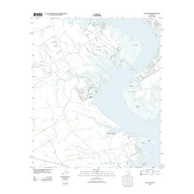
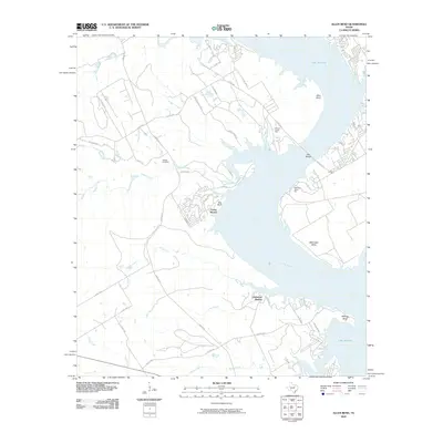 2010 Allen Bend2010 Print · USGSCovers Cedar Shores, including Lakewood Harbor, Hill County, and other nearby areas
 - 2012 Map of Allen Bend, 2012 Print
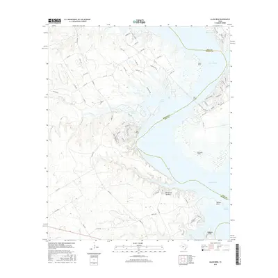
 2012 Allen Bend2012 Print · USGSCovers Cedar Shores, including Lakewood Harbor, Hill County, and other nearby areas
 - 2016 Map of Allen Bend, 2016 Print
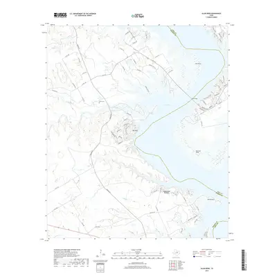
 2016 Allen Bend2016 Print · USGSCovers Cedar Shores, including Lakewood Harbor, Hill County, and other nearby areas
 - 2019 Map of Allen Bend, 2019 Print
 2019 Allen Bend2019 Print · USGSCovers Cedar Shores, including Lakewood Harbor, Hill County, and other nearby areas
 - 2022 Map of Allen Bend, 2022 Print
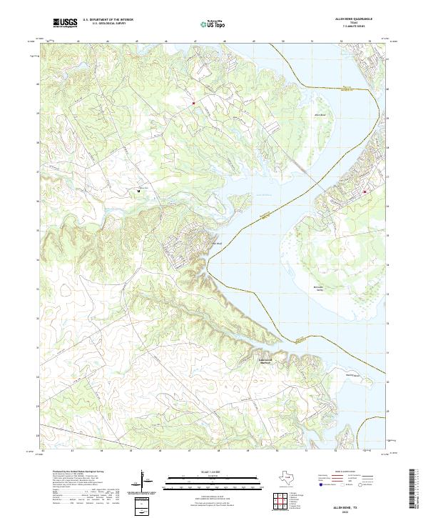 2022 Allen Bend2022 Print · USGSThe Bosque and Hill County line meets at the winding shores of the Brazos River basin in this contemporary study. Researchers can locate Cedron Cem and trace the development of lakeside communities like Lakewood Harbor and Pioneer Cove.
End of results
Showing maps 1-13 of 13
Top cities near Cedar Shores
- Clifton historical maps
- Whitney historical maps
- Meridian historical maps
- Gholson historical maps
- Morgan historical maps
- Blum historical maps
See more
Frequently asked questions
- What are the different types of historical maps available for Cedar Shores?
- What is the oldest map of Cedar Shores?
- Where can I purchase historical maps of Cedar Shores for my home or office?
- Where can I download high-res historical maps of Cedar Shores?
- Are there historical topographic maps available for Cedar Shores?
- Is there historical aerial imagery available for Cedar Shores?
- Where are historical maps of Cedar Shores sourced from?