Old Maps of Barkman, Texas for Metal Detecting
Plan your next treasure hunt with 11 historic maps of Barkman. Find old homesites, ghost towns, trails, and gathering spots that may be lost to time — perfect for identifying promising metal detecting locations.
- Locate forgotten sites: Uncover places like long-lost settlements, abandoned rail lines, or gathering spots.
- Plan better hunts: Use map overlays combined with LiDAR or satellite views to narrow in on historically rich areas.
- Made for detectorists: Thousands of hobbyists use these maps to discover relics, coins, and hidden history.
Use these historic maps to boost your research and find new opportunities beneath the surface of Barkman.
Barkman, TX maps
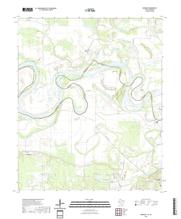
(11)- 1950 Map of Barkman, 1969 Print
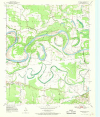 1950 Barkman1969 Print · USGSThe Texas-Arkansas borderlands are captured here at mid-century, where the Red River's shifting path created a rich landscape of oxbow lakes and bayous. Genealogists can trace rural life through landmarks like Rosenwald Sch, Barkman, and the Clear Lake Cem.5 unique versions available
 - 1951 Map of Barkman
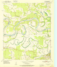 1951 Barkman1951 Print · USGSBowie County, Texas, and the Arkansas borderlands are captured here in the early fifties, dominated by the serpentine coils of the Red River. Researchers can locate family landmarks like the Rosenwald Sch, Clear Lake Cem, and the riverfront settlement of Barkman.
 - 1953 Map of Texarkana, 1964 Print
 1953 Texarkana1964 Print · USGSThe Texas-Arkansas borderlands are captured here in the mid-fifties, during a decade of massive military and hydraulic engineering projects. Genealogists and researchers can locate family landmarks like Old Boston Cem, Siloam Ch, and the vast Red River Arsenal.4 unique versions available
 - 1956 Map of Texarkana
 1956 Texarkana1956 Print · USGSThe Ark-La-Tex borderlands come alive in the mid-fifties, showing the transition from a rail-dependent rural economy to a post-war industrial landscape. Researchers can trace the massive Red River Ordnance Depot and find towns like Talco, Bogata, and Naples.
 - 1986 Map of Idabel
 1986 Idabel1986 Print · USGSThe tri-state borderlands of Oklahoma, Arkansas, and Texas come alive in the 1980s, centered on the Red River and the timberlands of the Ouachita National Forest. Genealogists and historians can trace the paths of the Missouri Pacific railroad through towns like Bokhoma and Ashdown.
 - 1990 Map of Idabel
 1990 Idabel1990 Print · USGSThe tri-state borderlands of Oklahoma, Arkansas, and Texas come alive in this late twentieth-century survey of the Red River valley. Researchers can trace the legacy of rail and river commerce through settlements like Bokhoma and Ashdown or find rural landmarks such as Hill Chapel.
 - 2011 Map of Barkman, 2011 Print
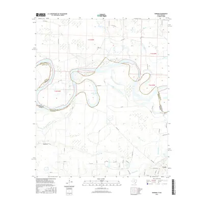
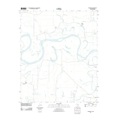 2011 Barkman2011 Print · USGSCovers Barkman, including Pine Prairie, Red Bank, and other nearby areas
 - 2013 Map of Barkman, 2013 Print
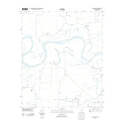 2013 Barkman2013 Print · USGSCovers Barkman, including Pine Prairie, Red Bank, and other nearby areas
 - 2016 Map of Barkman, 2016 Print
 2016 Barkman2016 Print · USGSCovers Barkman, including Pine Prairie, Red Bank, and other nearby areas
 - 2019 Map of Barkman, 2019 Print
 2019 Barkman2019 Print · USGSCovers Barkman, including Pine Prairie, Red Bank, and other nearby areas
 - 2022 Map of Barkman, 2022 Print
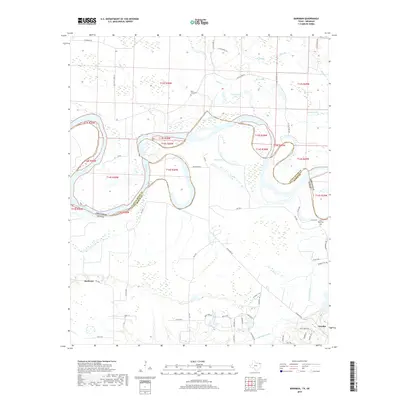
 2022 Barkman2022 Print · USGSThe Texas-Arkansas border along the Red River comes alive in the early 2020s, showing a landscape of shifting oxbows and rural settlements. Trace family roots at Saint Lukes Cem or explore the historical route of Trammel's Trce near Wamba.
End of results
Showing maps 1-11 of 11
Top cities near Barkman
- Texarkana historical maps
- Texarkana historical maps
- Wake Village historical maps
- New Boston historical maps
- Ashdown historical maps
- Nash historical maps
See more
Frequently asked questions
- What are the different types of historical maps available for Barkman?
- What is the oldest map of Barkman?
- Where can I purchase historical maps of Barkman for my home or office?
- Where can I download high-res historical maps of Barkman?
- Are there historical topographic maps available for Barkman?
- Is there historical aerial imagery available for Barkman?
- Where are historical maps of Barkman sourced from?