Old Maps of Long Meadow Farms, Fort Bend County for Hiking & Exploration
Hike through history with 12 historic maps of Long Meadow Farms. Explore old trails, ghost towns, and forgotten backroads — perfect for outdoor adventurers and local explorers.
- Rediscover forgotten places: Map out old mining camps, roads, and footpaths that no longer exist on modern maps.
- Layer with modern tools: Combine with LiDAR or satellite views to plan hikes through historical terrain.
- Made for exploration: Popular among hikers, overlanders, and local history lovers.
Use these maps to find adventure and explore the hidden past of Long Meadow Farms.
Long Meadow Farms, Fort Bend County maps
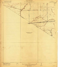
(12)- 1915 Map of Clodine, 1961 Print
 1915 Clodine1961 Print · USGSCovers Long Meadow Farms, including Houston, Sugar Land, and other nearby areas
 - 1919 Map of Clodine
 1919 Clodine1919 Print · USGSCovers Long Meadow Farms, including Houston, Sugar Land, and other nearby areas3 unique versions available
 - 1950 Map of Houston, 1953 Print
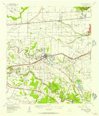
 1950 Houston1953 Print · USGSCovers Long Meadow Farms, including Houston, Pasadena, and other nearby areas
 - 1955 Map of Sugar Land, 1957 Print
 1955 Sugar Land1957 Print · USGSCovers Long Meadow Farms, including Houston, Sugar Land, and other nearby areas
 - 1955 Map of Richmond, 1958 Print
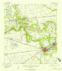 1955 Richmond1958 Print · USGSCovers Long Meadow Farms, including Houston, Rosenberg, and other nearby areas
 - 1956 Map of Houston, 1963 Print
 1956 Houston1963 Print · USGSCovers Long Meadow Farms, including Houston, Pasadena, and other nearby areas2 unique versions available
 - 1970 Map of Clodine, 1973 Print
 1970 Clodine1973 Print · USGSCovers Long Meadow Farms, including Houston, Sugar Land, and other nearby areas
 - 1971 Map of Richmond NE, 1973 Print
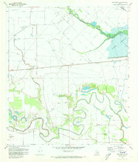 1971 Richmond NE1973 Print · USGSCovers Long Meadow Farms, including Houston, Katy, and other nearby areas3 unique versions available
 - 1975 Map of Houston, 1977 Print
 1975 Houston1977 Print · USGSCovers Long Meadow Farms, including Houston, Pasadena, and other nearby areas2 unique versions available
 - 1982 Map of Clodine
 1982 Clodine1982 Print · USGSCovers Long Meadow Farms, including Houston, Sugar Land, and other nearby areas
 - 1992 Map of Houston
 1992 Houston1992 Print · USGSCovers Long Meadow Farms, including Houston, Pasadena, and other nearby areas
 - 1995 Map of Clodine, 1999 Print
 1995 Clodine1999 Print · USGSCovers Long Meadow Farms, including Houston, Sugar Land, and other nearby areas
End of results
Showing maps 1-12 of 12
Frequently asked questions
- What are the different types of historical maps available for Long Meadow Farms?
- What is the oldest map of Long Meadow Farms?
- Where can I purchase historical maps of Long Meadow Farms for my home or office?
- Where can I download high-res historical maps of Long Meadow Farms?
- Are there historical topographic maps available for Long Meadow Farms?
- Is there historical aerial imagery available for Long Meadow Farms?
- Where are historical maps of Long Meadow Farms sourced from?