Old Maps of Meadow Glen, Fort Bend County for Genealogy
Trace your family roots with 22 historic maps of Meadow Glen. These high-res maps reveal old neighborhoods, homesites, landmarks, and streets — helping you uncover where your ancestors lived and how the area evolved over time.
- Explore historic neighborhoods: Identify where your relatives may have lived in the 1800s or 1900s.
- Compare maps over time: Trace the changes in streets, buildings, and landmarks for multi-generational research.
- Perfect for genealogy & ancestry research: Used by family historians and researchers to map out lineage and migration.
These maps are an incredible resource for exploring your personal connection to Meadow Glen's past.
Meadow Glen, Fort Bend County maps
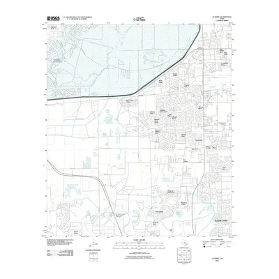
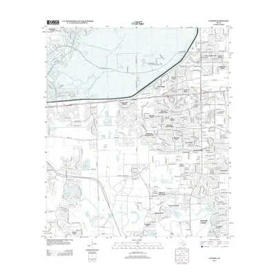
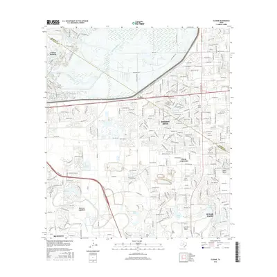
(22)- 1915 Map of Clodine, 1961 Print
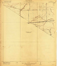
 1915 Clodine1961 Print · USGSSoutheast Texas prairie life is captured here during the mid-teens, when rail lines dictated the growth of small settlements. Trace the early footprints of Clodine and Howell or locate the defunct route of the Texas Western R R (Abandoned).
 - 1919 Map of Clodine
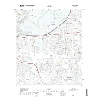
 1919 Clodine1919 Print · USGSThe coastal prairie of the Harris and Fort Bend county line is captured here just before the era of major flood control. Genealogists can trace early settlements like Clodine and Howell alongside the remnant Texas Western RR (Abandoned) rail bed.3 unique versions available
 - 1950 Map of Houston, 1953 Print
 1950 Houston1953 Print · USGSCoastal Texas in the early fifties reveals a landscape of massive civil engineering and industrial transit. Genealogists and researchers can trace the growth of the Houston suburbs and the maritime infrastructure of Galveston Bay, including the Gulf Freeway and the Texas City Dike.
 - 1955 Map of Sugar Land, 1957 Print
 1955 Sugar Land1957 Print · USGSFort Bend and Harris counties were transitioning from a plantation and prison-farm economy to a modern industrial corridor in the mid-1950s. Genealogists can trace family names at the Dewalt Cem or Riceville Ch, while researchers can map the early footprints of Sharpstown and Andrau Airpark.
 - 1955 Map of Richmond, 1958 Print
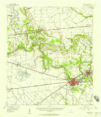 1955 Richmond1958 Print · USGSFort Bend County during the mid-fifties is captured here as a landscape of meandering rivers and burgeoning rail hubs. Genealogists can trace family names through rural sites like Little Prayer Cem or follow the Old Spanish Trail through Rosenberg.
 - 1956 Map of Houston, 1963 Print
 1956 Houston1963 Print · USGSSoutheast Texas in the mid-fifties is captured here as a powerhouse of oil and maritime trade. Genealogists and historians can trace the foundations of Houston and its ports, alongside landmarks like the Rice Institute and the Spindletop Oil Field.2 unique versions available
 - 1970 Map of Clodine, 1973 Print
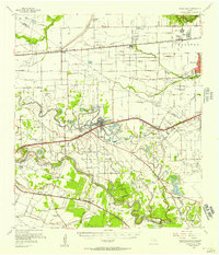
 1970 Clodine1973 Print · USGSFort Bend County in the early seventies shows a landscape of institutional farms and early suburban edges. Genealogists and researchers can trace the roads around Clodine, the grounds of the State Prison Farm, and local landmarks like Hull Field.
 - 1971 Map of Richmond NE, 1973 Print
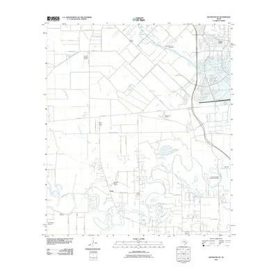
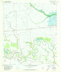 1971 Richmond NE1973 Print · USGSFort Bend and Harris counties are captured in the early seventies, showcasing a rural landscape defined by creek meanders and early energy development. Genealogists can locate Goss Cem and Briscoe Cem or trace family sites near Foster and Gaston.3 unique versions available
 - 1975 Map of Houston, 1977 Print
 1975 Houston1977 Print · USGSThe Texas Gulf Coast in the mid-seventies shows a sprawling Houston metropolis linked to the sea by the massive Houston Ship Channel. Researchers can trace the mid-century industrial landscape from the Astrodome to the Lyndon B. Johnson Space Center.2 unique versions available
 - 1982 Map of Clodine
 1982 Clodine1982 Print · USGSFort Bend and Harris counties were on the cusp of rapid suburban change in the early eighties. Genealogists and researchers can trace the footprint of the Jester State Prison Farm, find Magee Cemetery, or locate the rural Clodine crossroads.
 - 1992 Map of Houston
 1992 Houston1992 Print · USGSThe Houston metropolitan area reached its modern sprawl in the early nineties, centered on the Buffalo Bayou and a massive regional rail network. Genealogists and historians can trace the development of satellite cities like Sugar Land and Pasadena, or locate legacy sites like the Humble Oil Field and the NASA Lyndon B Johnson Space Center.
 - 1995 Map of Clodine, 1999 Print
 1995 Clodine1999 Print · USGSFort Bend and Harris counties were undergoing rapid suburban change in the mid-nineties as residential developments moved west toward the reservoir. Genealogists can locate family landmarks like Magee Cemetery and Hodges Bend Cem or trace the early footprint of Mission Bend.
 - 2010 Map of Clodine, 2010 Print
 2010 Clodine2010 Print · USGSCovers Meadow Glen, including Houston, Sugar Land, and other nearby areas
 - 2010 Map of Richmond NE, 2010 Print
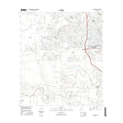
 2010 Richmond NE2010 Print · USGSCovers Meadow Glen, including Houston, Katy, and other nearby areas
 - 2013 Map of Richmond NE, 2013 Print
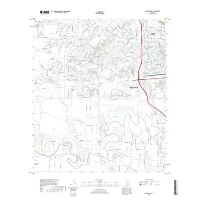
 2013 Richmond NE2013 Print · USGSCovers Meadow Glen, including Houston, Katy, and other nearby areas
 - 2013 Map of Clodine, 2013 Print
 2013 Clodine2013 Print · USGSCovers Meadow Glen, including Houston, Sugar Land, and other nearby areas
 - 2016 Map of Clodine, 2016 Print
 2016 Clodine2016 Print · USGSCovers Meadow Glen, including Houston, Sugar Land, and other nearby areas
 - 2016 Map of Richmond NE, 2016 Print
 2016 Richmond NE2016 Print · USGSCovers Meadow Glen, including Houston, Katy, and other nearby areas
 - 2019 Map of Clodine, 2019 Print
 2019 Clodine2019 Print · USGSCovers Meadow Glen, including Houston, Sugar Land, and other nearby areas
 - 2019 Map of Richmond NE, 2019 Print
 2019 Richmond NE2019 Print · USGSCovers Meadow Glen, including Houston, Katy, and other nearby areas
 - 2022 Map of Clodine, 2022 Print
 2022 Clodine2022 Print · USGSFort Bend and Harris counties meet here in a landscape of rapid suburban growth during the 2020s. Researchers can trace historic cemeteries and neighborhood landmarks like Pleasant Green Cem, Clodine, and Hodges Bend Cem.
 - 2022 Map of Richmond NE, 2022 Print
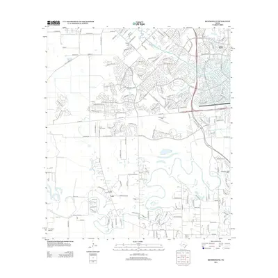
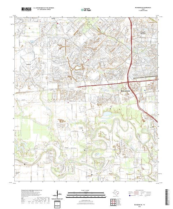 2022 Richmond NE2022 Print · USGSFort Bend County at the peak of its modern expansion reveals the intersection of suburban growth and deep-rooted rural history. Trace old family landholdings near Foster and numerous burial sites like Gaston-White Cem and Briscoe Cem.
End of results
Showing maps 1-22 of 22
Frequently asked questions
- What are the different types of historical maps available for Meadow Glen?
- What is the oldest map of Meadow Glen?
- Where can I purchase historical maps of Meadow Glen for my home or office?
- Where can I download high-res historical maps of Meadow Glen?
- Are there historical topographic maps available for Meadow Glen?
- Is there historical aerial imagery available for Meadow Glen?
- Where are historical maps of Meadow Glen sourced from?