Old Maps of Teague, Texas
Explore 29 old maps of Teague, spanning from 1919 to today. These high-resolution historic maps reveal how streets, neighborhoods, landmarks, and natural features evolved over time — perfect for genealogy, metal detecting, research, and local history exploration.
What you can do with these maps:
- See how Teague changed over time: Compare historical maps to modern-day views to trace roads, homesites, rail lines & more.
- View detailed metadata: Each map includes creators, publishers, year, scale, and archive source.
- Overlay maps with satellite & LiDAR: Visualize the past alongside modern tools to explore terrain & human change.
- Trusted historical sources: Maps sourced from the USGS, Library of Congress, and other archives.
- Access maps your way: View online, download high-res files, or order prints for personal or research use.
Start exploring old maps of Teague to uncover forgotten places, hidden landmarks, and the deep history beneath your feet.
Teague, TX maps
(29)- 1919 Map of Fairfield, 1956 Print
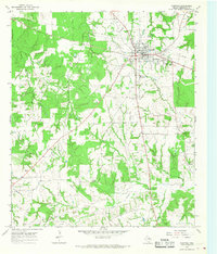
 1919 Fairfield1956 Print · USGSFreestone County is captured here after the Great War, showing a network of rural post offices and schoolhouses linked by early wagon roads. You can trace the Trinity and Brazos Valley Railway near Freestone P.O. or locate old community centers like Dew and Turlington P.O..
 - 1920 Map of Mexia
 1920 Mexia1920 Print · USGSLimestone and Freestone counties are shown here just after the Great War, during a period of significant railway expansion and rural settlement. Researchers can trace the routes of the Houston and Texas Central and locate sites like Cotton Gin, Pt. Enterprise, and Duck Lake.
 - 1954 Map of Waco, 1964 Print
 1954 Waco1964 Print · USGSCentral Texas during the mid-fifties shows a landscape defined by the expansion of Fort Hood Military Reservation and the Brazos river system. Trace the rail lines and early airfields like James Connally Air Force Base and settlements like Temple or McGregor.2 unique versions available
 - 1955 Map of Waco
 1955 Waco1955 Print · USGSCentral Texas at the peak of the Cold War reveals a landscape defined by military expansion and major water projects. Researchers can trace the footprints of Fort Hood, the waters of Lake Waco, and regional hubs like Temple or Mexia.
 - 1963 Map of Teague North, 1966 Print
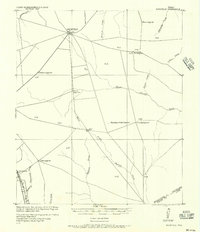
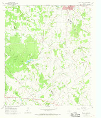
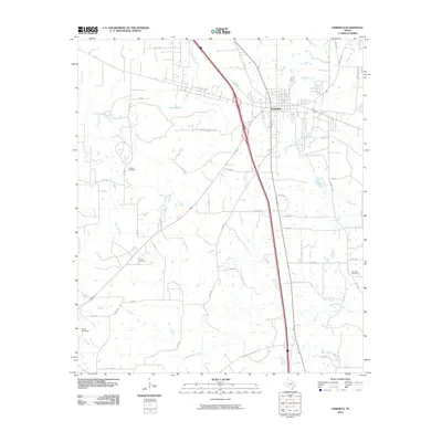
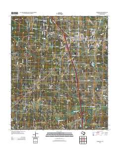
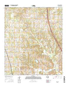
 1963 Teague North1966 Print · USGSThe railroad hub at Teague and the nearby settlements of Cotton Gin and Simsboro are captured here in the early sixties. Genealogists and local historians can trace rural congregations and schools such as Wesley Ch, Union Prim Ch, and the Furney-Richardson School.2 unique versions available
 - 1965 Map of Dew, 1967 Print
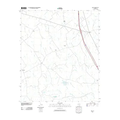
 1965 Dew1967 Print · USGSFreestone County in the mid-sixties remains a landscape of traditional Texas farmsteads and prairie openings. Genealogists and local historians can trace family roots through several named cemeteries and churches like Philpott Cem and Salem Ch, or follow the Chicago Rock Island and Pacific rail line.2 unique versions available
 - 1965 Map of Fairfield, 1968 Print
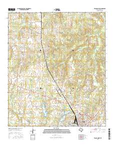
 1965 Fairfield1968 Print · USGSFairfield and the surrounding Freestone County countryside are captured here in the mid-sixties, showcasing a thriving Texas county seat. Researchers can find old landmarks like Dogan High School, the local Drive-in Theater, and rural cemeteries including George Cem and Driver Cem.2 unique versions available
 - 1966 Map of Teague South, 1968 Print
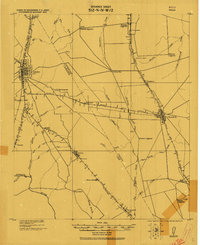
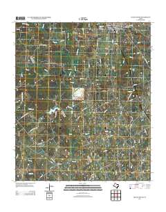
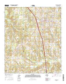
 1966 Teague South1968 Print · USGSFreestone and Limestone counties are captured in the mid-1960s as the rail-centered economy of Teague meets the rural crossroads of Personville. Researchers can trace family history at Greenwood Cem or locate the old Salem Ch and Union Ch amid the Bear Branch and Holman Creek bottoms.2 unique versions available
 - 1985 Map of Mexia
 1985 Mexia1985 Print · USGSLimestone and Freestone counties are shown in the mid-eighties as centers of rail-linked commerce and growing reservoir systems. Researchers can trace the grounds of Mexia State School, the campus of Westminster College, and historic Fort Parker.2 unique versions available
 - 2010 Map of Teague South, 2010 Print
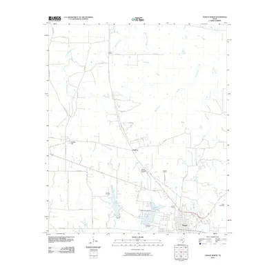
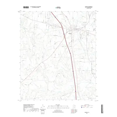
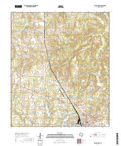
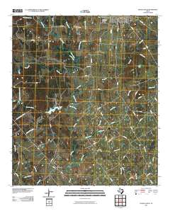 2010 Teague South2010 Print · USGSCovers Teague, including Personville, Limestone County, and other nearby areas
 - 2010 Map of Teague North, 2010 Print
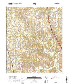
 2010 Teague North2010 Print · USGSCovers Teague, including Simsboro, Cotton Gin, and other nearby areas
 - 2010 Map of Dew, 2010 Print
 2010 Dew2010 Print · USGSCovers Teague, including Dew, Avant Prairie, and other nearby areas
 - 2010 Map of Fairfield, 2010 Print
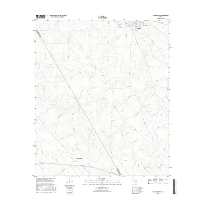
 2010 Fairfield2010 Print · USGSCovers Teague, including Fairfield, Freestone County, and other nearby areas
 - 2013 Map of Teague North, 2013 Print
 2013 Teague North2013 Print · USGSCovers Teague, including Simsboro, Cotton Gin, and other nearby areas
 - 2013 Map of Dew, 2013 Print
 2013 Dew2013 Print · USGSCovers Teague, including Dew, Avant Prairie, and other nearby areas
 - 2013 Map of Fairfield, 2013 Print
 2013 Fairfield2013 Print · USGSCovers Teague, including Fairfield, Freestone County, and other nearby areas
 - 2013 Map of Teague South, 2013 Print
 2013 Teague South2013 Print · USGSCovers Teague, including Personville, Limestone County, and other nearby areas
 - 2016 Map of Teague South, 2016 Print
 2016 Teague South2016 Print · USGSCovers Teague, including Personville, Limestone County, and other nearby areas
 - 2016 Map of Teague North, 2016 Print
 2016 Teague North2016 Print · USGSCovers Teague, including Simsboro, Cotton Gin, and other nearby areas
 - 2016 Map of Dew, 2016 Print
 2016 Dew2016 Print · USGSCovers Teague, including Dew, Avant Prairie, and other nearby areas
 - 2016 Map of Fairfield, 2016 Print
 2016 Fairfield2016 Print · USGSCovers Teague, including Fairfield, Freestone County, and other nearby areas
 - 2019 Map of Fairfield, 2019 Print
 2019 Fairfield2019 Print · USGSCovers Teague, including Fairfield, Freestone County, and other nearby areas
 - 2019 Map of Dew, 2019 Print
 2019 Dew2019 Print · USGSCovers Teague, including Dew, Avant Prairie, and other nearby areas
 - 2019 Map of Teague South, 2019 Print
 2019 Teague South2019 Print · USGSCovers Teague, including Personville, Limestone County, and other nearby areas
 - 2019 Map of Teague North, 2019 Print
 2019 Teague North2019 Print · USGSCovers Teague, including Simsboro, Cotton Gin, and other nearby areas
Showing maps 1-25 of 29
Top cities near Teague
- Mexia historical maps
- Groesbeck historical maps
- Fairfield historical maps
- Buffalo historical maps
- Wortham historical maps
- Richland historical maps
See more
Frequently asked questions
- What are the different types of historical maps available for Teague?
- What is the oldest map of Teague?
- Where can I purchase historical maps of Teague for my home or office?
- Where can I download high-res historical maps of Teague?
- Are there historical topographic maps available for Teague?
- Is there historical aerial imagery available for Teague?
- Where are historical maps of Teague sourced from?