Old Maps of Cleburne, Harris County for Genealogy
Trace your family roots with 13 historic maps of Cleburne. These high-res maps reveal old neighborhoods, homesites, landmarks, and streets — helping you uncover where your ancestors lived and how the area evolved over time.
- Explore historic neighborhoods: Identify where your relatives may have lived in the 1800s or 1900s.
- Compare maps over time: Trace the changes in streets, buildings, and landmarks for multi-generational research.
- Perfect for genealogy & ancestry research: Used by family historians and researchers to map out lineage and migration.
These maps are an incredible resource for exploring your personal connection to Cleburne's past.
Cleburne, Harris County maps
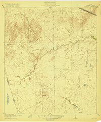
(13)- 1916 Map of Swanson, 1961 Print
 1916 Swanson1961 Print · USGSTexas ranching and rail history come together in this 1910s survey of western Harris County. Researchers can trace early family landholdings like Warren Ranch or locate the original path of the Southern Pacific System near Wolf Hill.
 - 1919 Map of Swanson
 1919 Swanson1919 Print · USGSHarris and Waller counties appear here at the end of the Great War, showing the transition from open ranch land to a rail-connected economy. Genealogists and researchers can trace family-named landmarks like Warren Ranch, Lake Peter Donley, and Freemans Dam.2 unique versions available
 - 1950 Map of Houston, 1953 Print
 1950 Houston1953 Print · USGSCoastal Texas in the early fifties reveals a landscape of massive civil engineering and industrial transit. Genealogists and researchers can trace the growth of the Houston suburbs and the maritime infrastructure of Galveston Bay, including the Gulf Freeway and the Texas City Dike.
 - 1955 Map of Brookshire, 1957 Print
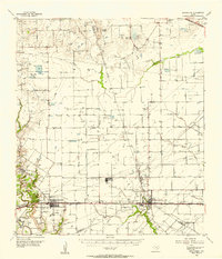 1955 Brookshire1957 Print · USGSThe growing railroad towns of Waller and Harris Counties are shown in the mid-fifties as the local energy economy takes hold. Genealogists and historians can locate family landmarks like Curry Chapel, Magnolia Cem, and the old Salt Mine at Hockley Mound.
 - 1956 Map of Houston, 1963 Print
 1956 Houston1963 Print · USGSSoutheast Texas in the mid-fifties is captured here as a powerhouse of oil and maritime trade. Genealogists and historians can trace the foundations of Houston and its ports, alongside landmarks like the Rice Institute and the Spindletop Oil Field.2 unique versions available
 - 1971 Map of Warren Lake, 1974 Print
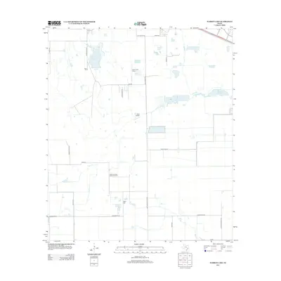
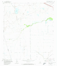 1971 Warren Lake1974 Print · USGSHarris County ranch land and prairie drainage are documented here in the early seventies, before suburban expansion reached these western reaches. Trace the Old Railroad Grade, explore the grounds of the Warren Ranch, and locate the Fish Hatchery along Cypress Creek.2 unique versions available
 - 1975 Map of Houston, 1977 Print
 1975 Houston1977 Print · USGSThe Texas Gulf Coast in the mid-seventies shows a sprawling Houston metropolis linked to the sea by the massive Houston Ship Channel. Researchers can trace the mid-century industrial landscape from the Astrodome to the Lyndon B. Johnson Space Center.2 unique versions available
 - 1992 Map of Houston
 1992 Houston1992 Print · USGSThe Houston metropolitan area reached its modern sprawl in the early nineties, centered on the Buffalo Bayou and a massive regional rail network. Genealogists and historians can trace the development of satellite cities like Sugar Land and Pasadena, or locate legacy sites like the Humble Oil Field and the NASA Lyndon B Johnson Space Center.
 - 2010 Map of Warren Lake, 2010 Print
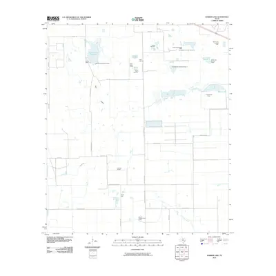 2010 Warren Lake2010 Print · USGSCovers Cleburne, including Houston, Harris County, and other nearby areas
 - 2013 Map of Warren Lake, 2013 Print
 2013 Warren Lake2013 Print · USGSCovers Cleburne, including Houston, Harris County, and other nearby areas
 - 2016 Map of Warren Lake, 2016 Print
 2016 Warren Lake2016 Print · USGSCovers Cleburne, including Houston, Harris County, and other nearby areas
 - 2019 Map of Warren Lake, 2019 Print
 2019 Warren Lake2019 Print · USGSCovers Cleburne, including Houston, Harris County, and other nearby areas
 - 2022 Map of Warren Lake, 2022 Print
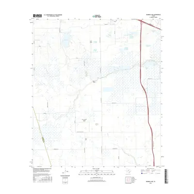
 2022 Warren Lake2022 Print · USGSWestern Harris County's ranching heritage meets modern expansion in this detailed 2022 survey. Genealogists and local historians can trace family-named routes like Warren Ranch Rd and landmarks including Fisher Lake and Wolf Hill.
End of results
Showing maps 1-13 of 13
Frequently asked questions
- What are the different types of historical maps available for Cleburne?
- What is the oldest map of Cleburne?
- Where can I purchase historical maps of Cleburne for my home or office?
- Where can I download high-res historical maps of Cleburne?
- Are there historical topographic maps available for Cleburne?
- Is there historical aerial imagery available for Cleburne?
- Where are historical maps of Cleburne sourced from?