Old Maps of Cypress Creek Landing, Harris County for Hiking & Exploration
Hike through history with 28 historic maps of Cypress Creek Landing. Explore old trails, ghost towns, and forgotten backroads — perfect for outdoor adventurers and local explorers.
- Rediscover forgotten places: Map out old mining camps, roads, and footpaths that no longer exist on modern maps.
- Layer with modern tools: Combine with LiDAR or satellite views to plan hikes through historical terrain.
- Made for exploration: Popular among hikers, overlanders, and local history lovers.
Use these maps to find adventure and explore the hidden past of Cypress Creek Landing.
Cypress Creek Landing, Harris County maps
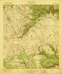
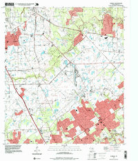
(28)- 1916 Map of Louetta
 1916 Louetta1916 Print · USGSHarris County was a rural landscape of timber mills and rail sidings during the mid-1910s. Genealogists can trace family footprints at Kohrville School, Hufsmith, and Ross Sawmill as the local economy transitioned into the motor age.
 - 1916 Map of Satsuma
 1916 Satsuma1916 Print · USGSHarris County is captured here in the years before rapid urban expansion, when timber and rail still dictated the pace of life. Trace the roots of local families near the Fuchs School or locate early industrial sites like Christy Sawmill and the Satsuma station.3 unique versions available
 - 1920 Map of Louetta
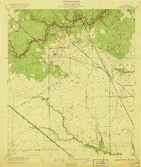
 1920 Louetta1920 Print · USGSNorthern Harris County was a landscape of timber mills and rail junctions in the years following the Great War. Genealogists and local historians can trace family roots through landmarks like Kohrville School, Ross Sawmill, and the settlement at Louetta.2 unique versions available
 - 1920 Map of Satsuma
 1920 Satsuma1920 Print · USGSHarris County is captured here just after the Great War, showing a landscape defined by timber mills and early rail lines. Genealogists can locate Fuchs School and family-operated sites like Christy Sawmill or Anderson Sawmill.2 unique versions available
 - 1950 Map of Houston, 1953 Print
 1950 Houston1953 Print · USGSCoastal Texas in the early fifties reveals a landscape of massive civil engineering and industrial transit. Genealogists and researchers can trace the growth of the Houston suburbs and the maritime infrastructure of Galveston Bay, including the Gulf Freeway and the Texas City Dike.
 - 1954 Map of Beaumont, 1964 Print
 1954 Beaumont1964 Print · USGSSoutheast Texas in the mid-fifties reveals a landscape of massive national forests, emerging reservoirs, and a booming oil economy. Genealogists and researchers can trace rural settlements like Dallardsville and Village Mills or locate early drilling sites at Sour Lake Oil Field.3 unique versions available
 - 1955 Map of Addicks, 1957 Print
 1955 Addicks1957 Print · USGSHarris County undergoes rapid transformation in the mid-fifties as Houston's city boundary pushes west. Trace family history and early industry through the Satsuma Oil Field, Addicks Dam, and Roeder Cem.
 - 1956 Map of Houston, 1963 Print
 1956 Houston1963 Print · USGSSoutheast Texas in the mid-fifties is captured here as a powerhouse of oil and maritime trade. Genealogists and historians can trace the foundations of Houston and its ports, alongside landmarks like the Rice Institute and the Spindletop Oil Field.2 unique versions available
 - 1957 Map of Beaumont
 1957 Beaumont1957 Print · USGSSoutheast Texas in the mid-fifties is defined by the timber-rich lands between the Trinity River and Beaumont. Trace the history of the Alabama and Coushatti Indian Reservation or locate early campus sites like Prairie View College.
 - 1962 Map of Tomball, 1964 Print
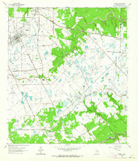 1962 Tomball1964 Print · USGSNorthwest Harris County in the early sixties was a landscape of expanding oil fields and legacy family farmsteads. Researchers can trace rural cemeteries like Huckabee Cem, the Hufsmith Oil Field, and early rail lines through Tomball and Kohrville.4 unique versions available
 - 1970 Map of Satsuma, 1973 Print
 1970 Satsuma1973 Print · USGSHarris County is seen during a period of suburban expansion and industrial growth in the early seventies. Genealogists and historians can trace the foundations of Jersey Village and Satsuma alongside old landmarks like Perry Cem and Matzke Sch.
 - 1975 Map of Houston, 1977 Print
 1975 Houston1977 Print · USGSThe Texas Gulf Coast in the mid-seventies shows a sprawling Houston metropolis linked to the sea by the massive Houston Ship Channel. Researchers can trace the mid-century industrial landscape from the Astrodome to the Lyndon B. Johnson Space Center.2 unique versions available
 - 1982 Map of Satsuma
 1982 Satsuma1982 Print · USGSNorthwest Harris County is seen during its rapid early 1980s expansion, as new subdivisions began to surround established rural landmarks. Genealogists can locate family sites like Dowdell Cem and Perry Cem among developments like Jersey Village.2 unique versions available
 - 1984 Map of Beaumont
 1984 Beaumont1984 Print · USGSSoutheast Texas in the late seventies and early eighties shows a landscape of expanding reservoirs and deep timber industry. Researchers can trace the development of the Sam Houston National Forest or locate regional landmarks like Grabbs Prairie and the Wynne State Prison Farm.3 unique versions available
 - 1985 Map of Conroe
 1985 Conroe1985 Print · USGSSoutheast Texas in the mid-eighties shows a landscape of timberlands and new lakeside developments. Researchers can trace the legacy of rail lines like the Southern Pacific RR or locate rural communities such as Plantersville, Yarboro, and Hufsmith.2 unique versions available
 - 1992 Map of Houston
 1992 Houston1992 Print · USGSThe Houston metropolitan area reached its modern sprawl in the early nineties, centered on the Buffalo Bayou and a massive regional rail network. Genealogists and historians can trace the development of satellite cities like Sugar Land and Pasadena, or locate legacy sites like the Humble Oil Field and the NASA Lyndon B Johnson Space Center.
 - 1995 Map of Tomball, 1999 Print
 1995 Tomball1999 Print · USGSNorth of Houston in the late twentieth century, this area shows the shift from oil fields to suburban residential blocks. Genealogists can locate several historic burial sites, including Pillot Cem and Klein Cem, near the growing settlements of Tomball and Kohrville.
 - 1995 Map of Satsuma, 2000 Print
 1995 Satsuma2000 Print · USGSNorthwest Harris County shows its late-century transition from open land to suburban density in this mid-nineties survey. Researchers can trace established neighborhoods near Jersey Village and locate community landmarks like Perry Cem, Satsuma Chapel, and the Sam Houston Racepark.
 - 2010 Map of Tomball, 2010 Print
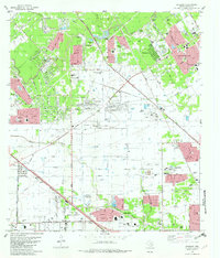
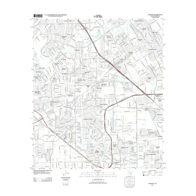
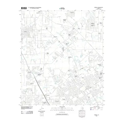 2010 Tomball2010 Print · USGSCovers Cypress Creek Landing, including Houston, Tomball, and other nearby areas
 - 2010 Map of Satsuma, 2010 Print
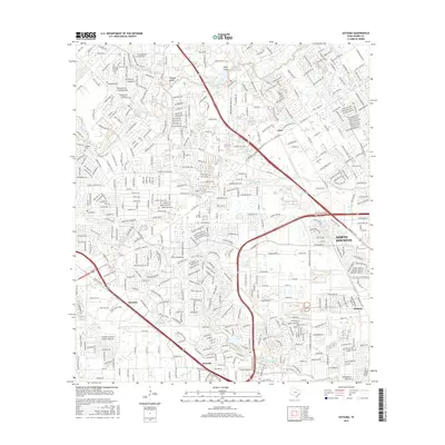
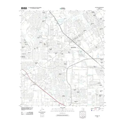 2010 Satsuma2010 Print · USGSCovers Cypress Creek Landing, including Houston, Jersey Village, and other nearby areas
 - 2013 Map of Tomball, 2013 Print
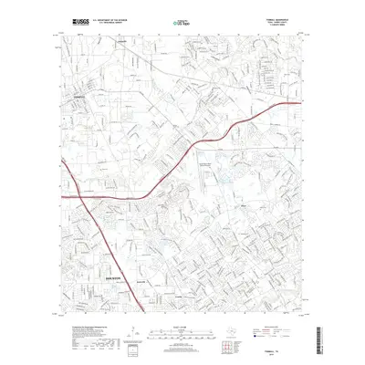
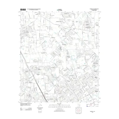 2013 Tomball2013 Print · USGSCovers Cypress Creek Landing, including Houston, Tomball, and other nearby areas
 - 2013 Map of Satsuma, 2013 Print
 2013 Satsuma2013 Print · USGSCovers Cypress Creek Landing, including Houston, Jersey Village, and other nearby areas
 - 2016 Map of Tomball, 2016 Print
 2016 Tomball2016 Print · USGSCovers Cypress Creek Landing, including Houston, Tomball, and other nearby areas
 - 2016 Map of Satsuma, 2016 Print
 2016 Satsuma2016 Print · USGSCovers Cypress Creek Landing, including Houston, Jersey Village, and other nearby areas
 - 2019 Map of Tomball, 2019 Print
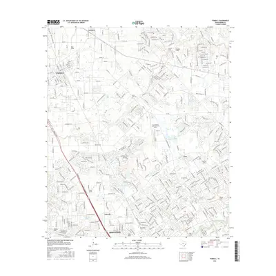
 2019 Tomball2019 Print · USGSCovers Cypress Creek Landing, including Houston, Tomball, and other nearby areas
Showing maps 1-25 of 28
Frequently asked questions
- What are the different types of historical maps available for Cypress Creek Landing?
- What is the oldest map of Cypress Creek Landing?
- Where can I purchase historical maps of Cypress Creek Landing for my home or office?
- Where can I download high-res historical maps of Cypress Creek Landing?
- Are there historical topographic maps available for Cypress Creek Landing?
- Is there historical aerial imagery available for Cypress Creek Landing?
- Where are historical maps of Cypress Creek Landing sourced from?