Old Maps of Enchanted Valley Estates, Harris County for Academic Research
Study the evolution of Enchanted Valley Estates with 14 high-resolution historic maps. Whether you're teaching, researching, or modeling changes in land use, these maps provide essential visual documentation of urban, environmental, and geographic change.
- Analyze long-term change: Track patterns in development, transportation, and natural features.
- Ideal for environmental or urban studies: Support academic projects with primary historical map data.
- Use in the classroom or lab: Educators and researchers rely on these maps to bring historical context to life.
These maps are a powerful tool for teaching, research, and visualizing how Enchanted Valley Estates has changed over the decades.
Enchanted Valley Estates, Harris County maps
(14)- 1915 Map of Cypress
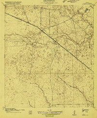 1915 Cypress1915 Print · USGSCoastal prairie and creek-side settlements define this Harris County area during the early twentieth century. Researchers can trace historic landholdings like Bains Ranch or find early educational sites including Big Cypress School and Brink School.3 unique versions available
 - 1918 Map of Cypress
 1918 Cypress1918 Print · USGSCypress and its surrounding prairie are documented here in the early 1900s, showing a rural Harris County landscape of ranching and creek-side schools. Genealogists and historians can trace family locations near Houston Hot Wells, Rams Ranch, or the Big Cypress School.2 unique versions available
 - 1950 Map of Houston, 1953 Print
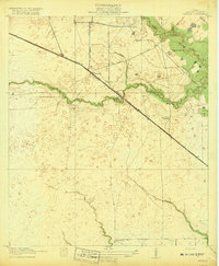
 1950 Houston1953 Print · USGSCoastal Texas in the early fifties reveals a landscape of massive civil engineering and industrial transit. Genealogists and researchers can trace the growth of the Houston suburbs and the maritime infrastructure of Galveston Bay, including the Gulf Freeway and the Texas City Dike.
 - 1955 Map of Addicks, 1957 Print
 1955 Addicks1957 Print · USGSHarris County undergoes rapid transformation in the mid-fifties as Houston's city boundary pushes west. Trace family history and early industry through the Satsuma Oil Field, Addicks Dam, and Roeder Cem.
 - 1956 Map of Houston, 1963 Print
 1956 Houston1963 Print · USGSSoutheast Texas in the mid-fifties is captured here as a powerhouse of oil and maritime trade. Genealogists and historians can trace the foundations of Houston and its ports, alongside landmarks like the Rice Institute and the Spindletop Oil Field.2 unique versions available
 - 1970 Map of Cypress, 1972 Print
 1970 Cypress1972 Print · USGSCypress and its surrounding prairie are shown here during the early 1970s as suburban growth began to reach into rural Harris County. Researchers can trace family history through sites like Graves Cem and Muller Cem, or follow the Southern Pacific rail line through Hot Wells.3 unique versions available
 - 1975 Map of Houston, 1977 Print
 1975 Houston1977 Print · USGSThe Texas Gulf Coast in the mid-seventies shows a sprawling Houston metropolis linked to the sea by the massive Houston Ship Channel. Researchers can trace the mid-century industrial landscape from the Astrodome to the Lyndon B. Johnson Space Center.2 unique versions available
 - 1992 Map of Houston
 1992 Houston1992 Print · USGSThe Houston metropolitan area reached its modern sprawl in the early nineties, centered on the Buffalo Bayou and a massive regional rail network. Genealogists and historians can trace the development of satellite cities like Sugar Land and Pasadena, or locate legacy sites like the Humble Oil Field and the NASA Lyndon B Johnson Space Center.
 - 1995 Map of Cypress, 1999 Print
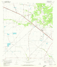
 1995 Cypress1999 Print · USGSNorthwest Harris County undergoes rapid suburbanization in the mid-nineties as neighborhood grids expand toward the Cypress community. Genealogists and local historians can trace family burial sites like Knigge Cem alongside landmarks like Weiser Air Park and Hot Wells.
 - 2010 Map of Cypress, 2010 Print
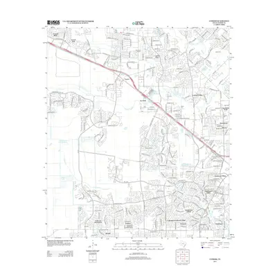
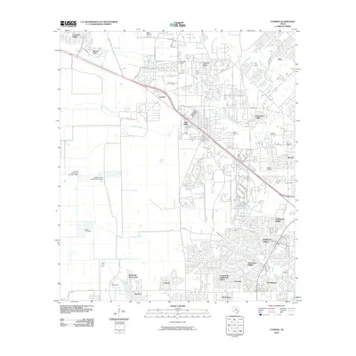 2010 Cypress2010 Print · USGSCovers Enchanted Valley Estates, including Houston, Cypress, and other nearby areas
 - 2013 Map of Cypress, 2013 Print
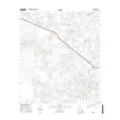
 2013 Cypress2013 Print · USGSCovers Enchanted Valley Estates, including Houston, Cypress, and other nearby areas
 - 2016 Map of Cypress, 2016 Print
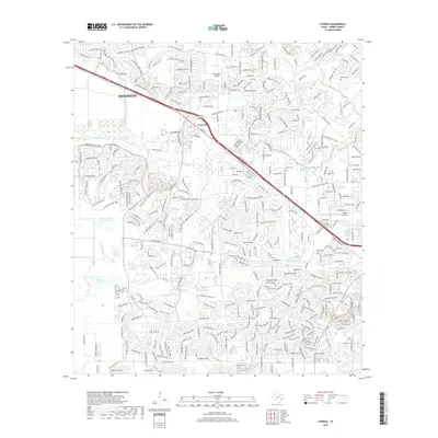
 2016 Cypress2016 Print · USGSCovers Enchanted Valley Estates, including Houston, Cypress, and other nearby areas
 - 2019 Map of Cypress, 2019 Print
 2019 Cypress2019 Print · USGSCovers Enchanted Valley Estates, including Houston, Cypress, and other nearby areas
 - 2022 Map of Cypress, 2022 Print
 2022 Cypress2022 Print · USGSCypress and the northwestern reaches of Houston are shown here during a period of intense suburban growth. Genealogists can locate several family burial sites like Dolen Family Cem 2 and Mueller Cem alongside landmarks like Dry Creek Airport.
End of results
Showing maps 1-14 of 14
Frequently asked questions
- What are the different types of historical maps available for Enchanted Valley Estates?
- What is the oldest map of Enchanted Valley Estates?
- Where can I purchase historical maps of Enchanted Valley Estates for my home or office?
- Where can I download high-res historical maps of Enchanted Valley Estates?
- Are there historical topographic maps available for Enchanted Valley Estates?
- Is there historical aerial imagery available for Enchanted Valley Estates?
- Where are historical maps of Enchanted Valley Estates sourced from?