Old Maps of Lakewood Forest, Harris County for Hiking & Exploration
Hike through history with 18 historic maps of Lakewood Forest. Explore old trails, ghost towns, and forgotten backroads — perfect for outdoor adventurers and local explorers.
- Rediscover forgotten places: Map out old mining camps, roads, and footpaths that no longer exist on modern maps.
- Layer with modern tools: Combine with LiDAR or satellite views to plan hikes through historical terrain.
- Made for exploration: Popular among hikers, overlanders, and local history lovers.
Use these maps to find adventure and explore the hidden past of Lakewood Forest.
Lakewood Forest, Harris County maps
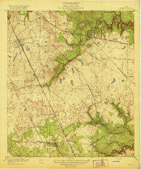
(18)- 1916 Map of Louetta
 1916 Louetta1916 Print · USGSCovers Lakewood Forest, including Houston, Tomball, and other nearby areas
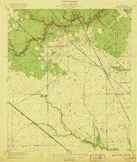
 - 1916 Map of Satsuma
 1916 Satsuma1916 Print · USGSCovers Lakewood Forest, including Houston, Jersey Village, and other nearby areas3 unique versions available
 - 1920 Map of Louetta
 1920 Louetta1920 Print · USGSCovers Lakewood Forest, including Houston, Tomball, and other nearby areas2 unique versions available
 - 1920 Map of Satsuma
 1920 Satsuma1920 Print · USGSCovers Lakewood Forest, including Houston, Jersey Village, and other nearby areas2 unique versions available
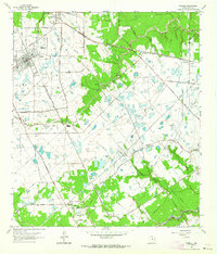
 - 1950 Map of Houston, 1953 Print
 1950 Houston1953 Print · USGSCovers Lakewood Forest, including Houston, Pasadena, and other nearby areas
 - 1954 Map of Beaumont, 1964 Print
 1954 Beaumont1964 Print · USGSCovers Lakewood Forest, including Houston, Beaumont, and other nearby areas3 unique versions available
 - 1955 Map of Addicks, 1957 Print
 1955 Addicks1957 Print · USGSCovers Lakewood Forest, including Houston, Cypress, and other nearby areas
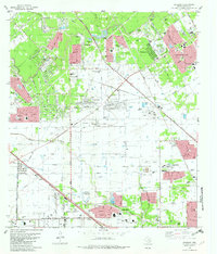
 - 1956 Map of Houston, 1963 Print
 1956 Houston1963 Print · USGSCovers Lakewood Forest, including Houston, Pasadena, and other nearby areas2 unique versions available
 - 1957 Map of Beaumont
 1957 Beaumont1957 Print · USGSCovers Lakewood Forest, including Houston, Beaumont, and other nearby areas
 - 1962 Map of Tomball, 1964 Print
 1962 Tomball1964 Print · USGSCovers Lakewood Forest, including Houston, Tomball, and other nearby areas4 unique versions available
 - 1970 Map of Satsuma, 1973 Print
 1970 Satsuma1973 Print · USGSCovers Lakewood Forest, including Houston, Jersey Village, and other nearby areas
 - 1975 Map of Houston, 1977 Print
 1975 Houston1977 Print · USGSCovers Lakewood Forest, including Houston, Pasadena, and other nearby areas2 unique versions available
 - 1982 Map of Satsuma
 1982 Satsuma1982 Print · USGSCovers Lakewood Forest, including Houston, Jersey Village, and other nearby areas2 unique versions available
 - 1984 Map of Beaumont
 1984 Beaumont1984 Print · USGSCovers Lakewood Forest, including Houston, Beaumont, and other nearby areas3 unique versions available
 - 1985 Map of Conroe
 1985 Conroe1985 Print · USGSCovers Lakewood Forest, including Houston, The Woodlands, and other nearby areas2 unique versions available
 - 1992 Map of Houston
 1992 Houston1992 Print · USGSCovers Lakewood Forest, including Houston, Pasadena, and other nearby areas
 - 1995 Map of Tomball, 1999 Print
 1995 Tomball1999 Print · USGSCovers Lakewood Forest, including Houston, Tomball, and other nearby areas
 - 1995 Map of Satsuma, 2000 Print
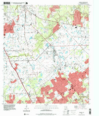
 1995 Satsuma2000 Print · USGSCovers Lakewood Forest, including Houston, Jersey Village, and other nearby areas
End of results
Showing maps 1-18 of 18
Frequently asked questions
- What are the different types of historical maps available for Lakewood Forest?
- What is the oldest map of Lakewood Forest?
- Where can I purchase historical maps of Lakewood Forest for my home or office?
- Where can I download high-res historical maps of Lakewood Forest?
- Are there historical topographic maps available for Lakewood Forest?
- Is there historical aerial imagery available for Lakewood Forest?
- Where are historical maps of Lakewood Forest sourced from?