Old Maps of Hopkins County, Texas
Explore 136 old maps of Hopkins County, spanning from 1953 to today. These high-resolution historic maps reveal how streets, neighborhoods, landmarks, and natural features evolved over time — perfect for genealogy, metal detecting, research, and local history exploration.
What you can do with these maps:
- See how Hopkins County changed over time: Compare historical maps to modern-day views to trace roads, homesites, rail lines & more.
- View detailed metadata: Each map includes creators, publishers, year, scale, and archive source.
- Overlay maps with satellite & LiDAR: Visualize the past alongside modern tools to explore terrain & human change.
- Trusted historical sources: Maps sourced from the USGS, Library of Congress, and other archives.
- Access maps your way: View online, download high-res files, or order prints for personal or research use.
Start exploring old maps of Hopkins County to uncover forgotten places, hidden landmarks, and the deep history beneath your feet.
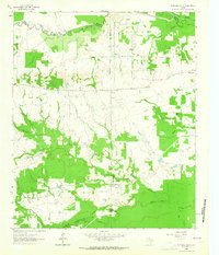
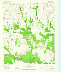
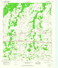
Hopkins County, TX maps
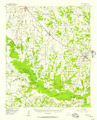
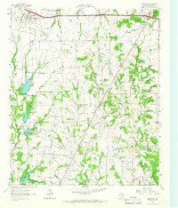
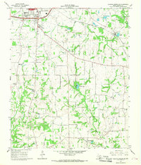
(136)- 1953 Map of Texarkana, 1964 Print
 1953 Texarkana1964 Print · USGSThe Texas-Arkansas borderlands are captured here in the mid-fifties, during a decade of massive military and hydraulic engineering projects. Genealogists and researchers can locate family landmarks like Old Boston Cem, Siloam Ch, and the vast Red River Arsenal.4 unique versions available
 - 1956 Map of Texarkana
 1956 Texarkana1956 Print · USGSThe Ark-La-Tex borderlands come alive in the mid-fifties, showing the transition from a rail-dependent rural economy to a post-war industrial landscape. Researchers can trace the massive Red River Ordnance Depot and find towns like Talco, Bogata, and Naples.
 - 1956 Map of Tyler
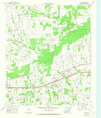
 1956 Tyler1956 Print · USGSEast Texas was a powerhouse of oil production and rail transport during the mid-fifties, centered on the sprawling East Texas Oil Field. Researchers can trace the heritage of industrial hubs like Kilgore, military sites such as the Longhorn Ordnance Works, and many rural landmarks like Mount Enterprise.5 unique versions available
 - 1956 Map of Emory, 1957 Print
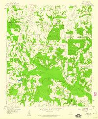
 1956 Emory1957 Print · USGSRains County and its neighbors are shown here in the mid-fifties, just as the Sabine River valley prepared for the construction of the Iron Bridge Damsite. Genealogists can trace family roots through numerous small landmarks like Bright Star Ch, Cody Sch, and Parks Cem.3 unique versions available
 - 1958 Map of Arbala, 1960 Print
 1958 Arbala1960 Print · USGSEast Texas rural life in the late fifties is captured here through the quiet settlements and family cemeteries of Rains and Hopkins counties. Genealogists can trace local roots at Arbala, Bonanza, and the Ishmael Cem along the banks of Lake Fork Creek.4 unique versions available
 - 1959 Map of Yantis, 1960 Print
 1959 Yantis1960 Print · USGSEast Texas ranching and timber lands meet the burgeoning energy sector in the late fifties. Genealogists and local researchers can trace family landmarks like Sandifer Sch, Yantis Cem, and the rural community at Seymore.3 unique versions available
 - 1959 Map of Alba, 1961 Print
 1959 Alba1961 Print · USGSNortheast Texas at the dawn of the 1960s reveals a landscape of oil fields, family cemeteries, and rural rail stops. Genealogists and local historians can locate early sites like Sandifer Sch, Shady Grove, and the Bucks Yandell Cem scattered near the Elm Fork.2 unique versions available
 - 1960 Map of Winnsboro, 1962 Print
 1960 Winnsboro1962 Print · USGSEast Texas oil and rail culture intersect here at the start of the 1960s, showing the town and its surrounding fields. Trace family history through Lee Cemetery or explore the local petroleum boom at the Pickton Oil Field and McCrary Oil Field.3 unique versions available
 - 1960 Map of Pleasant Grove, 1962 Print
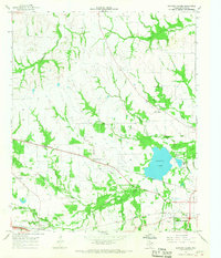
 1960 Pleasant Grove1962 Print · USGSWood and Hopkins County land sits at the peak of its oil-producing era in the early sixties. Genealogists and historians can locate rural landmarks like Stormville Ch, Black Oak, and the wells of the extensive Manziel Oil Field.2 unique versions available
 - 1962 Map of Sulphur Bluff, 1964 Print
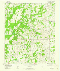
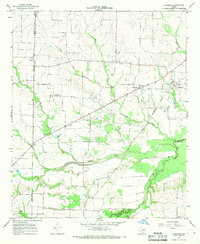
 1962 Sulphur Bluff1964 Print · USGSIn the early 1960s, the boundary between Delta and Hopkins Counties was defined by the meandering course of the South Sulphur River. Researchers can trace the rural layout of Sulphur Bluff, Nelta, and the East Dike Ch during a period of active local oil exploration.
 - 1962 Map of Miller Grove, 1966 Print
 1962 Miller Grove1966 Print · USGSCrossing the Hopkins and Hunt county line in the early sixties, this area shows a landscape of rural crossroads and creek-side settlements. Genealogists can trace early families at Donelton Cem, Liberty Point Cem, and the rural Donelton Ch.2 unique versions available
 - 1962 Map of Brashear, 1966 Print
 1962 Brashear1966 Print · USGSHopkins County in the early sixties reveals a landscape of tight-knit rural communities and emerging water management systems. Genealogists and local historians can trace the foundations of Brashear, Shirley, and Rockdale, including specific locations for Rockdale Ch and Greenview Ch.
 - 1963 Map of Mitchell Creek, 1964 Print
 1963 Mitchell Creek1964 Print · USGSNortheast Texas rural life and industrial growth intersect in the 1960s at the convergence of four counties. Trace family history at Fairview Ch or the Shell Oil Field and explore the bottoms of the South Sulphur River.
 - 1963 Map of Cunningham, 1964 Print
 1963 Cunningham1964 Print · USGSNortheast Texas river country in the early sixties reveals a landscape shaped by the meeting of the North and South Sulphur Rivers. Researchers can locate family landmarks like Restland Cem and Morris Chapel Cem near the historic settlements of Cunningham and Halesboro.
 - 1964 Map of Saltillo, 1967 Print
 1964 Saltillo1967 Print · USGSNorthwest Texas during the mid-sixties reveals a landscape of rural schoolhouses and creekside settlements. Genealogists and local historians can locate legacy landmarks like Old Saltillo Ch, Stouts Creek Cem, and the path of the St Louis Southwestern rail line.
 - 1964 Map of Como, 1968 Print
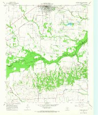
 1964 Como1968 Print · USGSHopkins County's rural landscape is captured in the mid-sixties, a period when the energy sector and railroads shaped local life. Researchers can trace family history through Woodland Cem, locate the St Marks Sch, or map the footprint of the Pickton Oil Field.
 - 1964 Map of Purley, 1968 Print
 1964 Purley1968 Print · USGSThe rural borderlands of Hopkins and Franklin Counties are captured here in the mid-sixties, showing a landscape of small farming settlements and creek bottoms. Researchers can trace the Louisiana and Arkansas rail line or locate family sites near Purley, Greenwood, and Pleasant Hill Cem.2 unique versions available
 - 1964 Map of Cumby, 1968 Print
 1964 Cumby1968 Print · USGSThe rural landscape of Hopkins and Hunt Counties in the 1960s is defined by its rail-and-river network before major landscape changes. Genealogists can trace family landmarks like Oakland Cem and small settlements such as Ridgeway and Branom.2 unique versions available
 - 1964 Map of Sulphur Springs, 1968 Print
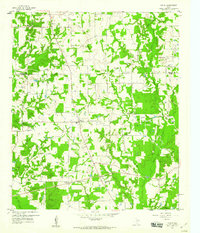
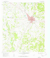
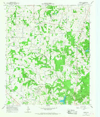
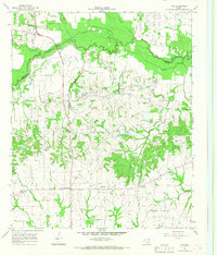
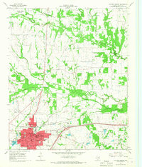 1964 Sulphur Springs1968 Print · USGSSulphur Springs and its rural environs are captured in the mid-1960s, showing a landscape defined by the St Louis Southwestern railroad and numerous country churches. Genealogists and researchers can trace family-named sites like Beckham Ch, Old Tarrant Ch, and the Odd Fellows Cem.
 - 1964 Map of Gafford Chapel, 1968 Print
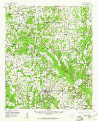
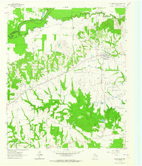
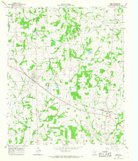
 1964 Gafford Chapel1968 Print · USGSHopkins County, Texas, is captured here in the mid-1960s as a landscape of rural communities and vital rail lines. Genealogists and researchers can trace local landmarks like Gafford Chapel, Webb, and the old Drive-in Theater near the railroad junctions.
 - 1964 Map of Klondike, 1968 Print
 1964 Klondike1968 Print · USGSDelta County agricultural life is captured here in the mid-sixties, showing a landscape defined by the Southern Pacific rail line and the Sulphur River forks. Genealogists can locate family landmarks like Shiloh Cem, Wintermute Mem Hosp, and the community of Klondike.2 unique versions available
 - 1964 Map of Tira, 1968 Print
 1964 Tira1968 Print · USGSNorth Texas in the mid-sixties remains a landscape of small agricultural settlements and family-named cemeteries. Genealogists can trace local roots at the North Hopkins Sch or through family sites like Aiguier Cem, Self Cem, and the community of Birthright.2 unique versions available
 - 1964 Map of Cooper South, 1968 Print
 1964 Cooper South1968 Print · USGSDelta and Hopkins counties in the mid-1960s are defined by the river bottom and the iron rails of the Southern Pacific. Genealogists and local historians can trace rural life through the Free Hope Ch and old burial sites like Dawson Cem or Hickory Grove Cem.
 - 1964 Map of Sulphur Springs SE, 1968 Print
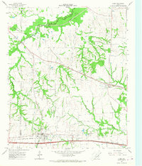
 1964 Sulphur Springs SE1968 Print · USGSThe southeastern corner of Hopkins County in the mid-1960s reveals a network of rural communities and rail-side industry. Genealogists and local historians can trace family-named sites like Mc Keever, old burial grounds like Gamblin Cem, and the quiet community of Reilly Springs.2 unique versions available
 - 1965 Map of Dike, 1968 Print
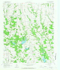
 1965 Dike1968 Print · USGSHopkins County in the mid-1960s is a landscape of creek-fed bottomlands and rural crossroads. Genealogists and local historians can trace family-named sites like Connor Cem and Bennett Cem, or locate the Richland Ch along the St Louis Southwestern rail line.2 unique versions available
Showing maps 1-25 of 136
Top cities of Hopkins County
Frequently asked questions
- What are the different types of historical maps available for Hopkins County?
- What is the oldest map of Hopkins County?
- Where can I purchase historical maps of Hopkins County for my home or office?
- Where can I download high-res historical maps of Hopkins County?
- Are there historical topographic maps available for Hopkins County?
- Is there historical aerial imagery available for Hopkins County?
- Where are historical maps of Hopkins County sourced from?