Old Maps of Shady Grove, Texas
Explore 11 old maps of Shady Grove, spanning from 1953 to today. These high-resolution historic maps reveal how streets, neighborhoods, landmarks, and natural features evolved over time — perfect for genealogy, metal detecting, research, and local history exploration.
What you can do with these maps:
- See how Shady Grove changed over time: Compare historical maps to modern-day views to trace roads, homesites, rail lines & more.
- View detailed metadata: Each map includes creators, publishers, year, scale, and archive source.
- Overlay maps with satellite & LiDAR: Visualize the past alongside modern tools to explore terrain & human change.
- Trusted historical sources: Maps sourced from the USGS, Library of Congress, and other archives.
- Access maps your way: View online, download high-res files, or order prints for personal or research use.
Start exploring old maps of Shady Grove to uncover forgotten places, hidden landmarks, and the deep history beneath your feet.
Shady Grove, TX maps
(11)- 1953 Map of Palestine, 1964 Print
 1953 Palestine1964 Print · USGSEast Texas was defined by its deep pine forests and burgeoning energy sector in the mid-1950s. Genealogists and historians can trace the rail-and-river economy through settlements like Tennessee Colony and Pollok or explore the early footprints of the Cayuga Oil Field and Davy Crockett National Forest.2 unique versions available
 - 1957 Map of Palestine
 1957 Palestine1957 Print · USGSEast Texas in the mid-fifties reveals a landscape of deep pine forests and winding river valleys before the era of massive reservoir construction. Researchers can trace the legacy of the timber and rail industries through labels for the Missouri Pacific RR, Davy Crockett National Forest, and Nacogdoches.
 - 1963 Map of Fodice, 1965 Print
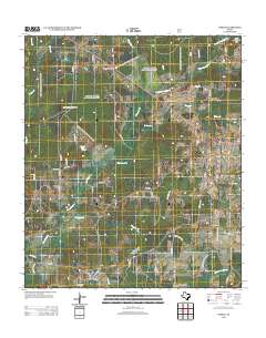
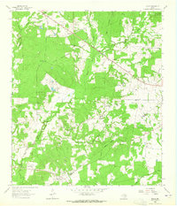 1963 Fodice1965 Print · USGSThe piney woods and crossroads of East Texas appear in the early sixties, showing a landscape defined by timber and agriculture. Trace old family sites and rural landmarks like Fodice Cem, White Rock Ch, and the settlement of Shady Grove.2 unique versions available
 - 1984 Map of Palestine
 1984 Palestine1984 Print · USGSEast Texas in the mid-eighties reveals a landscape of massive reservoirs and protected timberlands between Palestine and Nacogdoches. Researchers can trace old routes like the Missouri Pacific RR and locate rural communities such as Tennessee Colony, Latexo, and Etoile.3 unique versions available
 - 1985 Map of Crockett
 1985 Crockett1985 Print · USGSEast Texas timber and river country are captured here during the mid-eighties, showing the region's transition into the modern era. Genealogists and historians can trace the Old San Antonio Road and locate rural landmarks like Hazel Chapel or Weldon Cem.2 unique versions available
 - 2004 Map of Fodice, 2006 Print
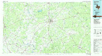
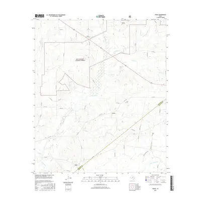
 2004 Fodice2006 Print · USGSHouston and Trinity Counties in East Texas are shown in the early 2000s, centered on the wooded reaches of the Davy Crockett National Forest. Researchers can trace rural community centers at Fodice, locate family history at Fodice Cem, and map the small churches like Thankful Ch.
 - 2011 Map of Fodice, 2011 Print
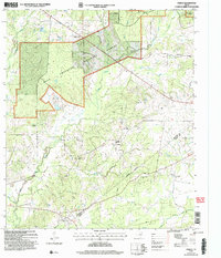
 2011 Fodice2011 Print · USGSCovers Shady Grove, including Holly, Fodice, and other nearby areas
 - 2013 Map of Fodice, 2013 Print
 2013 Fodice2013 Print · USGSCovers Shady Grove, including Holly, Fodice, and other nearby areas
 - 2016 Map of Fodice, 2016 Print
 2016 Fodice2016 Print · USGSCovers Shady Grove, including Holly, Fodice, and other nearby areas
 - 2019 Map of Fodice, 2019 Print
 2019 Fodice2019 Print · USGSCovers Shady Grove, including Holly, Fodice, and other nearby areas
 - 2022 Map of Fodice, 2022 Print
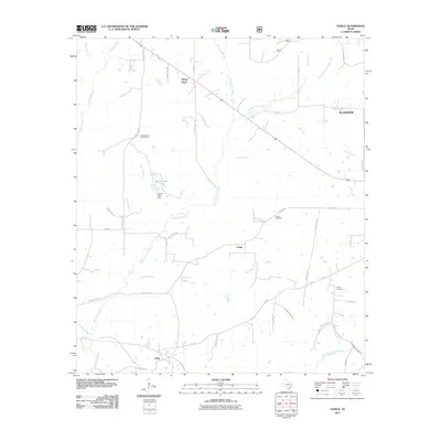
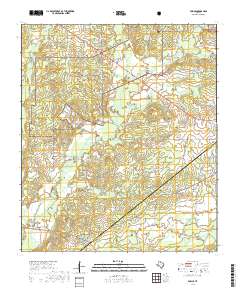
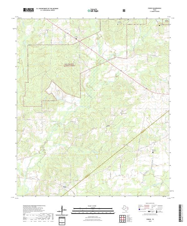 2022 Fodice2022 Print · USGSEast Texas forest lands and rural Houston County communities come into focus in this recent survey. Local historians can trace the legacy of Fodice and Holly, while genealogists can locate several remote burial sites like Old Shady Grove Cemetery and Lake Creek Cemetery.
End of results
Showing maps 1-11 of 11
Top cities near Shady Grove
- Crockett historical maps
- Groveton historical maps
- Lovelady historical maps
- Kennard historical maps
- Latexo historical maps
- Hickory Creek historical maps
Frequently asked questions
- What are the different types of historical maps available for Shady Grove?
- What is the oldest map of Shady Grove?
- Where can I purchase historical maps of Shady Grove for my home or office?
- Where can I download high-res historical maps of Shady Grove?
- Are there historical topographic maps available for Shady Grove?
- Is there historical aerial imagery available for Shady Grove?
- Where are historical maps of Shady Grove sourced from?