Old Maps of Borger, Texas
Explore 17 old maps of Borger, spanning from 1953 to today. These high-resolution historic maps reveal how streets, neighborhoods, landmarks, and natural features evolved over time — perfect for genealogy, metal detecting, research, and local history exploration.
What you can do with these maps:
- See how Borger changed over time: Compare historical maps to modern-day views to trace roads, homesites, rail lines & more.
- View detailed metadata: Each map includes creators, publishers, year, scale, and archive source.
- Overlay maps with satellite & LiDAR: Visualize the past alongside modern tools to explore terrain & human change.
- Trusted historical sources: Maps sourced from the USGS, Library of Congress, and other archives.
- Access maps your way: View online, download high-res files, or order prints for personal or research use.
Start exploring old maps of Borger to uncover forgotten places, hidden landmarks, and the deep history beneath your feet.
Borger, TX maps
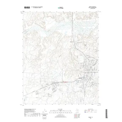
(17)- 1953 Map of Phillips, 1955 Print
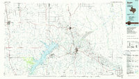
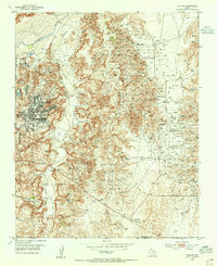 1953 Phillips1955 Print · USGSThe Texas Panhandle oil boom is in full swing on this mid-century survey of the Borger Oil Field. Local researchers can trace industrial sites like the Refinery and Texroy, or find family roots at Phillips Camp and Haile Ch.
 - 1953 Map of Borger, 1955 Print
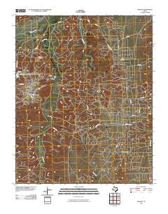
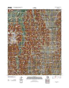
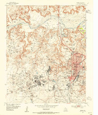 1953 Borger1955 Print · USGSMid-century Borger is captured here during its height as an industrial powerhouse, showing a landscape defined by oil fields and chemical plants. Researchers can trace the development of worker communities like Philrich and Electric City or locate family history at Highland Park Cem.
 - 1954 Map of Amarillo, 1966 Print
 1954 Amarillo1966 Print · USGSThe Texas Panhandle in the mid-1960s shows a landscape of rising industrial power and deep-rooted ranching tradition. Local historians can trace the paths of the Panhandle and Santa Fe railroad or locate sites like the Pantex Ordnance Plant and Mobeetie.2 unique versions available
 - 1958 Map of Amarillo
 1958 Amarillo1958 Print · USGSThe Texas Panhandle in the mid-1950s reveals a landscape of expanding military installations and oil-rich rail towns. Local historians can trace the development of Amarillo Air Force Base or locate smaller settlements like Magic City and New Mobeetie.
 - 1970 Map of Borger, 1973 Print
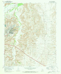
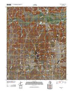
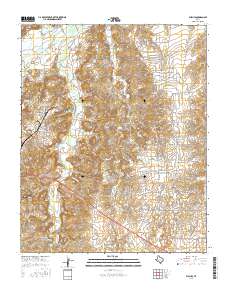
 1970 Borger1973 Print · USGSThe Texas Panhandle petroleum landscape is on full display here in the 1970s, from the industrial plants of Bunavista to the city of Borger. Researchers can trace local landmarks like Highland Park (Cem), Frank Phillips College, and the sprawling Dial Oil Field.2 unique versions available
 - 1970 Map of Phillips, 1973 Print
 1970 Phillips1973 Print · USGSHutchinson County at the height of the Texas oil boom reveals a landscape transformed by extraction and industry. Follow the development of the company town of Phillips and trace historical land use through Haile Ch, the Borger Oil Field, and Spring Creek Sch.2 unique versions available
 - 1986 Map of Borger
 1986 Borger1986 Print · USGSThe Texas Panhandle's energy landscape is captured here in the mid-eighties, showing the intersection of industrial development and the Lake Meredith shoreline. Researchers can trace company-town heritage and rail history through sites like Signal Hill, Supreme Camp, and the Atchison Topeka and Santa Fe railroad line.2 unique versions available
 - 2010 Map of Phillips, 2010 Print
 2010 Phillips2010 Print · USGSCovers Borger, including Phillips, Texroy, and other nearby areas
 - 2010 Map of Borger, 2010 Print
 2010 Borger2010 Print · USGSCovers Borger, including Electric City, Philrich, and other nearby areas
 - 2012 Map of Borger, 2012 Print
 2012 Borger2012 Print · USGSCovers Borger, including Electric City, Philrich, and other nearby areas
 - 2013 Map of Phillips, 2013 Print
 2013 Phillips2013 Print · USGSCovers Borger, including Phillips, Texroy, and other nearby areas
 - 2016 Map of Phillips, 2016 Print
 2016 Phillips2016 Print · USGSCovers Borger, including Phillips, Texroy, and other nearby areas
 - 2016 Map of Borger, 2016 Print
 2016 Borger2016 Print · USGSCovers Borger, including Electric City, Philrich, and other nearby areas
 - 2019 Map of Phillips, 2019 Print
 2019 Phillips2019 Print · USGSCovers Borger, including Phillips, Texroy, and other nearby areas
 - 2019 Map of Borger, 2019 Print
 2019 Borger2019 Print · USGSCovers Borger, including Electric City, Philrich, and other nearby areas
 - 2022 Map of Borger, 2022 Print
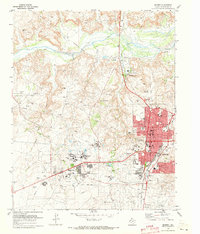
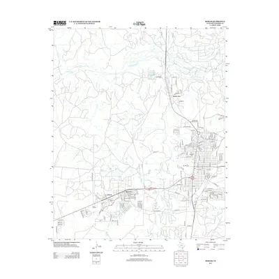
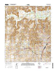
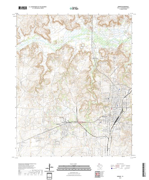 2022 Borger2022 Print · USGSThe Texas Panhandle town of Borger and its surrounding industrial settlements are shown here in the early twenty-first century. Researchers can trace the layout of Bunavista and Philrich, locate Highland Park Cemetery, and see the city's relationship to the Canadian River.
 - 2022 Map of Phillips, 2022 Print
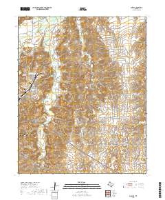
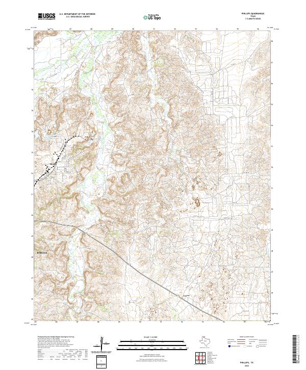 2022 Phillips2022 Print · USGSPhillips and the outskirts of Borger are captured here during the 2020s, showcasing the intersection of Texas Panhandle industry and river geography. Trace the local landscape along Dixon Cr and Bear Cr or locate specific sites like Texroy and the Phillips Stormwater Control Reservoir Pantex Reservoir.
End of results
Showing maps 1-17 of 17
Top cities near Borger
Top neighborhoods of Borger
Frequently asked questions
- What are the different types of historical maps available for Borger?
- What is the oldest map of Borger?
- Where can I purchase historical maps of Borger for my home or office?
- Where can I download high-res historical maps of Borger?
- Are there historical topographic maps available for Borger?
- Is there historical aerial imagery available for Borger?
- Where are historical maps of Borger sourced from?