Old Maps of Irion County, Texas
Explore 197 old maps of Irion County, spanning from 1895 to today. These high-resolution historic maps reveal how streets, neighborhoods, landmarks, and natural features evolved over time — perfect for genealogy, metal detecting, research, and local history exploration.
What you can do with these maps:
- See how Irion County changed over time: Compare historical maps to modern-day views to trace roads, homesites, rail lines & more.
- View detailed metadata: Each map includes creators, publishers, year, scale, and archive source.
- Overlay maps with satellite & LiDAR: Visualize the past alongside modern tools to explore terrain & human change.
- Trusted historical sources: Maps sourced from the USGS, Library of Congress, and other archives.
- Access maps your way: View online, download high-res files, or order prints for personal or research use.
Start exploring old maps of Irion County to uncover forgotten places, hidden landmarks, and the deep history beneath your feet.
Irion County, TX maps
(197)- 1895 Map of Sherwood
 1895 Sherwood1895 Print · USGSCentral West Texas at the close of the nineteenth century centers on the cattle-country hubs of Sherwood and Knickerbocker. Genealogists and researchers can trace early homesteading patterns near Spring Creek, the Middle Concho River, and Lopez Peaks.5 unique versions available
 - 1920 Map of Big Lake, 1965 Print
 1920 Big Lake1965 Print · USGSReagan County ranching and rail life are preserved in this early twentieth-century survey of the West Texas plains. Researchers can trace historic family-named landholdings like Carroll Ranch and the route of the Kansas City Mexico and Orient railroad.
 - 1920 Map of Barnhart, 1965 Print
 1920 Barnhart1965 Print · USGSThe ranching country of West Texas comes into focus during the 1920s as the rail line reached the Irion and Crockett county line. Genealogists can trace family holdings at the Murphy Ranch and Noelke Ranch or follow the route of the old Ozona Road.
 - 1921 Map of Ketchum Mountain, 1957 Print
 1921 Ketchum Mountain1957 Print · USGSWest Texas ranching life is frozen in time during the early 1920s, revealing a landscape of family-named cattle spreads and essential water sources. Researchers can trace the heritage of the Evans Ranch, 7 Bar D Ranch, and the remote Burney School near Ketchum Mountain.
 - 1922 Map of Big Lake
 1922 Big Lake1922 Print · USGSBig Lake and the surrounding West Texas ranchlands are captured here in the early 1920s as the railroad drove local growth. Genealogists and historians can trace family-named sites like Luther Ranch and Wilson Ranch along the historic Sheffield Road.
 - 1922 Map of Barnhart
 1922 Barnhart1922 Print · USGSWest Texas ranching country comes into focus in the early 1920s as the rail line brings industry to the high plains. Genealogists and historians can trace the vast boundaries of the Slaughter Ranch and Noelke Ranch or locate the original depot at Barnhart.
 - 1923 Map of Ketchum Mountain
 1923 Ketchum Mountain1923 Print · USGSIrion County ranching life in the early twenties is centered around the Middle Concho River and its essential water wells. Researchers can trace the layout of early Texas landholdings including the 7 Bar D Ranch, Bristow Ranch, and the rural Burney School.2 unique versions available
 - 1928 Map of Tankersly
 1928 Tankersly1928 Print · USGSWest Texas ranching country comes alive in the late 1920s, centered on the strategic river junctions of Tom Green County. Trace the early cattle and rail routes near Knickerbocker, the distinctive Twin Buttes, and the Middle Concho River.3 unique versions available
 - 1954 Map of San Angelo, 1967 Print
 1954 San Angelo1967 Print · USGSThe Concho Valley and eastern Permian Basin transition from ranching to a burgeoning oil economy during the mid-twentieth century. Trace the expansion of San Angelo near Goodfellow AFB and locate old crossroads like Stiles, Texon, and Barnhart along the SANTA FE railroad.2 unique versions available
 - 1957 Map of Carlsbad, 1958 Print
 1957 Carlsbad1958 Print · USGSTom Green County ranching and rail infrastructure are on full display in the late fifties as the San Angelo Reservoir takes shape. Genealogists can locate family landmarks like the McKnight State Sanatorium, Grape Creek Cem, and Turner Ranch Headquarters.2 unique versions available
 - 1957 Map of Knickerbocker, 1958 Print
 1957 Knickerbocker1958 Print · USGSTom Green County and the Concho River forks are captured here in the late fifties as San Angelo's water system expanded. Genealogists and historians can locate family landmarks like the Mayer Ranch, the Midway Cem, and the Knickerbocker settlement.2 unique versions available
 - 1958 Map of San Angelo
 1958 San Angelo1958 Print · USGSWest Texas in the late fifties centers on the growing hub of San Angelo and its vital river confluences. Genealogists and historians can trace the paths of the Santa Fe railroad to outposts like Fort Chadbourne, Big Lake, and the specialized community of Sanatorium.
 - 1965 Map of San Angelo
 1965 San Angelo1965 Print · USGSWest Texas in the mid-sixties reveals a landscape shaped by the petroleum industry and strategic water management. Genealogists and historians can trace the rail corridor through Texon and Big Lake, or locate military landmarks like Goodfellow AFB and Broome Air Force Auxiliary Airfield.
 - 1970 Map of South Mustang Draw SE, 1973 Print
 1970 South Mustang Draw SE1973 Print · USGSReagan and Irion Counties in the early seventies reveal an arid ranching landscape transitioning into an oil-producing region. Genealogists and historians can trace livestock infrastructure and water sources like West Line Camp, Lewis Windmill, and Whatley Windmill.
 - 1970 Map of South Mustang Draw NE, 1973 Print
 1970 South Mustang Draw NE1973 Print · USGSThe Reagan and Irion county line comes to life in the early 1970s, showing a West Texas rangeland dependent on vital water outposts. Trace the locations of isolated ranching hubs like Elbow Line Camp and family-named landmarks such as Dogtown Windmill and Bluff Water Hole.
 - 1971 Map of Witco, 1973 Print
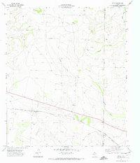 1971 Witco1973 Print · USGSReagan County in the early 1970s shows the height of the West Texas energy boom centered around the Witco settlement. Researchers can trace the extensive OIL FIELD infrastructure, numerous Oil Wells, and the path of the ATCHISON TOPEKA AND SANTA FE railroad.
 - 1971 Map of Barnhart SW, 1974 Print
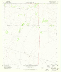 1971 Barnhart SW1974 Print · USGSWest Texas ranching and resource extraction are captured here in the early seventies along the Irion and Crockett County line. Researchers can trace the Atchison Topeka and Santa Fe rail line and locate old sites at Owens or Bissett.
 - 1971 Map of Noelke, 1974 Print
 1971 Noelke1974 Print · USGSIrion County ranchlands meet the West Texas petroleum industry in the early seventies, centered around the settlement of Noelke. Researchers can trace the legacy of the Mertzon Oil Field and find specific family-named landmarks like the Upper Vinson Windmill and Jehovahs Witnesses Waterhole.2 unique versions available
 - 1971 Map of Barnhart, 1974 Print
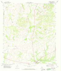 1971 Barnhart1974 Print · USGSBarnhart and the ranchlands of Irion County are captured here in the early seventies, centered on the intersection of the regional highway and rail networks. Researchers can trace the Atchison Topeka and Santa Fe rail line or locate family landmarks like Park Windmill and the Rest Haven Cem.
 - 1971 Map of Barnhart NE, 1974 Print
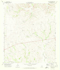 1971 Barnhart NE1974 Print · USGSIrion County ranching and oil production are at the forefront in the early seventies, centered around the Ketchum Oil Field. Researchers can trace old family-named landmarks and essential water sources like Brooks Windmill, Cedar Well, and the Atchison Topeka and Santa Fe rail line.
 - 1971 Map of Noelke SW, 1974 Print
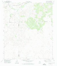 1971 Noelke SW1974 Print · USGSThe West Texas ranchlands at the intersection of Irion, Crockett, and Schleicher counties are captured here in the early 1970s. Trace the path of the Atchison Topeka and Santa Fe railroad as it passes through Dutch Woman Draw and near the Spring.2 unique versions available
 - 1971 Map of Suggs, 1974 Print
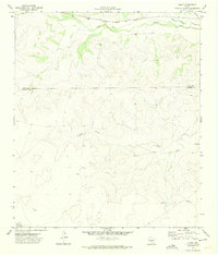 1971 Suggs1974 Print · USGSRanching and rail life converge at the Irion and Crockett county line during the early seventies. Genealogists and historians can trace family holdings like De Long Ranch and the small settlement of Suggs along the Atchison Topeka and Santa Fe railroad.
 - 1971 Map of Big Lake SE, 1974 Print
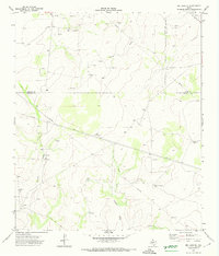 1971 Big Lake SE1974 Print · USGSThe West Texas ranching and oil country of the early seventies is revealed where the Reagan, Crockett, and Irion county lines meet. Researchers can trace the infrastructure of the Permian Basin via numerous Oil Wells and remote landmarks like West Windmill and Humble.
 - 1972 Map of Arden, 1974 Print
 1972 Arden1974 Print · USGSIrion County in the early 1970s is documented here as a landscape of river basins and emerging infrastructure. Researchers can trace family roots at the Arden Cem or follow the paths of the Middle Concho River and the small settlement at Mertz.
 - 1972 Map of Hulldale NW, 1974 Print
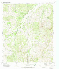 1972 Hulldale NW1974 Print · USGSThe West Texas ranchlands of Tom Green and Irion counties appear in the early 1970s as a landscape of oil production and creek-side landmarks. Local researchers can trace old ranching sites like the Headquarters Windmill and an isolated Cem near Dove Creek.2 unique versions available
Showing maps 1-25 of 197
Top cities of Irion County
Frequently asked questions
- What are the different types of historical maps available for Irion County?
- What is the oldest map of Irion County?
- Where can I purchase historical maps of Irion County for my home or office?
- Where can I download high-res historical maps of Irion County?
- Are there historical topographic maps available for Irion County?
- Is there historical aerial imagery available for Irion County?
- Where are historical maps of Irion County sourced from?