Old Maps of Cleburne, Texas
Explore 43 old maps of Cleburne, spanning from 1889 to today. These high-resolution historic maps reveal how streets, neighborhoods, landmarks, and natural features evolved over time — perfect for genealogy, metal detecting, research, and local history exploration.
What you can do with these maps:
- See how Cleburne changed over time: Compare historical maps to modern-day views to trace roads, homesites, rail lines & more.
- View detailed metadata: Each map includes creators, publishers, year, scale, and archive source.
- Overlay maps with satellite & LiDAR: Visualize the past alongside modern tools to explore terrain & human change.
- Trusted historical sources: Maps sourced from the USGS, Library of Congress, and other archives.
- Access maps your way: View online, download high-res files, or order prints for personal or research use.
Start exploring old maps of Cleburne to uncover forgotten places, hidden landmarks, and the deep history beneath your feet.
Cleburne, TX maps
(43)- 1889 Map of Granbury
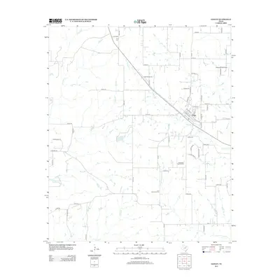
 1889 Granbury1889 Print · USGSIn the late 1880s, the Brazos River dictated the life and travel of North Texas, carving deep bends through Hood and Somervell counties. Genealogists and historians can trace early settlements like Fort Spunky and Glenrose or the routes of the Texas Central Railroad.6 unique versions available
 - 1891 Map of Cleburne
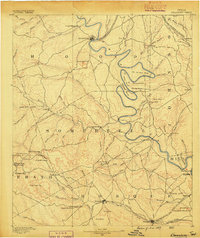
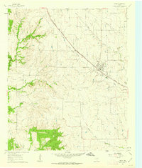
 1891 Cleburne1891 Print · USGSNorth Texas in the late nineteenth century was a land transformed by new iron rails and established river crossings. Genealogists and researchers can trace the early footprints of Cleburne and Hillsboro alongside vanished stops like Port Graham and Files Valley.
 - 1894 Map of Cleburne
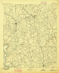 1894 Cleburne1894 Print · USGSNorth Central Texas was a burgeoning rail and cattle hub in the late nineteenth century. Genealogists and historians can trace the growth of Cleburne and Hillsboro alongside vanished river landings like Fort Graham and Kimball on the Brazos River.5 unique versions available
 - 1928 Map of Godley
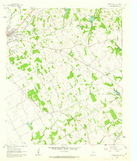
 1928 Godley1928 Print · USGSThe Brazos River winds through Hood and Somervell Counties in the mid-1920s, defining a landscape of deep river bends and rural crossroads. Researchers can locate early educational landmarks like Cordova Bend School and Harmony School, or trace the site of Ft Spunky.2 unique versions available
 - 1954 Map of Dallas, 1963 Print
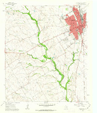
 1954 Dallas1963 Print · USGSNorth Texas in the mid-fifties and early sixties reveals a landscape of rapid urban growth and water management. Genealogists and historians can trace the evolution of the metroplex through landmarks like Hensley Field, Boles Orphan Home, and the Texas & Pacific RR.4 unique versions available
 - 1958 Map of Dallas
 1958 Dallas1958 Print · USGSNorth Texas in the late fifties shows the dramatic expansion of the Metroplex as it absorbs surrounding farm towns. Genealogists and historians can trace old rail lines like the Missouri-Kansas-Texas and locate early lakefront developments at Eagle Mountain Lake and Lake Worth Village.
 - 1960 Map of Keene, 1963 Print
 1960 Keene1963 Print · USGSJohnson County is shown here during a period of steady growth centered on the town of Keene and its local college. Genealogists and historians can trace the foundations of the community through rural landmarks like Lane Prairie Ch, Hopewell Cem, and the path of the Missouri Kansas and Texas railroad.3 unique versions available
 - 1960 Map of Cleburne East, 1963 Print
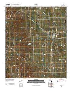
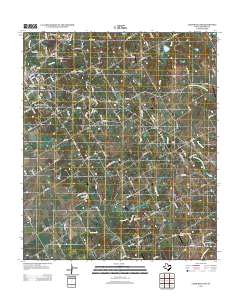
 1960 Cleburne East1963 Print · USGSThe eastern outskirts of Cleburne and the nearby rural farming communities appear here in the early 1960s. Genealogists and local historians can trace rural congregations and family burial sites like Watts Chapel, Morrow Cem, and the Liberty Chapel Sch.4 unique versions available
 - 1961 Map of Cleburne West, 1963 Print
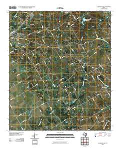
 1961 Cleburne West1963 Print · USGSCleburne enters the 1960s as a bustling rail and transit hub, surrounded by a rural landscape of family-named settlements. Trace local heritage at Bono Cem, find old schools like Cooke Sch, or follow the Gulf Colorado and Santa Fe railroad through town.3 unique versions available
 - 1961 Map of Bono, 1963 Print
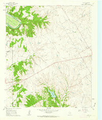 1961 Bono1963 Print · USGSJohnson County and the surrounding ranch lands are captured here in the early sixties as the Brazos River winds through its massive oxbow. Researchers can locate the small settlement of Bono, the quiet Nemo Cem, and the early layout of Cleburne State Park.3 unique versions available
 - 1961 Map of Joshua, 1963 Print
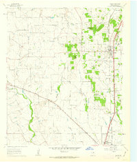 1961 Joshua1963 Print · USGSJohnson County is shown here in the early sixties as the communities of Joshua and Cleburne expanded along the rail lines. Researchers can locate family landmarks like Old Bethany Cem, the Buchanan Cem, and the distinctive height of Caddo Peak.3 unique versions available
 - 1961 Map of Godley, 1963 Print
 1961 Godley1963 Print · USGSThe town of Godley and its surrounding Johnson County ranch land are shown here in the early 1960s. Genealogists can locate family burial sites at Unity Cem and Lone Cottonwood Cem, or trace the Gulf Colorado and Santa Fe rail line.3 unique versions available
 - 1985 Map of Cleburne
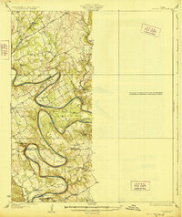
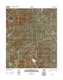
 1985 Cleburne1985 Print · USGSThe Brazos River valley and its major mid-century reservoirs dominate this North Central Texas landscape during the 1980s. Local researchers can trace family roots through sites like Mt Carmel Ch, Oak Hill Sch, and the unique river bends near Glen Rose.2 unique versions available
 - 2010 Map of Joshua, 2010 Print
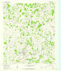
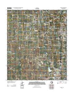
 2010 Joshua2010 Print · USGSCovers Cleburne, including Burleson, Joshua, and other nearby areas
 - 2010 Map of Bono, 2010 Print
 2010 Bono2010 Print · USGSCovers Cleburne, including Bono, Johnson County, and other nearby areas
 - 2010 Map of Keene, 2010 Print
 2010 Keene2010 Print · USGSCovers Cleburne, including Burleson, Joshua, and other nearby areas
 - 2010 Map of Godley, 2010 Print
 2010 Godley2010 Print · USGSCovers Cleburne, including Godley, Johnson County, and other nearby areas
 - 2010 Map of Cleburne West, 2010 Print
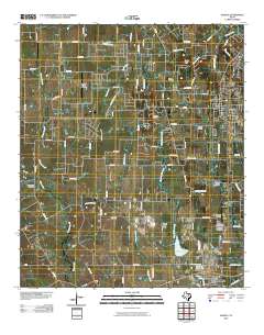
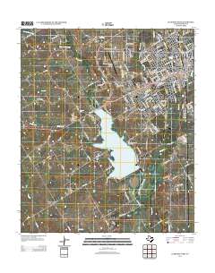
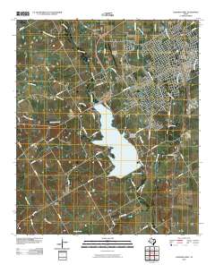 2010 Cleburne West2010 Print · USGSCovers Cleburne, including Rio Vista, Lone Willow, and other nearby areas
 - 2010 Map of Cleburne East, 2010 Print
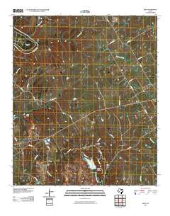
 2010 Cleburne East2010 Print · USGSCovers Cleburne, including Keene, Alvarado, and other nearby areas
 - 2012 Map of Cleburne East, 2012 Print
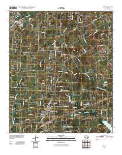
 2012 Cleburne East2012 Print · USGSCovers Cleburne, including Keene, Alvarado, and other nearby areas
 - 2012 Map of Keene, 2012 Print
 2012 Keene2012 Print · USGSCovers Cleburne, including Burleson, Joshua, and other nearby areas
 - 2012 Map of Godley, 2012 Print
 2012 Godley2012 Print · USGSCovers Cleburne, including Godley, Johnson County, and other nearby areas
 - 2012 Map of Joshua, 2012 Print
 2012 Joshua2012 Print · USGSCovers Cleburne, including Burleson, Joshua, and other nearby areas
 - 2012 Map of Cleburne West, 2012 Print
 2012 Cleburne West2012 Print · USGSCovers Cleburne, including Rio Vista, Lone Willow, and other nearby areas
 - 2013 Map of Bono, 2013 Print
 2013 Bono2013 Print · USGSCovers Cleburne, including Bono, Johnson County, and other nearby areas
Showing maps 1-25 of 43
Top cities near Cleburne
- Fort Worth historical maps
- Arlington historical maps
- Burleson historical maps
- Crowley historical maps
- Joshua historical maps
- Keene historical maps
See more
Top neighborhoods of Cleburne
- Lebanon historical maps
- Oak Hill historical maps
- Cross Creek Estates historical maps
- Willowcreek historical maps
- Placid Acres historical maps
- Woodward historical maps
See more
Frequently asked questions
- What are the different types of historical maps available for Cleburne?
- What is the oldest map of Cleburne?
- Where can I purchase historical maps of Cleburne for my home or office?
- Where can I download high-res historical maps of Cleburne?
- Are there historical topographic maps available for Cleburne?
- Is there historical aerial imagery available for Cleburne?
- Where are historical maps of Cleburne sourced from?