Old Maps of Amanda, Texas
Explore 11 old maps of Amanda, spanning from 1941 to today. These high-resolution historic maps reveal how streets, neighborhoods, landmarks, and natural features evolved over time — perfect for genealogy, metal detecting, research, and local history exploration.
What you can do with these maps:
- See how Amanda changed over time: Compare historical maps to modern-day views to trace roads, homesites, rail lines & more.
- View detailed metadata: Each map includes creators, publishers, year, scale, and archive source.
- Overlay maps with satellite & LiDAR: Visualize the past alongside modern tools to explore terrain & human change.
- Trusted historical sources: Maps sourced from the USGS, Library of Congress, and other archives.
- Access maps your way: View online, download high-res files, or order prints for personal or research use.
Start exploring old maps of Amanda to uncover forgotten places, hidden landmarks, and the deep history beneath your feet.
Amanda, TX maps
(11)- 1941 Map of Standart, 1965 Print
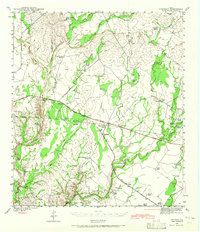 1941 Standart1965 Print · USGSKinney County ranching country is documented here in the early 1940s, showing the intersection of rail transport and rural livestock life. Family historians can locate specific homesteads like Belcher Ranch and the community Mud Creek Sch along the Southern Pacific tracks.2 unique versions available
 - 1943 Map of Standart
 1943 Standart1943 Print · USGSKinney County ranching country and the railroad corridor are captured here during the early years of the Second World War. Researchers can trace the heritage of local families through landmarks like Mud Creek Sch, Stricklin Spr, and the Standart rail stop.
 - 1958 Map of Del Rio, 1970 Print
 1958 Del Rio1970 Print · USGSThe Texas-Mexico borderlands come alive in the late fifties, showing the confluence of the Rio Grande and the emerging Amistad Reservoir. Trace the lineage of the Southern Pacific rail line through stops at Pumpville, Shumla, and the mining vicinity of Blewett.2 unique versions available
 - 1964 Map of Del Rio
 1964 Del Rio1964 Print · USGSAlong the Mexican border during the mid-sixties, this area centered on the confluence of the Rio Grande and Devils River. Researchers can trace the Southern Pacific line through isolated stops like Pumpville or locate military and industrial sites such as Laughlin Air Force Base and the mines at Blewett.
 - 1978 Map of Mud Creek South
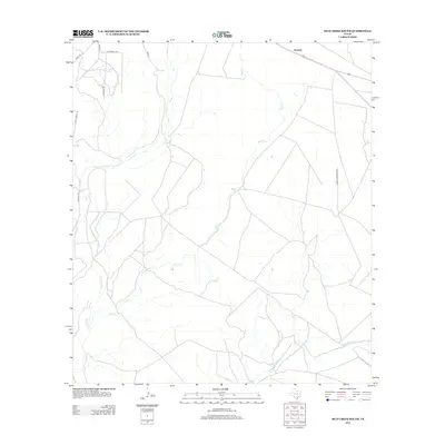
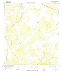 1978 Mud Creek South1978 Print · USGSKinney County ranch land and rail corridors come into focus in the late 1970s. Genealogists and historians can trace the Southern Pacific line through Amanda, locate family-named terrain like Ross, and find numerous crossings over Pinto Creek.
 - 1986 Map of Del Rio
 1986 Del Rio1986 Print · USGSThe West Texas borderlands come alive in the mid-eighties as Del Rio expands and Laughlin AFB anchors the local economy. Researchers can trace the rail corridors through Spofford and Cline or locate family sites near Alamo Village.2 unique versions available
 - 2010 Map of Mud Creek South, 2010 Print
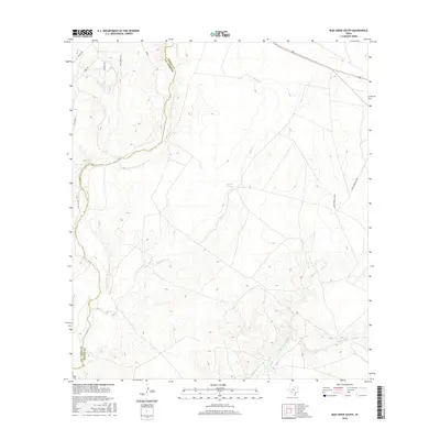
 2010 Mud Creek South2010 Print · USGSCovers Amanda, including Val Verde County, Kinney County, and other nearby areas
 - 2012 Map of Mud Creek South, 2012 Print
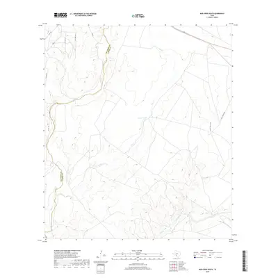
 2012 Mud Creek South2012 Print · USGSCovers Amanda, including Val Verde County, Kinney County, and other nearby areas
 - 2016 Map of Mud Creek South, 2016 Print
 2016 Mud Creek South2016 Print · USGSCovers Amanda, including Val Verde County, Kinney County, and other nearby areas
 - 2019 Map of Mud Creek South, 2019 Print
 2019 Mud Creek South2019 Print · USGSCovers Amanda, including Val Verde County, Kinney County, and other nearby areas
 - 2022 Map of Mud Creek South, 2022 Print
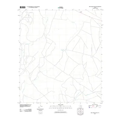
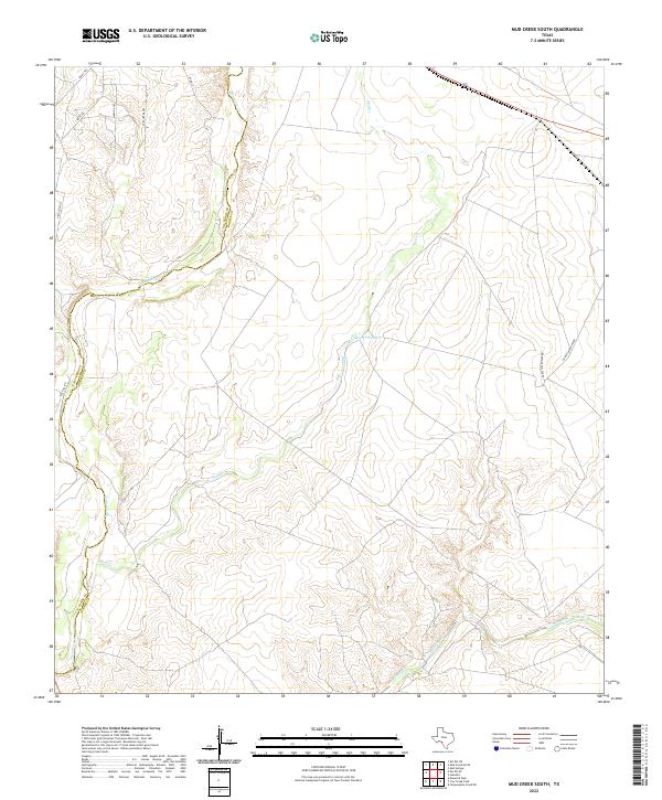 2022 Mud Creek South2022 Print · USGSKinney County in the early twenty-first century remains a landscape of sprawling ranches and seasonal waterways. You can trace the rugged creek beds of Sycamore Cr and Pinto Creek or locate local landmarks like Mud Cr Tank and Jack Hill Rd.
End of results
Showing maps 1-11 of 11
Top cities near Amanda
Frequently asked questions
- What are the different types of historical maps available for Amanda?
- What is the oldest map of Amanda?
- Where can I purchase historical maps of Amanda for my home or office?
- Where can I download high-res historical maps of Amanda?
- Are there historical topographic maps available for Amanda?
- Is there historical aerial imagery available for Amanda?
- Where are historical maps of Amanda sourced from?