2020s Maps of Grand Cane, Texas
Explore 1 historic maps of Grand Cane from the 2020s. These maps offer a rare glimpse into what life looked like during the 2020s — showing old roads, neighborhoods, homes, and landmarks that have changed or disappeared over time.
Whether you're researching your family's past, planning a metal detecting trip, or studying how Grand Cane's landscape evolved across the 2020s, these high-resolution maps are a powerful tool for exploring the history of this region.
- Focus on a specific era: All maps on this page are from the 2020s, giving you a focused view of this time period.
- See what’s changed: Compare century-old streets, trails, and buildings to today's modern landscape using overlays and satellite layers.
- Research with precision: Use these maps for genealogy, historical research, land use analysis, or educational projects.
- View, download, or print: Maps are fully viewable online in high resolution, and can be downloaded or printed for your own records.
Start exploring Grand Cane's history through authentic maps from the 2020s. This is your window into the past.
Grand Cane, TX maps
(1)- 2022 Map of Davis Hill, 2022 Print
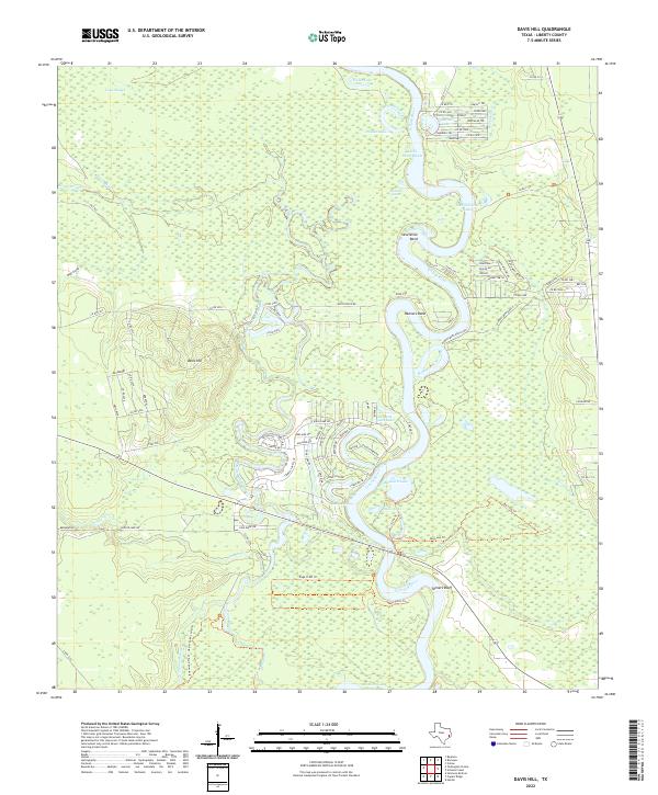 2022 Davis Hill2022 Print · USGSThe Trinity River bottomlands of Liberty County appear here in their modern state, characterized by a dense network of oxbow lakes and coastal sloughs. Researchers can trace the elevation of Davis Hill and locate specific riverside features like Tanners Bluff or the winding Hannas Bend Ranch Rd.
End of results
Showing maps 1-1 of 1
Top cities near Grand Cane
- Liberty historical maps
- Dayton historical maps
- Daisetta historical maps
- Hardin historical maps
- Kenefick historical maps
- Hull historical maps
See more
Frequently asked questions
- What are the different types of historical maps available for Grand Cane?
- What is the oldest map of Grand Cane?
- Where can I purchase historical maps of Grand Cane for my home or office?
- Where can I download high-res historical maps of Grand Cane?
- Are there historical topographic maps available for Grand Cane?
- Is there historical aerial imagery available for Grand Cane?
- Where are historical maps of Grand Cane sourced from?