Old Maps of Belgrade, Texas
Explore 12 old maps of Belgrade, spanning from 1935 to today. These high-resolution historic maps reveal how streets, neighborhoods, landmarks, and natural features evolved over time — perfect for genealogy, metal detecting, research, and local history exploration.
What you can do with these maps:
- See how Belgrade changed over time: Compare historical maps to modern-day views to trace roads, homesites, rail lines & more.
- View detailed metadata: Each map includes creators, publishers, year, scale, and archive source.
- Overlay maps with satellite & LiDAR: Visualize the past alongside modern tools to explore terrain & human change.
- Trusted historical sources: Maps sourced from the USGS, Library of Congress, and other archives.
- Access maps your way: View online, download high-res files, or order prints for personal or research use.
Start exploring old maps of Belgrade to uncover forgotten places, hidden landmarks, and the deep history beneath your feet.
Belgrade, TX maps
(12)- 1935 Map of Wilson Lake, 1954 Print
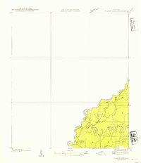 1935 Wilson Lake1954 Print · USGSThe Louisiana and Texas borderlands come to life in this mid-1930s survey of the Sabine River bottoms. Genealogists and historians can trace the original river channels and oxbows like Wilson Lake, Old River, and the curiously named Bugger Branch.2 unique versions available
 - 1947 Map of Wilson Lake
 1947 Wilson Lake1947 Print · USGSThe Sabine River bottomlands at the Texas-Louisiana border are captured here during the mid-1930s, revealing a shifting landscape of river channels and marsh. Researchers can trace the complex meanders of Old River, Middle River, and the banks of Wilson Lake.
 - 1952 Map of Lake Charles
 1952 Lake Charles1952 Print · USGSSouthwest Louisiana is captured here in the mid-fifties, showing a landscape defined by the rise of the petrochemical industry and deep-water navigation. Researchers can trace family roots through numerous small-town settlements and oil developments like Nibletts Bluff, the Lockport Oil Field, and Starks.
 - 1954 Map of Lake Charles, 1964 Print
 1954 Lake Charles1964 Print · USGSSouthwest Louisiana in the mid-fifties is defined by its massive petroleum industry and its complex network of bayous and rail lines. Researchers can trace the development of the Sulphur Mines Oil Field or locate historic settlements like Longville and De Quincy.3 unique versions available
 - 1959 Map of Bon Wier, 1960 Print
 1959 Bon Wier1960 Print · USGSThe Sabine River bottomlands at the end of the fifties reveal a landscape of timber, oil, and river-bend settlements. Genealogists can trace family names at Belgrade Cem and Hamm Cem, or locate the Biloxi Sch and Fredonia Ch.2 unique versions available
 - 1982 Map of Bon Wier, 1983 Print
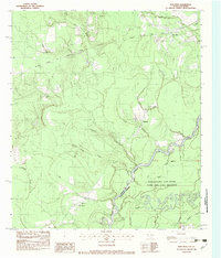 1982 Bon Wier1983 Print · USGSThe Sabine River bottomlands on the Texas-Louisiana border are captured here in the early 1980s, showcasing a landscape of winding sloughs and rail lines. You can trace the path of the Atchison Topeka and Santa Fe through Bon Wier or locate local landmarks like Belgrade Cem and Liveoak Ch.
 - 1986 Map of DeRidder
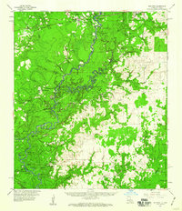
 1986 DeRidder1986 Print · USGSThe Louisiana-Texas borderlands come to life in the mid-eighties, showcasing the timber country and rail corridors of the Sabine River valley. Researchers can trace the legacy of small communities and transit lines through Merryville, Holly Springs, and the Missouri Pacific railroad.2 unique versions available
 - 2010 Map of Bon Wier, 2010 Print
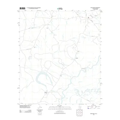
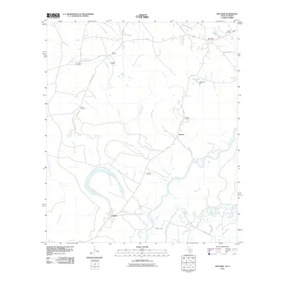 2010 Bon Wier2010 Print · USGSCovers Belgrade, including Bon Wier, Sandjack, and other nearby areas
 - 2012 Map of Bon Wier, 2012 Print
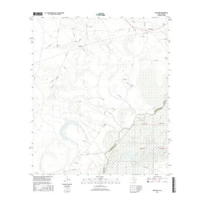
 2012 Bon Wier2012 Print · USGSCovers Belgrade, including Bon Wier, Sandjack, and other nearby areas
 - 2016 Map of Bon Wier, 2016 Print
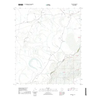
 2016 Bon Wier2016 Print · USGSCovers Belgrade, including Bon Wier, Sandjack, and other nearby areas
 - 2019 Map of Bon Wier, 2019 Print
 2019 Bon Wier2019 Print · USGSCovers Belgrade, including Bon Wier, Sandjack, and other nearby areas
 - 2022 Map of Bon Wier, 2022 Print
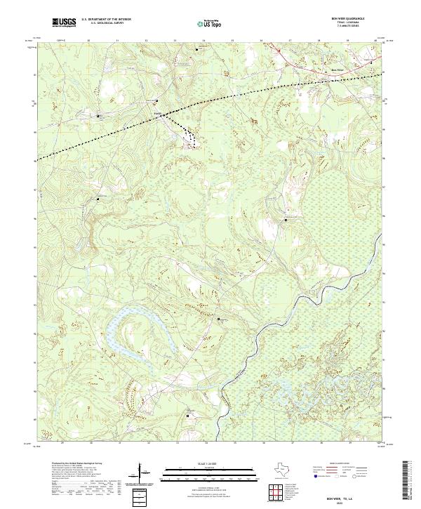 2022 Bon Wier2022 Print · USGSThe Sabine River bottomlands meet the upland timber country of Newton County in the late 2010s. Researchers can locate numerous family burial sites like Old Belgrade Cem and Davis Cem or trace the wetland drainages of Bee Slough and Wickersham Lake.
End of results
Showing maps 1-12 of 12
Top cities near Belgrade
Frequently asked questions
- What are the different types of historical maps available for Belgrade?
- What is the oldest map of Belgrade?
- Where can I purchase historical maps of Belgrade for my home or office?
- Where can I download high-res historical maps of Belgrade?
- Are there historical topographic maps available for Belgrade?
- Is there historical aerial imagery available for Belgrade?
- Where are historical maps of Belgrade sourced from?