Old Maps of Reagan County, Texas
Explore 188 old maps of Reagan County, spanning from 1920 to today. These high-resolution historic maps reveal how streets, neighborhoods, landmarks, and natural features evolved over time — perfect for genealogy, metal detecting, research, and local history exploration.
What you can do with these maps:
- See how Reagan County changed over time: Compare historical maps to modern-day views to trace roads, homesites, rail lines & more.
- View detailed metadata: Each map includes creators, publishers, year, scale, and archive source.
- Overlay maps with satellite & LiDAR: Visualize the past alongside modern tools to explore terrain & human change.
- Trusted historical sources: Maps sourced from the USGS, Library of Congress, and other archives.
- Access maps your way: View online, download high-res files, or order prints for personal or research use.
Start exploring old maps of Reagan County to uncover forgotten places, hidden landmarks, and the deep history beneath your feet.
Reagan County, TX maps
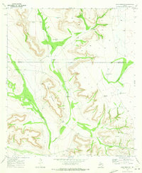
(188)- 1920 Map of Big Lake, 1965 Print
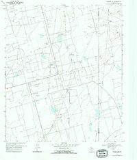
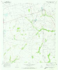
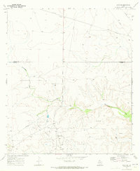
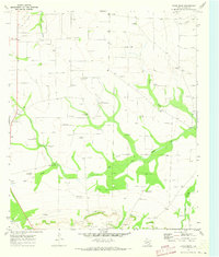
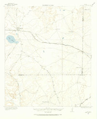 1920 Big Lake1965 Print · USGSReagan County ranching and rail life are preserved in this early twentieth-century survey of the West Texas plains. Researchers can trace historic family-named landholdings like Carroll Ranch and the route of the Kansas City Mexico and Orient railroad.
 - 1922 Map of Big Lake
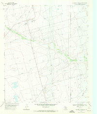
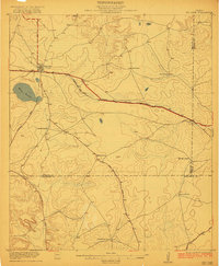 1922 Big Lake1922 Print · USGSBig Lake and the surrounding West Texas ranchlands are captured here in the early 1920s as the railroad drove local growth. Genealogists and historians can trace family-named sites like Luther Ranch and Wilson Ranch along the historic Sheffield Road.
 - 1928 Map of Rankin
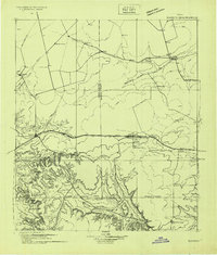 1928 Rankin1928 Print · USGSWest Texas is captured during the transformative oil boom of the late twenties, showing the rise of petroleum towns alongside older ranch outposts. Genealogists and historians can trace early Permian Basin settlements like Texon, Santa Rita, and the legendary boomtown of Best.
 - 1954 Map of San Angelo, 1967 Print
 1954 San Angelo1967 Print · USGSThe Concho Valley and eastern Permian Basin transition from ranching to a burgeoning oil economy during the mid-twentieth century. Trace the expansion of San Angelo near Goodfellow AFB and locate old crossroads like Stiles, Texon, and Barnhart along the SANTA FE railroad.2 unique versions available
 - 1958 Map of San Angelo
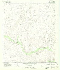
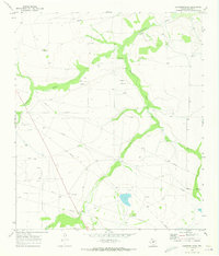
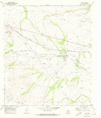
 1958 San Angelo1958 Print · USGSWest Texas in the late fifties centers on the growing hub of San Angelo and its vital river confluences. Genealogists and historians can trace the paths of the Santa Fe railroad to outposts like Fort Chadbourne, Big Lake, and the specialized community of Sanatorium.
 - 1965 Map of San Angelo
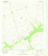
 1965 San Angelo1965 Print · USGSWest Texas in the mid-sixties reveals a landscape shaped by the petroleum industry and strategic water management. Genealogists and historians can trace the rail corridor through Texon and Big Lake, or locate military landmarks like Goodfellow AFB and Broome Air Force Auxiliary Airfield.
 - 1967 Map of Midkiff, 1970 Print
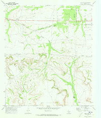
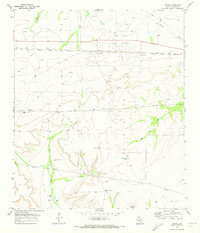
 1967 Midkiff1970 Print · USGSMidland and Upton counties are shown during a peak of mid-century industrial growth. Local historians can trace energy development through the Midkiff settlement, the Midkiff Gas Plant, and a sprawling network of Oil Wells.2 unique versions available
 - 1968 Map of Midkiff SE, 1970 Print
 1968 Midkiff SE1970 Print · USGSThe West Texas oil boom and ranching traditions meet in the late sixties along the Upton and Reagan County line. Researchers can trace the industrial footprint of the Oil Field and find family-named landmarks like the Barrett Ranch.
 - 1970 Map of Sevenmile Corner NE, 1972 Print
 1970 Sevenmile Corner NE1972 Print · USGSThe Upton and Reagan County line comes alive in the 1970s as a hub of energy production. Trace the industrial footprint of the Benedum Oil Field through its network of Oil Wells, Pumping Sta, and the High Lonesome Draw.
 - 1970 Map of Stiles NW, 1972 Print
 1970 Stiles NW1972 Print · USGSReagan County ranchlands meet the Permian Basin oil boom in this early 1970s survey. Genealogists and historians can locate family outposts like Hartgrove Ranch and Ham Ranch alongside the industrial footprint of the Oil Field and High Lonesome Draw.
 - 1970 Map of South Mustang Draw SE, 1973 Print
 1970 South Mustang Draw SE1973 Print · USGSReagan and Irion Counties in the early seventies reveal an arid ranching landscape transitioning into an oil-producing region. Genealogists and historians can trace livestock infrastructure and water sources like West Line Camp, Lewis Windmill, and Whatley Windmill.
 - 1970 Map of Sevenmile Corner SE, 1973 Print
 1970 Sevenmile Corner SE1973 Print · USGSUpton and Reagan counties in the early 1970s show the peak of the West Texas petroleum boom. Researchers can trace the industrial footprint of the Benedum Oil Field, including Benedum Camp, a Refinery, and the Atchison Topeka and Santa Fe railroad.
 - 1970 Map of South Mustang Draw NE, 1973 Print
 1970 South Mustang Draw NE1973 Print · USGSThe Reagan and Irion county line comes to life in the early 1970s, showing a West Texas rangeland dependent on vital water outposts. Trace the locations of isolated ranching hubs like Elbow Line Camp and family-named landmarks such as Dogtown Windmill and Bluff Water Hole.
 - 1970 Map of Rankin SE, 1973 Print
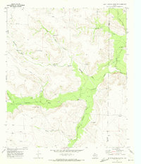
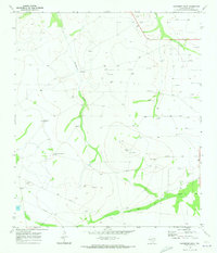
 1970 Rankin SE1973 Print · USGSThe West Texas ranchlands at the start of the 1970s are captured here, centered on the Noelke Ranch and its vital water infrastructure. Researchers can trace family-named landmarks like Schlinke Windmill and remote features like Lost Tank.3 unique versions available
 - 1970 Map of Moore Hill, 1973 Print
 1970 Moore Hill1973 Print · USGSReagan County in the early seventies shows a landscape where ranching heritage meets the growing oil industry. Genealogists and historians can locate remote outposts like the Whoo Doo Line camp and trace the development of the Stiles Oil Field near Centralia.
 - 1970 Map of Texon SE, 1973 Print
 1970 Texon SE1973 Print · USGSCrockett County in the early seventies reveals the intensive development of the West Texas oil fields. Researchers can trace the industrial footprint of the World Powell Field and locate local landmarks like the North Crockett Community Center and Schneemann Draw.
 - 1970 Map of Rankin NE, 1973 Print
 1970 Rankin NE1973 Print · USGSUpton and Reagan Counties are captured here in the early 1970s during a period of active resource extraction and cattle ranching. Researchers can trace the Flat Rock Oil Field, the Atchison Topeka and Santa Fe rail line, and family-named landmarks like Flat Rock Ranch.
 - 1970 Map of Garrison Draw, 1973 Print
 1970 Garrison Draw1973 Print · USGSReagan County ranch land at the start of the seventies reveals a landscape shaped by water scarcity and emerging industry. Researchers can trace the placement of family-named landmarks like Shamlin Windmill alongside early oil exploration at various drill holes.
 - 1970 Map of Gardener Draw, 1973 Print
 1970 Gardener Draw1973 Print · USGSThe Reagan County plains appear in the early seventies during a period of steady petroleum expansion. Researchers can trace the ranching and energy layout of the era through Gardener Windmill, the Stiles oil field, and Big Jim Draw.
 - 1970 Map of Divide Draw, 1973 Print
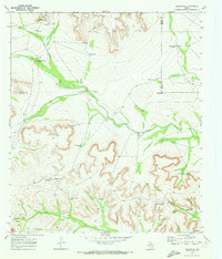
 1970 Divide Draw1973 Print · USGSThe Permian Basin oil and ranching landscape comes into focus in the 1970s, defined by the Stiles Oil Field and seasonal watercourses. Researchers can trace family-named landmarks like North Arndell Windmill, Dixon Windmill, and Isaac Windmills.
 - 1970 Map of Best, 1973 Print
 1970 Best1973 Print · USGSReagan County is shown during a period of transition in the 1970s, as ranching traditions met the growing energy infrastructure of West Texas. Researchers can trace the rail line at Best or locate historic water sites like Kemper Station and Six Section Windmill.
 - 1970 Map of Stiles, 1973 Print
 1970 Stiles1973 Print · USGSReagan County enters a period of intensive energy production in the late sixties as the petroleum industry reshapes the high plains. Researchers can trace the layout of the Stiles Oil Field and find local landmarks like Stiles Cem and the Community Ch.
 - 1970 Map of Texon, 1973 Print
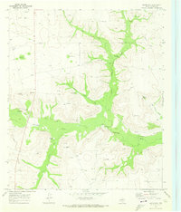
 1970 Texon1973 Print · USGSReagan County in the early 1970s centers on the petroleum industry and the railroads that sustained West Texas energy hubs. Researchers can trace the infrastructure of the Big Lake Oil Field, early settlements like Texon and Santa Rita, and essential water sources such as Grierson Springs.
 - 1970 Map of Lone Mountain, 1973 Print
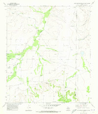
 1970 Lone Mountain1973 Print · USGSThe Edwards Plateau meets the Permian Basin in the early 1970s, where ranching and energy interests collide. Local historians can trace family-named windmills like Gay Windmill and remote outposts such as Santa Maria Camp or Redman Camp.
 - 1971 Map of Witco, 1973 Print
 1971 Witco1973 Print · USGSReagan County in the early 1970s shows the height of the West Texas energy boom centered around the Witco settlement. Researchers can trace the extensive OIL FIELD infrastructure, numerous Oil Wells, and the path of the ATCHISON TOPEKA AND SANTA FE railroad.
Showing maps 1-25 of 188
Top cities of Reagan County
Frequently asked questions
- What are the different types of historical maps available for Reagan County?
- What is the oldest map of Reagan County?
- Where can I purchase historical maps of Reagan County for my home or office?
- Where can I download high-res historical maps of Reagan County?
- Are there historical topographic maps available for Reagan County?
- Is there historical aerial imagery available for Reagan County?
- Where are historical maps of Reagan County sourced from?