Old Maps of Arno, Texas for Hiking & Exploration
Hike through history with 9 historic maps of Arno. Explore old trails, ghost towns, and forgotten backroads — perfect for outdoor adventurers and local explorers.
- Rediscover forgotten places: Map out old mining camps, roads, and footpaths that no longer exist on modern maps.
- Layer with modern tools: Combine with LiDAR or satellite views to plan hikes through historical terrain.
- Made for exploration: Popular among hikers, overlanders, and local history lovers.
Use these maps to find adventure and explore the hidden past of Arno.
Arno, TX maps
(9)- 1954 Map of Pecos, 1964 Print
 1954 Pecos1964 Print · USGSMid-century West Texas reveals a landscape of expanding oil fields and cattle ranching along the winding Pecos River. Local historians can trace family ranch lands like Goodrich Ranch, follow the Texas and Pacific rails, or locate the historic Horsehead Crossing.3 unique versions available
 - 1957 Map of Pecos
 1957 Pecos1957 Print · USGSWest Texas in the mid-fifties is a landscape of desert oil fields and vital rail corridors. Researchers can trace the sprawling Pyote Air Force Base, the historic Horsehead Crossing, and the rail stops at Mentone and Saragosa.
 - 1961 Map of Anderson Ranch, 1963 Print
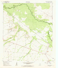 1961 Anderson Ranch1963 Print · USGSThe Pecos River frontier in the early sixties reveals a landscape shaped by petroleum and ranching at the border of Reeves and Loving counties. Researchers can trace the mid-century industrial footprint of the Dixieland Oil Field and the rail sidings at Arno.2 unique versions available
 - 1986 Map of Kermit
 1986 Kermit1986 Print · USGSWest Texas during the mid-eighties was a landscape defined by the energy industry and the winding Pecos River. Trace the development of Oil Field networks near Kermit, the historic Horsehead Crossing, and the rail lines of the Missouri Pacific.2 unique versions available
 - 2010 Map of Anderson Ranch, 2010 Print
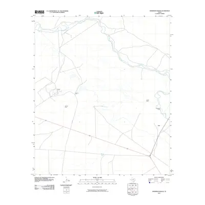 2010 Anderson Ranch2010 Print · USGSCovers Arno, including Reeves County, Loving County, and other nearby areas
 - 2013 Map of Anderson Ranch, 2013 Print
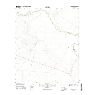
 2013 Anderson Ranch2013 Print · USGSCovers Arno, including Reeves County, Loving County, and other nearby areas
 - 2016 Map of Anderson Ranch, 2016 Print
 2016 Anderson Ranch2016 Print · USGSCovers Arno, including Reeves County, Loving County, and other nearby areas
 - 2019 Map of Anderson Ranch, 2019 Print
 2019 Anderson Ranch2019 Print · USGSCovers Arno, including Reeves County, Loving County, and other nearby areas
 - 2022 Map of Anderson Ranch, 2022 Print
 2022 Anderson Ranch2022 Print · USGSThe Pecos River valley at the Loving and Reeves county line remains a sparsely populated landscape of ranching and resource extraction. Researchers can locate the settlement of Arno and trace ephemeral drainage features like Horsehead Draw and Smith Draw.
End of results
Showing maps 1-9 of 9
Top cities near Arno
Frequently asked questions
- What are the different types of historical maps available for Arno?
- What is the oldest map of Arno?
- Where can I purchase historical maps of Arno for my home or office?
- Where can I download high-res historical maps of Arno?
- Are there historical topographic maps available for Arno?
- Is there historical aerial imagery available for Arno?
- Where are historical maps of Arno sourced from?