2020s Maps of Bear Creek, Texas
Explore 1 historic maps of Bear Creek from the 2020s. These maps offer a rare glimpse into what life looked like during the 2020s — showing old roads, neighborhoods, homes, and landmarks that have changed or disappeared over time.
Whether you're researching your family's past, planning a metal detecting trip, or studying how Bear Creek's landscape evolved across the 2020s, these high-resolution maps are a powerful tool for exploring the history of this region.
- Focus on a specific era: All maps on this page are from the 2020s, giving you a focused view of this time period.
- See what’s changed: Compare century-old streets, trails, and buildings to today's modern landscape using overlays and satellite layers.
- Research with precision: Use these maps for genealogy, historical research, land use analysis, or educational projects.
- View, download, or print: Maps are fully viewable online in high resolution, and can be downloaded or printed for your own records.
Start exploring Bear Creek's history through authentic maps from the 2020s. This is your window into the past.
Bear Creek, TX maps
(1)- 2022 Map of Bear Creek, 2022 Print
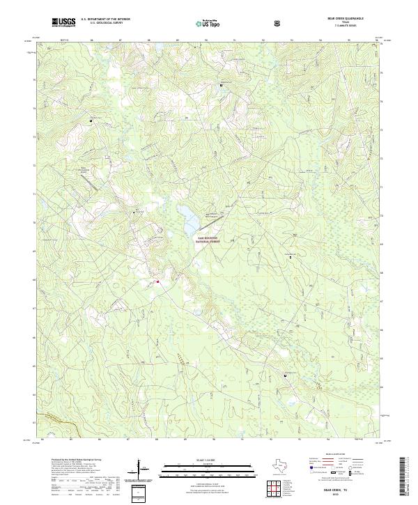 2022 Bear Creek2022 Print · USGSSan Jacinto County and the northern reaches of Montgomery County are shown here in the 2020s, dominated by the timberlands of the Sam Houston National Forest. Genealogists can locate family burial grounds like Purkerson Cem and Red Rock Cem among the many forks of Winters Bayou.
End of results
Showing maps 1-1 of 1
Top cities near Bear Creek
- The Woodlands historical maps
- Conroe historical maps
- Cleveland historical maps
- Shepherd historical maps
- Splendora historical maps
- Cut and Shoot historical maps
See more
Frequently asked questions
- What are the different types of historical maps available for Bear Creek?
- What is the oldest map of Bear Creek?
- Where can I purchase historical maps of Bear Creek for my home or office?
- Where can I download high-res historical maps of Bear Creek?
- Are there historical topographic maps available for Bear Creek?
- Is there historical aerial imagery available for Bear Creek?
- Where are historical maps of Bear Creek sourced from?