Old Maps of Casa de Peidras, Texas
Explore 11 old maps of Casa de Peidras, spanning from 1943 to today. These high-resolution historic maps reveal how streets, neighborhoods, landmarks, and natural features evolved over time — perfect for genealogy, metal detecting, research, and local history exploration.
What you can do with these maps:
- See how Casa de Peidras changed over time: Compare historical maps to modern-day views to trace roads, homesites, rail lines & more.
- View detailed metadata: Each map includes creators, publishers, year, scale, and archive source.
- Overlay maps with satellite & LiDAR: Visualize the past alongside modern tools to explore terrain & human change.
- Trusted historical sources: Maps sourced from the USGS, Library of Congress, and other archives.
- Access maps your way: View online, download high-res files, or order prints for personal or research use.
Start exploring old maps of Casa de Peidras to uncover forgotten places, hidden landmarks, and the deep history beneath your feet.
Casa de Peidras, TX maps
(11)- 1943 Map of Malvado, 1957 Print
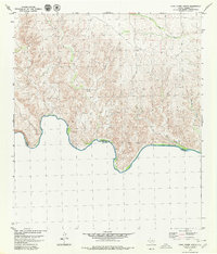
 1943 Malvado1957 Print · USGSIn the early 1940s, the remote borderlands of West Texas were defined by the Southern Pacific railroad and isolated ranching outposts. Genealogists and historians can trace family landholdings like Whitehead Ranch, the settlement of Malvado, and the winding path of Lozier Canyon.
 - 1944 Map of Malvado
 1944 Malvado1944 Print · USGSWestern Terrell County in the 1940s is a rugged landscape of deep canyons and isolated ranching outposts along the Mexican border. Genealogists and local historians can trace legacy family holdings like Williams Ranch and Foster Ranch near the winding Rio Grande.
 - 1958 Map of Del Rio, 1970 Print
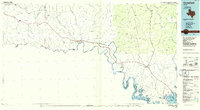
 1958 Del Rio1970 Print · USGSThe Texas-Mexico borderlands come alive in the late fifties, showing the confluence of the Rio Grande and the emerging Amistad Reservoir. Trace the lineage of the Southern Pacific rail line through stops at Pumpville, Shumla, and the mining vicinity of Blewett.2 unique versions available
 - 1964 Map of Del Rio
 1964 Del Rio1964 Print · USGSAlong the Mexican border during the mid-sixties, this area centered on the confluence of the Rio Grande and Devils River. Researchers can trace the Southern Pacific line through isolated stops like Pumpville or locate military and industrial sites such as Laughlin Air Force Base and the mines at Blewett.
 - 1979 Map of Cook Creek South
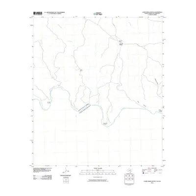
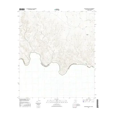
 1979 Cook Creek South1979 Print · USGSThe Texas-Mexico borderlands in Terrell County come into focus during the late seventies, showing the winding Rio Grande frontier. Researchers can trace remote ranching life at Watts Ranch and Casa de Piedras while navigating the terrain via a lone Jeep Trail.
 - 1985 Map of Comstock, 1986 Print
 1985 Comstock1986 Print · USGSVal Verde County was a landscape of deep canyons and borderland outposts in the mid-1980s. Local researchers can trace the Southern Pacific rail line through Langtry and Pumpville or locate landmarks like Big Tree Cave.2 unique versions available
 - 2010 Map of Cook Creek South, 2010 Print
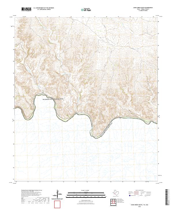
 2010 Cook Creek South2010 Print · USGSCovers Casa de Peidras, including Acuña, Terrell County, and other nearby areas
 - 2013 Map of Cook Creek South, 2013 Print
 2013 Cook Creek South2013 Print · USGSCovers Casa de Peidras, including Acuña, Terrell County, and other nearby areas
 - 2016 Map of Cook Creek South, 2016 Print
 2016 Cook Creek South2016 Print · USGSCovers Casa de Peidras, including Acuña, Terrell County, and other nearby areas
 - 2019 Map of Cook Creek South, 2019 Print
 2019 Cook Creek South2019 Print · USGSCovers Casa de Peidras, including Acuña, Terrell County, and other nearby areas
 - 2022 Map of Cook Creek South, 2022 Print
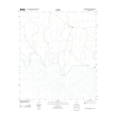
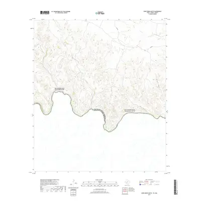
 2022 Cook Creek South2022 Print · USGSThe international boundary along the Rio Grande in Terrell County is captured here in the early twenty-first century. Researchers can trace the rugged drainages of Bear Canyon, Mesquite Canyon, and Cook Creek as they descend toward the river.
End of results
Showing maps 1-11 of 11
Frequently asked questions
- What are the different types of historical maps available for Casa de Peidras?
- What is the oldest map of Casa de Peidras?
- Where can I purchase historical maps of Casa de Peidras for my home or office?
- Where can I download high-res historical maps of Casa de Peidras?
- Are there historical topographic maps available for Casa de Peidras?
- Is there historical aerial imagery available for Casa de Peidras?
- Where are historical maps of Casa de Peidras sourced from?