Old Maps of Titus County, Texas for Metal Detecting
Plan your next treasure hunt with 111 historic maps of Titus County. Find old homesites, ghost towns, trails, and gathering spots that may be lost to time — perfect for identifying promising metal detecting locations.
- Locate forgotten sites: Uncover places like long-lost settlements, abandoned rail lines, or gathering spots.
- Plan better hunts: Use map overlays combined with LiDAR or satellite views to narrow in on historically rich areas.
- Made for detectorists: Thousands of hobbyists use these maps to discover relics, coins, and hidden history.
Use these historic maps to boost your research and find new opportunities beneath the surface of Titus County.
Titus County, TX maps
(111)- 1953 Map of Texarkana, 1964 Print
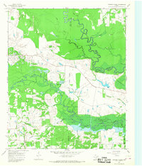
 1953 Texarkana1964 Print · USGSThe Texas-Arkansas borderlands are captured here in the mid-fifties, during a decade of massive military and hydraulic engineering projects. Genealogists and researchers can locate family landmarks like Old Boston Cem, Siloam Ch, and the vast Red River Arsenal.4 unique versions available
 - 1956 Map of Texarkana
 1956 Texarkana1956 Print · USGSThe Ark-La-Tex borderlands come alive in the mid-fifties, showing the transition from a rail-dependent rural economy to a post-war industrial landscape. Researchers can trace the massive Red River Ordnance Depot and find towns like Talco, Bogata, and Naples.
 - 1956 Map of Tyler
 1956 Tyler1956 Print · USGSEast Texas was a powerhouse of oil production and rail transport during the mid-fifties, centered on the sprawling East Texas Oil Field. Researchers can trace the heritage of industrial hubs like Kilgore, military sites such as the Longhorn Ordnance Works, and many rural landmarks like Mount Enterprise.5 unique versions available
 - 1960 Map of La Fayette, 1962 Print
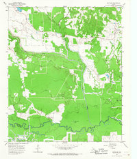
 1960 La Fayette1962 Print · USGSUpper East Texas is shown here at the dawn of the sixties, just as the rising waters of the newly formed Lake O' the Pines began to reshape the Big Cypress Creek basin. Researchers can pinpoint rural life at LaFayette and Holly Springs, or trace family sites like Pleasant Grove Cem and Slaton Cem.2 unique versions available
 - 1964 Map of Mount Vernon, 1967 Print
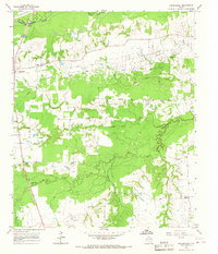
 1964 Mount Vernon1967 Print · USGSMount Vernon and its surrounding rural communities are captured here in the mid-1960s as a thriving Northeast Texas hub. Genealogists and historians can trace family locations through numerous country landmarks like Denton Ch, Fuquay Cem, and the old Denton Sch.
 - 1964 Map of Cuthand, 1967 Print
 1964 Cuthand1967 Print · USGSRed River County in the mid-1960s was a landscape of river-bottom industry and scattered rural settlements. Genealogists and historians can trace family locations near Cuthand, locate the McKinzie Ch, or study the footprint of the Trix-Liz Oil Field.
 - 1964 Map of Harvard, 1967 Print
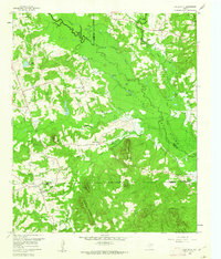
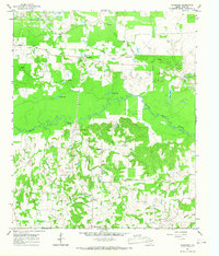
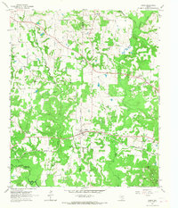
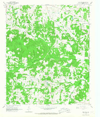
 1964 Harvard1967 Print · USGSIn the mid-1960s, the rural landscapes of Titus and Camp Counties were defined by the winding Big Cypress Creek and the intersection of major rail lines. Genealogists can trace family footprints at Concord Cem, North Chapel Cem, and old church sites like East New Hope Ch.
 - 1964 Map of Wilkinson, 1967 Print
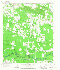
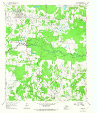
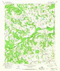
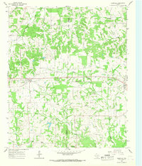
 1964 Wilkinson1967 Print · USGSTitus County during the mid-1960s shows a landscape defined by the winding White Oak Creek and an active petroleum industry. Researchers can trace the development of the Trix-Liz Oil Field and locate rural landmarks like Harris Ch and Deshiell Cem.
 - 1964 Map of Talco, 1967 Print
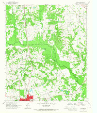
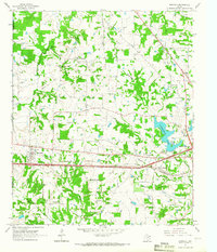
 1964 Talco1967 Print · USGSTitus County’s midcentury landscape is defined here by the intersection of the energy industry and rural East Texas life. Genealogists and historians can trace family-named sites like Belcher Cem, the community at Bridges Chapel, and the footprint of the Talco Oil Field.2 unique versions available
 - 1964 Map of Hagansport, 1967 Print
 1964 Hagansport1967 Print · USGSFranklin County during the mid-sixties reveals a landscape shaped by the Talco Oil Field and the winding Sulphur River. Genealogists can locate community anchors like Hagansport, Prairie Academy Cem, and Mt Olive Ch.
 - 1964 Map of Bogata, 1967 Print
 1964 Bogata1967 Print · USGSThe town of Bogata and the surrounding Red River County countryside are captured here in the mid-1960s. Researchers can trace family history at Dodds Cem and Hinson Cem or locate industrial sites like the Talco City Pumping Sta and the Old Railroad Grade.
 - 1964 Map of Cason, 1967 Print
 1964 Cason1967 Print · USGSNortheast Texas in the mid-sixties reveals a landscape of family-owned ridges and bottomlands centered on Cason. Genealogists can locate several rural landmarks including Central Grove Sch, Justiss Cem, and Black Mtn Mine.2 unique versions available
 - 1965 Map of Lydia, 1967 Print
 1965 Lydia1967 Print · USGSThe Red River and Titus county line in the mid-1960s follows the meandering Sulphur River through a landscape of prairies and family cemeteries. Genealogists can locate numerous burial sites like Cedar Creek Cem, Baker Cem, and Wilkes Cem.
 - 1965 Map of Winfield, 1967 Print
 1965 Winfield1967 Print · USGSThe Titus County landscape of the mid-sixties centers on the rail-side community of Winfield and its surrounding rural settlements. Genealogists and local historians can trace family locations near Marshall Springs Ch, Tranquil Cem, and the Farmers Academy district.
 - 1965 Map of Monticello, 1967 Print
 1965 Monticello1967 Print · USGSNortheast Texas was a landscape of small settlements and creek-bottom timber in the mid-sixties. Genealogists can trace family footprints through rural centers like Monticello and Rocky Mound, or locate local landmarks like Adams Chapel and Blundell Creek Ch.
 - 1965 Map of New Hope, 1967 Print
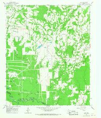
 1965 New Hope1967 Print · USGSFranklin and Titus counties in the mid-1960s reveal a landscape defined by the petroleum industry and rural community life. Genealogists and local historians can trace family-named sites like Bethel Cem and Rock Hill Cem alongside the infrastructure of the New Hope Oil Field.2 unique versions available
 - 1965 Map of Mount Pleasant, 1967 Print
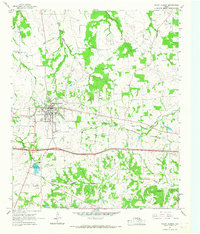
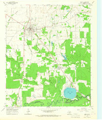
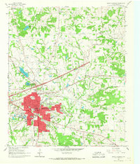 1965 Mount Pleasant1967 Print · USGSMount Pleasant and its surrounding Titus County communities appear here in the mid-sixties during a period of steady industrial and civic expansion. Local historians can trace the town's evolution through the St Louis Southwestern rail lines, old country landmarks like Harts Bluff Sch, and family cemeteries including Masonic Cem.3 unique versions available
 - 1965 Map of Boxelder, 1967 Print
 1965 Boxelder1967 Print · USGSRed River County in the mid-1960s was a landscape of winding bottomland creeks and emerging petroleum activity. Researchers can trace family sites near Boxelder, find the Evergreen Cem, or locate landmarks like Harts Bluff and the Trix-Liz Oil Field.2 unique versions available
 - 1965 Map of Cookville, 1968 Print
 1965 Cookville1968 Print · USGSMid-century East Texas comes into focus along the St Louis Southwestern rail line between Cookville and Omaha. Genealogists and local historians can trace family roots through numerous sites like Mt Moriah Ch, Concord Cem, and Center Grove.2 unique versions available
 - 1965 Map of Coopers Chapel, 1968 Print
 1965 Coopers Chapel1968 Print · USGSNortheast Texas in the 1960s was a landscape of winding river bottoms and small rural outposts. Genealogists and historians can trace family locations near Coopers Chapel, the Evergreen Cem, and the industry of the Pewitt Ranch Oil Field.2 unique versions available
 - 1984 Map of Tyler
 1984 Tyler1984 Print · USGSEast Texas at the peak of its reservoir-building era shows a landscape defined by new lakes and established rail corridors. Trace the path of the St Louis Southwestern RR or locate industrial sites like the Longhorn Ordnance Works.3 unique versions available
 - 1985 Map of Sulphur Springs
 1985 Sulphur Springs1985 Print · USGSNortheast Texas in the mid-eighties shows a landscape transitioning between its deep-rooted rail towns and a new era of reservoir development. Genealogists and historians can trace family locations near Shooks Chapel, the rural Farmers Academy, and the banks of the South Sulphur River.
 - 1986 Map of Marshall
 1986 Marshall1986 Print · USGSEast Texas and the Louisiana borderlands are shown in the mid-1980s during a period of sustained industrial and energy production. Researchers can trace family roots through settlements like Ebenezer or study the impact of the Longhorn Army Ammunition Plant and Rodessa Oil Field.2 unique versions available
 - 1986 Map of Texarkana
 1986 Texarkana1986 Print · USGSThe Texas-Arkansas borderlands are captured here in the mid-eighties as a hub of military industry and river-basin geography. Genealogists and local historians can locate rural landmarks like Red Hill Cem, Coopers Chapel, and the Lone Star Army Ammunition Plant.
 - 1991 Map of Sulphur Springs
 1991 Sulphur Springs1991 Print · USGSNortheast Texas in the early nineties shows a transition from rail-dependent agriculture to a landscape defined by massive reservoirs. Researchers can trace rural lineages through sites like Gafford Chapel and the Forest Academy Cem, or follow the path of the St Louis Southwestern RR.
Showing maps 1-25 of 111
Top cities of Titus County
- Mount Pleasant historical maps
- Talco historical maps
- Winfield historical maps
- Miller's Cove historical maps
Frequently asked questions
- What are the different types of historical maps available for Titus County?
- What is the oldest map of Titus County?
- Where can I purchase historical maps of Titus County for my home or office?
- Where can I download high-res historical maps of Titus County?
- Are there historical topographic maps available for Titus County?
- Is there historical aerial imagery available for Titus County?
- Where are historical maps of Titus County sourced from?