1960s Maps of Huntsville, Texas
Explore 5 historic maps of Huntsville from the 1960s. These maps offer a rare glimpse into what life looked like during the 1960s — showing old roads, neighborhoods, homes, and landmarks that have changed or disappeared over time.
Whether you're researching your family's past, planning a metal detecting trip, or studying how Huntsville's landscape evolved across the 1960s, these high-resolution maps are a powerful tool for exploring the history of this region.
- Focus on a specific era: All maps on this page are from the 1960s, giving you a focused view of this time period.
- See what’s changed: Compare century-old streets, trails, and buildings to today's modern landscape using overlays and satellite layers.
- Research with precision: Use these maps for genealogy, historical research, land use analysis, or educational projects.
- View, download, or print: Maps are fully viewable online in high resolution, and can be downloaded or printed for your own records.
Start exploring Huntsville's history through authentic maps from the 1960s. This is your window into the past.
Huntsville, TX maps
(5)- 1960 Map of Phelps, 1963 Print
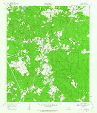 1960 Phelps1963 Print · USGSSoutheastern Walker County is shown at the start of the 1960s, a landscape defined by the Sam Houston National Forest and the Missouri Pacific line. Genealogists can locate Grant Colony Cem and the State Prison Farm (Goree).3 unique versions available
 - 1962 Map of Pine Prairie, 1964 Print
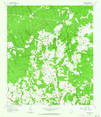 1962 Pine Prairie1964 Print · USGSWalker County's rural interior comes to life in the early sixties, showing the vital connection between institutional land use and small-town Texas life. Researchers can trace local heritage through sites like Pine Prairie Cem, the Rosenwald Sch, and the Wynne State Prison Farm.3 unique versions available
 - 1962 Map of Galilee, 1965 Print
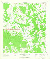 1962 Galilee1965 Print · USGSWalker County during the early sixties shows a landscape of scattered rural settlements and winding river branches. Researchers can trace family ties through dozens of landmarks like Ebenezer Cem, Mt Zion Ch, and the small community of Galilee.
 - 1963 Map of Crabbs Prairie, 1964 Print
 1963 Crabbs Prairie1964 Print · USGSWalker County timberlands and rural homesteads come into focus in the early sixties. Genealogists and historians can trace the Old Railroad Grade past Cook Spring Ch or locate family roots near Petree Cem.2 unique versions available
 - 1963 Map of Huntsville, 1966 Print
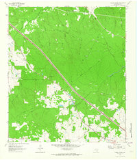
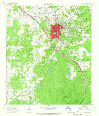 1963 Huntsville1966 Print · USGSHuntsville and the surrounding East Texas piney woods are documented here in the early sixties, highlighting the town's growth as an educational and institutional hub. Researchers can locate the Sam Houston State Teachers College campus and various correctional facilities like Wynne State Prison Farm.4 unique versions available
End of results
Showing maps 1-5 of 5
Top cities near Huntsville
Top neighborhoods of Huntsville
Frequently asked questions
- What are the different types of historical maps available for Huntsville?
- What is the oldest map of Huntsville?
- Where can I purchase historical maps of Huntsville for my home or office?
- Where can I download high-res historical maps of Huntsville?
- Are there historical topographic maps available for Huntsville?
- Is there historical aerial imagery available for Huntsville?
- Where are historical maps of Huntsville sourced from?