Old Maps of Quarry, Texas
Explore 10 old maps of Quarry, spanning from 1954 to today. These high-resolution historic maps reveal how streets, neighborhoods, landmarks, and natural features evolved over time — perfect for genealogy, metal detecting, research, and local history exploration.
What you can do with these maps:
- See how Quarry changed over time: Compare historical maps to modern-day views to trace roads, homesites, rail lines & more.
- View detailed metadata: Each map includes creators, publishers, year, scale, and archive source.
- Overlay maps with satellite & LiDAR: Visualize the past alongside modern tools to explore terrain & human change.
- Trusted historical sources: Maps sourced from the USGS, Library of Congress, and other archives.
- Access maps your way: View online, download high-res files, or order prints for personal or research use.
Start exploring old maps of Quarry to uncover forgotten places, hidden landmarks, and the deep history beneath your feet.
Quarry, TX maps
(10)- 1954 Map of Austin, 1964 Print
 1954 Austin1964 Print · USGSCentral Texas is captured during a period of steady growth as the capital city and its neighboring farm towns began to modernize. Researchers can trace historic rail corridors like the Southern Pacific RR or locate landmarks such as Bergstrom Air Force Base and Pilot Knob.4 unique versions available
 - 1956 Map of Somerville
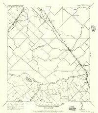 1956 Somerville1956 Print · USGSThe rail junctions of Burleson County come into focus in this post-World War I era survey of the Brazos River valley hinterlands. Genealogists can locate family-named landmarks and rural hubs like Frenstat, Charlesville School, and Lyons P.O.
 - 1959 Map of Somerville, 1960 Print
 1959 Somerville1960 Print · USGSSomerville was a bustling railway junction in the late fifties where the Burleson and Washington county lines meet along the river. Researchers can locate family sites like Schoppe Cem, Sweet Home, and the old Somerville Substa rail yard.
 - 1971 Map of Somerville, 1974 Print
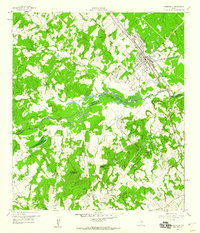
 1971 Somerville1974 Print · USGSSomerville and the surrounding Brazos Valley uplands are captured here in the early seventies, following the inundation of the Yegua Creek basin. Researchers can trace the extensive Atchison Topeka and Santa Fe rail yards and rural family sites like Schoppe Cem or Rehburg.3 unique versions available
 - 1993 Map of Brenham
 1993 Brenham1993 Print · USGSTexas river country and the birthplace of the republic are showcased in the early nineties, centered on the confluence of the Brazos and Navasota. Researchers can trace the rail sidings of the Southern Pacific RR and locate historic community landmarks like St Paul Ch and Washington-on-the-Brazos State Park.
 - 2010 Map of Somerville, 2010 Print
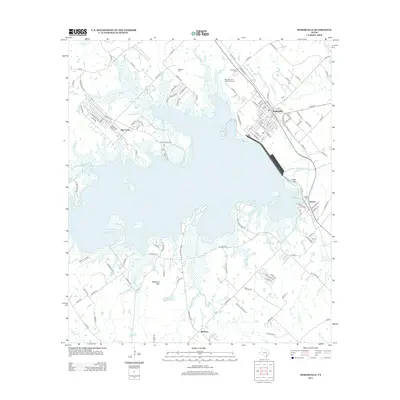
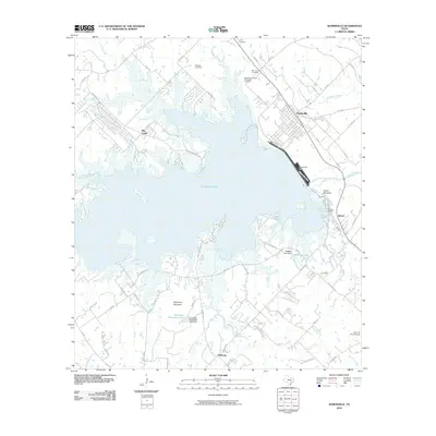 2010 Somerville2010 Print · USGSCovers Quarry, including Somerville, Rehburg, and other nearby areas
 - 2013 Map of Somerville, 2013 Print
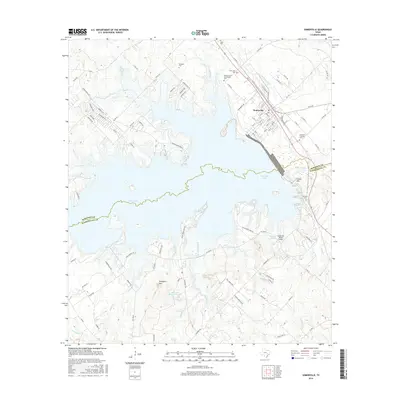
 2013 Somerville2013 Print · USGSCovers Quarry, including Somerville, Rehburg, and other nearby areas
 - 2016 Map of Somerville, 2016 Print
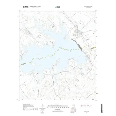
 2016 Somerville2016 Print · USGSCovers Quarry, including Somerville, Rehburg, and other nearby areas
 - 2019 Map of Somerville, 2019 Print
 2019 Somerville2019 Print · USGSCovers Quarry, including Somerville, Rehburg, and other nearby areas
 - 2022 Map of Somerville, 2022 Print
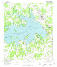
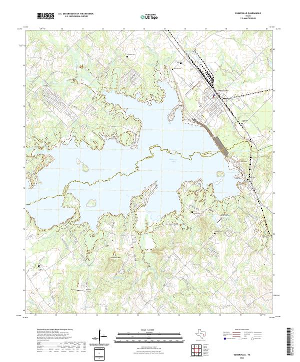 2022 Somerville2022 Print · USGSSomerville and its surrounding lakefront are captured here in the early twenty-first century, showing the town's proximity to the water. Genealogists can locate numerous small burial sites like Schoppe Cem and Mexican Cem near landmarks like Green Mtn.
End of results
Showing maps 1-10 of 10
Top cities near Quarry
- College Station historical maps
- Brenham historical maps
- Caldwell historical maps
- Somerville historical maps
- Snook historical maps
- Burton historical maps
See more
Frequently asked questions
- What are the different types of historical maps available for Quarry?
- What is the oldest map of Quarry?
- Where can I purchase historical maps of Quarry for my home or office?
- Where can I download high-res historical maps of Quarry?
- Are there historical topographic maps available for Quarry?
- Is there historical aerial imagery available for Quarry?
- Where are historical maps of Quarry sourced from?