
1954 Map of Austin
USGS Topo · Published 1964About this map
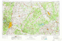
Austin and the surrounding Central Texas counties are documented here just as the post-war era transformed the region's capital and its agricultural hinterlands. The city's footprint is anchored by Bergstrom Air Force Base and the distinctive geological boundary of the Balcones Escarpment, which separates the eastern plains from the Jollyville Plateau. This 1:250,000 scale survey captures the dense network of rail lines that sustained the cotton and cattle economies, including the Missouri Pacific RR and Southern Pacific RR serving hubs like Bryan and Taylor.
Find a feature on this map
111 named features on this map. Tap any name to fly to it.
Don’t see what you’re looking for? This feature index may not catch every label — zoom into the map to look around manually.
Map Details
Editions of this 1954 Austin Map
4 editions found
Other maps of this area

1885 · Taylor
USGS Topo · 1:125,000

1885 · Bastrop
USGS Topo · 1:125,000

1887 · Taylor
USGS Topo · 1:125,000

1887 · Lampasas
USGS Topo · 1:125,000

1887 · Blanco
USGS Topo · 1:125,000

1887 · Burnet
USGS Topo · 1:125,000

1892 · Temple
USGS Topo · 1:125,000

1893 · Georgetown
USGS Topo · 1:125,000

1893 · Burnet
USGS Topo · 1:125,000

1893 · Bastrop
USGS Topo · 1:125,000