1887 Map of Burnet
USGS Topo · Published 1887About this map
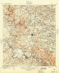
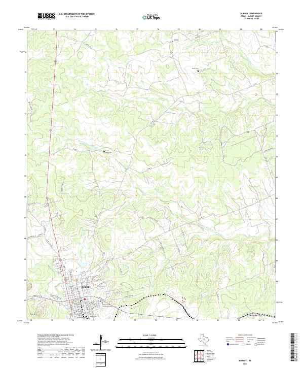
Burnet serves as the central hub of this 1885 survey, situated at the headwaters of Hamilton Creek where the Austin and Northwestern Railroad terminates from the east. The landscape of the Texas Hill Country is defined by prominent elevations like Post Mountain and Potato Top Peak, while the Colorado River winds along the western boundary. This era precedes the massive dam projects that would later transform the river valley, showing the original course near Bluffton and Foremans.
Find a feature on this map
71 named features on this map. Tap any name to fly to it.
Don’t see what you’re looking for? This feature index may not catch every label — zoom into the map to look around manually.
Map Details
Editions of this 1887 Burnet Map
This is the sole edition of this map. No revisions or reprints were ever made.
Historical Maps of Marble Falls Through Time
10 maps found