
Loading...
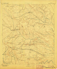
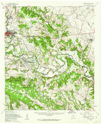
Loading map...1894 Map of Gatesville
USGS Topo · Published 1894About this map
Gatesville serves as the focal point of this 1880s survey, situated along the winding course of the Leon River in Coryell County. The landscape is defined by a dense network of gaps and limestone ridges, with numerous family-named landmarks such as Dalton Mountain and Henson Mountain overlooking the valley. Evidence of early industry and settlement appears at Straws Mill and the community of Fort Gates, while the northeastern corridor is shaped by the St. Louis Arkansas and Texas Railroad.
Find a feature on this map
89 named features on this map. Tap any name to fly to it.
Don’t see what you’re looking for? This feature index may not catch every label — zoom into the map to look around manually.
Map Details
Date Portrayed1894
Date Published1894
PublisherU.S. Geological Survey
Map TypeTopographic
Scale1:125,000
Physical Dimensions16.8 x 19.9 inches
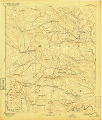
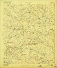
Editions of this 1894 Gatesville Map
4 editions found
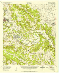
Historical Maps of Killeen Through Time
3 maps found
Featured Locations
Source Details
SourceU.S. Geological Survey
CopyrightPublic Domain