Loading...
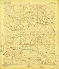
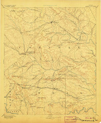
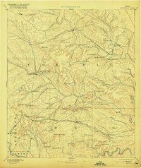
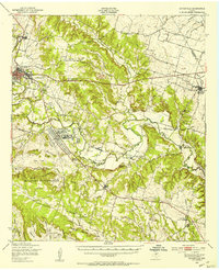
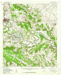
Loading map...1894 Map of Gatesville
USGS Topo · Published 1917About this map
Gatesville serves as the focal point for this late 19th-century survey of Central Texas, where the early regional economy was defined by the arrival of iron rails. The St. Louis Arkansas and Texas Railroad parallels the Leon River, connecting settlements like Leon Junction and Fort Gates along the valley floor. To the south, the Gulf Colorado and Santa Fe Railroad cuts through the territory near Killeen and Coperas Cove, marking the path of expansion across Bell and Coryell counties.
Find a feature on this map
89 named features on this map. Tap any name to fly to it.
Don’t see what you’re looking for? This feature index may not catch every label — zoom into the map to look around manually.
Map Details
Date Portrayed1894
Date Published1917
PublisherU.S. Geological Survey
Map TypeTopographic
Scale1:125,000
Physical Dimensions17 x 19.9 inches
Editions of this 1894 Gatesville Map
4 editions found

Historical Maps of Killeen Through Time
3 maps found
Featured Locations
Source Details
SourceU.S. Geological Survey
CopyrightPublic Domain