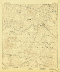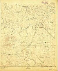
1887 Map of Blanco
USGS Topo · Published 1887About this map
The Pedernales River and Blanco River define this 1880s landscape at the heart of the Texas Hill Country, where early settlements were beginning to anchor the cattle and agricultural economy. Johnson City and Blanco serve as primary hubs, while smaller crossroads like Cypress Mill, Henly, and Dripping Springs appear as key social centers. The map documents a rugged hydrology, noting landmarks such as the famous Jacob's Well and the curiously named Dead Mans Hole. This survey, conducted by Henry Gannett and A.H. Thompson, captures the era before major dams or highways, showing the original winding course of the Colorado River at the northern boundary and the distinct family-named peaks like Lone Man Mt and Lone Woman Mt that guided travelers through the limestone hills and cypress-lined creek beds.
Find a feature on this map
44 named features on this map. Tap any name to fly to it.
Don’t see what you’re looking for? This feature index may not catch every label — zoom into the map to look around manually.
Map Details
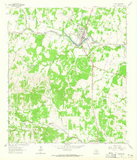
Editions of this 1887 Blanco Map
This is the sole edition of this map. No revisions or reprints were ever made.
Historical Maps of Lakeway Through Time
8 maps found