1903 Map of Burnet
USGS Topo · Published 1903About this map
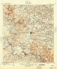
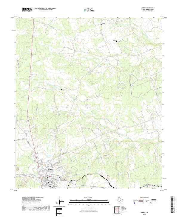
Burnet serves as the central hub of this Central Texas landscape at the dawn of the twentieth century, situated along the Western Division of the Houston and Texas Central Railroad. The map reveals an economy deeply tied to the land's geology and water, characterized by the Stone Quarry and the numerous river crossings that predate modern bridging. Along the curves of the Colorado River, early industrial sites like Tiger Mill, Morman Mill, and Old Cedar Mills mark the importance of water power for local processing.
Find a feature on this map
96 named features on this map. Tap any name to fly to it.
Don’t see what you’re looking for? This feature index may not catch every label — zoom into the map to look around manually.
Map Details
Editions of this 1903 Burnet Map
This is the sole edition of this map. No revisions or reprints were ever made.
Historical Maps of Marble Falls Through Time
10 maps found