Old Maps of Burnet County, Texas
Explore 214 old maps of Burnet County, spanning from 1887 to today. These high-resolution historic maps reveal how streets, neighborhoods, landmarks, and natural features evolved over time — perfect for genealogy, metal detecting, research, and local history exploration.
What you can do with these maps:
- See how Burnet County changed over time: Compare historical maps to modern-day views to trace roads, homesites, rail lines & more.
- View detailed metadata: Each map includes creators, publishers, year, scale, and archive source.
- Overlay maps with satellite & LiDAR: Visualize the past alongside modern tools to explore terrain & human change.
- Trusted historical sources: Maps sourced from the USGS, Library of Congress, and other archives.
- Access maps your way: View online, download high-res files, or order prints for personal or research use.
Start exploring old maps of Burnet County to uncover forgotten places, hidden landmarks, and the deep history beneath your feet.
Burnet County, TX maps
(214)- 1887 Map of Lampasas
 1887 Lampasas1887 Print · USGSThe Lampasas region in the late 1880s shows the arrival of the Gulf Colorado and Santa Fe Railroad alongside early frontier settlements. Local historians can trace old post offices and milling sites like Townsen Mills, Wayback, and Senterfitt among the numerous gaps and peaks of the Hill Country.
 - 1887 Map of Blanco
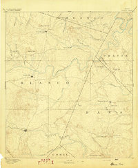
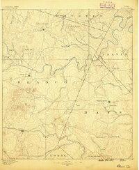 1887 Blanco1887 Print · USGSCentral Texas at the dawn of the Hill Country's development, when early ranching life centered on river fords and spring-fed creeks. Trace the paths between Johnson City, Blanco, and Dripping Springs, or locate landmarks like Jacob's Well and Dead Mans Hole.
 - 1887 Map of Burnet
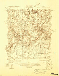
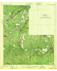
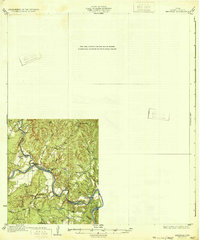
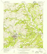
 1887 Burnet1887 Print · USGSCentral Texas in the late nineteenth century is defined here by the arrival of the rail line and the wild course of the Colorado River. Genealogists and historians can trace early settlements and transit points like Tiger Mill, Bluffton, and Wolf Crossing.
 - 1893 Map of Georgetown
 1893 Georgetown1893 Print · USGSCentral Texas in the late 1800s was a landscape in flux as rail lines reshaped old frontier settlements. Genealogists can trace the shift from riverside villages like Bagdad and Old Round Rock to new rail hubs such as Leander and Hutto.5 unique versions available
 - 1893 Map of Burnet
 1893 Burnet1893 Print · USGSThe Texas Hill Country comes alive in this late nineteenth-century survey, showcasing a landscape of river crossings and early rail expansion. Researchers can locate vanished communities and rural landmarks like Tiger Mill, Wolf Crossing, and the old depot at Bertram.
 - 1894 Map of Lampasas
 1894 Lampasas1894 Print · USGSLampasas and the surrounding hill country are shown in the years following the arrival of the rail. Genealogists can trace family-named landmarks like Kinchelo Peak and old post offices at Senterfitt, Nix, and Wayback.4 unique versions available
 - 1894 Map of Gatesville
 1894 Gatesville1894 Print · USGSCentral Texas in the late nineteenth century was a landscape of expanding rail lines and established river settlements. Genealogists can trace family names across Pidcock Ranch, Fort Gates, and Coperas Cove, while following the path of the St. Louis Arkansas and Texas Railroad.4 unique versions available
 - 1894 Map of Blanco
 1894 Blanco1894 Print · USGSThe Texas Hill Country comes into focus during the late frontier era, centered on the newly established Johnson City and Blanco. Genealogists can trace early homesteads and communities near Jacobs Well, Dripping Springs, and the isolated Cypress Mill.5 unique versions available
 - 1903 Map of Burnet
 1903 Burnet1903 Print · USGSThe Texas Hill Country at the turn of the century shows a landscape of river-side industry and early rail expansion. Trace the historic Houston and Texas Central Railroad line through Burnet and Bertram or locate long-standing landmarks like Morman Mill and Tanyard Crossing.
 - 1909 Map of Burnet
 1909 Burnet1909 Print · USGSThe Texas Hill Country at the turn of the century shows a landscape of river crossings and rail towns before the creation of the Highland Lakes. Genealogists can locate family-named landmarks like Morman Mill, Tumlinson, and rural schoolhouses such as Berry School or Sunny Lane.3 unique versions available
 - 1925 Map of Burnet 3-b
 1925 Burnet 3-b1925 Print · USGSThe confluence of the Colorado and Llano Rivers defines this central Texas landscape in the mid-twenties. Genealogists can trace early rural life through family-named landmarks like Hoover Valley, the Pack Saddle School, and Mason Crossing.
 - 1925 Map of Burnet 2-c
 1925 Burnet 2-c1925 Print · USGSLlano and Burnet counties are defined by the winding course of the Colorado River in the mid-twenties. Genealogists and local historians can trace the foundations of riverside life at Bluffton, including Bluffton Cemetery and the old Saltworks Ford.
 - 1925 Map of Burnet 3-d
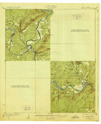
 1925 Burnet 3-d1925 Print · USGSTexas hill country in the mid-twenties centers on the river-bend industry of the Colorado. Researchers can trace the early layout of Marble Falls and locate historical landmarks like Granite Mtn Sta, Rennison Knob, and Flatrock Spring.
 - 1929 Map of Marble Falls
 1929 Marble Falls1929 Print · USGSThe Texas Hill Country at the end of the 1920s shows the original river channels and granite industry before major reservoir construction. Trace early rail stops like Wood Spur and local landmarks such as Granite Mtn and Hoover Sch.
 - 1930 Map of Blanco-1
 1930 Blanco-11930 Print · USGSCentral Texas river valleys appear in high detail during the early 1930s, showing the landscape before later reservoir projects. Trace the original paths of the Colorado River and Pedernales River past Pleasant Grove Sch and Buggy Ford.
 - 1931 Map of Marble Falls
 1931 Marble Falls1931 Print · USGSThe Texas Hill Country at the start of the 1930s is revealed here as a landscape of isolated peaks and winding river bends. Genealogists and local historians can trace family roots near Gaddy Crossing, the Upshaw settlement, or old schools like Sandy Mtn Sch.
 - 1932 Map of Tow
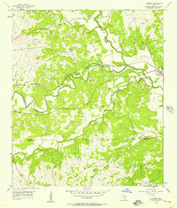
 1932 Tow1932 Print · USGSThe Colorado River valley along the Llano and Burnet county line is captured here in the mid-1920s, before the landscape was altered by dams. Researchers can locate the settlement of Bluffton, the Bluffton Sch, and the river crossing at Saltworks Ford.2 unique versions available
 - 1932 Map of Marble Falls
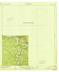
 1932 Marble Falls1932 Print · USGSThe Colorado River valley at the LLano and Burnet County line is shown here in the early thirties, before the creation of the modern lakes. Researchers can trace the Southern Pacific rail line through Kingsland and locate rural schools like La Vista School and Hoover School.2 unique versions available
 - 1932 Map of Bertram
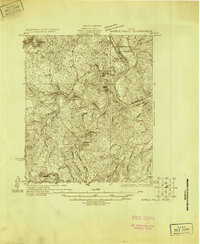
 1932 Bertram1932 Print · USGSBurnet County’s river-bound landscape is documented here in the early 1930s, featuring the rural life of Smithwick and the winding COLORADO RIVER. Genealogists can trace family footprints at Pleasant Valley Sch, Hale Ch, and historic river fords like SINGLETON CROSSING.2 unique versions available
 - 1947 Map of Fort Hood
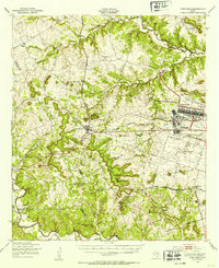 1947 Fort Hood1947 Print · USGSCoryell and Lampasas Counties are shown here during the post-war expansion of military and rail infrastructure. Researchers can trace the layout of Fort Hood alongside rural landmarks like Willow Springs School, Starkle Cemetery, and the Variety Club Boys Ranch.
 - 1947 Map of Copperas Cove, 1953 Print
 1947 Copperas Cove1953 Print · USGSCopperas Cove and Kempner are shown in the late 1940s as rural centers alongside the growing military presence at Fort Hood. Genealogists can locate family sites at Starkie Cem and Smith Cem or trace the early course of the Lampasas River.
 - 1954 Map of Brownwood, 1955 Print
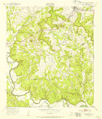
 1954 Brownwood1955 Print · USGSCentral Texas in the early fifties shows a landscape of rail-linked cattle towns and winding river valleys before modern highway expansion. Genealogists and historians can trace family-named peaks and vanished rail stops like Trickham, Santa Anna, and the Brady Mountains.3 unique versions available
 - 1954 Map of Lampasas, 1956 Print
 1954 Lampasas1956 Print · USGSLampasas and the surrounding ranchlands are shown here in the mid-fifties, centered on the confluence of several creeks and the rail corridor. Researchers can trace the layout of Kempner and Rumley, find rural landmarks like Clay Rock Ch, or locate family plots at Garner Cem.
 - 1954 Map of Lampasas, 1957 Print
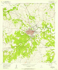 1954 Lampasas1957 Print · USGSMid-century Lampasas, Texas, serves as a railroad and highway crossroads where the hills meet the creek valleys. Trace the routes of the Santa Fe Railroad and find local landmarks like Hancock Park and Cook Cem.
 - 1954 Map of Kempner, 1957 Print
 1954 Kempner1957 Print · USGSKempner and the Lampasas River valley are captured in the mid-fifties, showing a landscape shaped by the railroad and river crossings. Trace family history at Pickett Cem or explore rail landmarks like Deadmans Cut and the siding at Shortall.2 unique versions available
Showing maps 1-25 of 214
Top cities of Burnet County
- Marble Falls historical maps
- Burnet historical maps
- Granite Shoals historical maps
- Meadowlakes historical maps
- Bertram historical maps
- Cottonwood Shores historical maps
See more
Frequently asked questions
- What are the different types of historical maps available for Burnet County?
- What is the oldest map of Burnet County?
- Where can I purchase historical maps of Burnet County for my home or office?
- Where can I download high-res historical maps of Burnet County?
- Are there historical topographic maps available for Burnet County?
- Is there historical aerial imagery available for Burnet County?
- Where are historical maps of Burnet County sourced from?