1960s Maps of Burnet County, Texas
Explore 22 historic maps of Burnet County from the 1960s. These maps offer a rare glimpse into what life looked like during the 1960s — showing old roads, neighborhoods, homes, and landmarks that have changed or disappeared over time.
Whether you're researching your family's past, planning a metal detecting trip, or studying how Burnet County's landscape evolved across the 1960s, these high-resolution maps are a powerful tool for exploring the history of this region.
- Focus on a specific era: All maps on this page are from the 1960s, giving you a focused view of this time period.
- See what’s changed: Compare century-old streets, trails, and buildings to today's modern landscape using overlays and satellite layers.
- Research with precision: Use these maps for genealogy, historical research, land use analysis, or educational projects.
- View, download, or print: Maps are fully viewable online in high resolution, and can be downloaded or printed for your own records.
Start exploring Burnet County's history through authentic maps from the 1960s. This is your window into the past.
Burnet County, TX maps
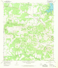
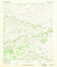
(22)- 1962 Map of Liberty Hill, 1966 Print
 1962 Liberty Hill1966 Print · USGSThe rural landscape of Liberty Hill and Seward Junction is captured in the early sixties as the railroad era still shaped the hill country. Researchers can find family-named landmarks and old burial grounds like Buck Cem and Liberty Hill Cem.2 unique versions available
 - 1964 Map of Mahomet, 1966 Print
 1964 Mahomet1966 Print · USGSThe Burnet and Williamson county line comes alive in the mid-1960s, showing a landscape of Hill Country ranching and river crossings. Genealogists and historians can trace family roots at Mahomet Cem, Gabriel Mills, and the crossing at Greens Crossing.2 unique versions available
 - 1964 Map of Florence, 1966 Print
 1964 Florence1966 Print · USGSFlorence and the surrounding Williamson County countryside are captured here in the mid-sixties, a landscape of limestone ridges and winding creeks. Genealogists can locate several family burial grounds including Wesley Chapel Cem and Andice Cem, or trace the rural road network connecting Florence and Andice.2 unique versions available
 - 1966 Map of Travis Peak, 1969 Print
 1966 Travis Peak1969 Print · USGSThe Texas Hill Country at the meeting of Travis, Burnet, and Williamson counties is shown here in the mid-1960s. Family historians and researchers can locate Hensel Cem, trace the drainage of Cow Creek, and identify high points like Boultinghouse Mountain.2 unique versions available
 - 1967 Map of Bachelor Peak, 1969 Print
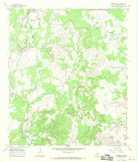
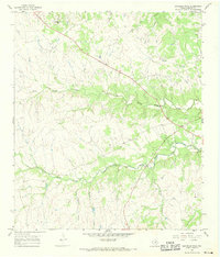 1967 Bachelor Peak1969 Print · USGSThe hills of Burnet County come into sharp focus in the late sixties, showing a landscape of deep hollows and winding creek beds. Researchers can locate the settlement of Watson, trace the path of South Rocky Creek, and find small landmarks like a rural Cem and Stone Quarry Hollow.
 - 1967 Map of Burnet, 1969 Print
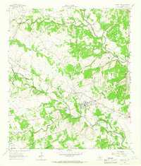
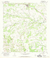
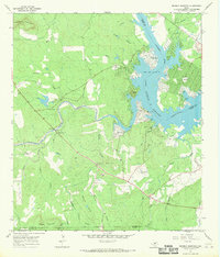
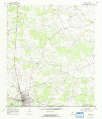 1967 Burnet1969 Print · USGSBurnet and the surrounding ranchlands are captured here in the late sixties as the area's rail-and-river geography shaped local growth. Genealogists and historians can locate legacy sites like the Fort Croghan Historical Site, Bethel Cem, and the Old Grade Railroad.2 unique versions available
 - 1967 Map of Pace Bend, 1969 Print
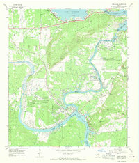
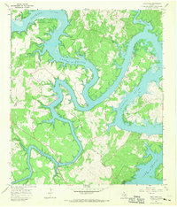 1967 Pace Bend1969 Print · USGSLake Travis and the Colorado River meander through Travis and Burnet Counties in the late sixties as the shoreline began its modern transformation. Genealogists can locate family landmarks like Fall Creek Cem and the traces of Old Ferry Road.2 unique versions available
 - 1967 Map of Round Mountain, 1969 Print
 1967 Round Mountain1969 Print · USGSThe Texas Hill Country at the end of the 1960s comes into focus at the intersection of Blanco, Burnet, and Llano counties. Researchers can trace land boundaries and rural development near Round Mountain, the Round Mountain Cem, and Cypress Mill.2 unique versions available
 - 1967 Map of Spicewood, 1969 Print
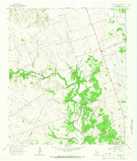
 1967 Spicewood1969 Print · USGSThe Blanco and Burnet county line is shown here in the late sixties as the rising waters of the Colorado River reshaped the land. Trace family history at Holloway Cem or follow the old paths near Spicewood and Cypress Mill.4 unique versions available
 - 1967 Map of Lake Victor, 1969 Print
 1967 Lake Victor1969 Print · USGSThe Lake Victor area during the late sixties was a landscape of transitioning transport and rural industry. Family researchers can locate Dobyville Cem, Sunnylane, and the Old Railroad Grade that once connected these central Texas communities.
 - 1967 Map of Longhorn Cavern, 1969 Print
 1967 Longhorn Cavern1969 Print · USGSThe Burnet County Hill Country is captured here in the late sixties as the region's parklands and rail lines defined the local economy. Researchers can trace family sites like Tobey Cem and the small settlements of Fairland and Sudduth along the Southern Pacific tracks.3 unique versions available
 - 1967 Map of Smithwick, 1969 Print
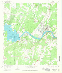
 1967 Smithwick1969 Print · USGSThe Colorado River valley in Burnet County is shown here during the late 1960s as the landscape adapted to the presence of the lake. Local researchers can trace numerous family burial sites like Richland Cem and Burnam Cem or locate the Spicewood Beach Landing Strip.3 unique versions available
 - 1967 Map of Joppa, 1969 Print
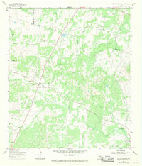
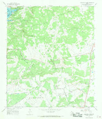
 1967 Joppa1969 Print · USGSTexas hill country life comes into focus in the late sixties as small communities like Joppa and Shady Grove thrive along the San Gabriel forks. Researchers can find ancestral landmarks like Strickling Cem, the Blacks Fort ruins, and the Price Landing Strip.
 - 1967 Map of Mormon Mill, 1970 Print
 1967 Mormon Mill1970 Print · USGSIn the late sixties, the area south of Burnet balanced its pioneer heritage with modern industrial growth. Genealogists and historians can locate family burial sites like Holland Cem or trace the early industrial footprint at the Mormon Mill (Historical Site).2 unique versions available
 - 1967 Map of Bertram, 1970 Print
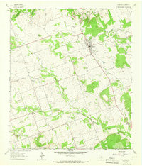
 1967 Bertram1970 Print · USGSBertram thrived as a railroad and quarrying hub in the Texas Hill Country during the late sixties. Genealogists and local researchers can trace old family burial grounds like South Gabriel Cem or locate rural landmarks such as Mt Zion Ch and Buzzard Roost.2 unique versions available
 - 1967 Map of Kingsland, 1970 Print
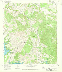
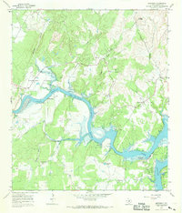
 1967 Kingsland1970 Print · USGSKingsland at the end of the 1960s reveals a Hill Country landscape reshaped by the Colorado River dams and the growth of lakefront communities. Trace family history at Murchison Cem or explore the mid-century footprints of the Buckner Boys Ranch and Kingsland Estates.3 unique versions available
 - 1967 Map of Lake Buchanan, 1970 Print
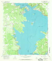 1967 Lake Buchanan1970 Print · USGSThe Burnet and Llano county line bisects the waters of the Hill Country in the late sixties. You can trace lakeside developments like Bluffton and Wirth Haven, or locate landmarks such as Buchanan Dam and the Aero-Bee Ranch Landing Strip.2 unique versions available
 - 1967 Map of Council Creek, 1970 Print
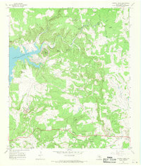 1967 Council Creek1970 Print · USGSThe eastern shoreline of Lake Buchanan is captured here in the late sixties as recreation and rural life intersected in the Hill Country. Researchers can trace family history at Pebble Mound Cem or explore landmarks like Spider Mountain and Hoovers Valley.2 unique versions available
 - 1967 Map of Naruna, 1970 Print
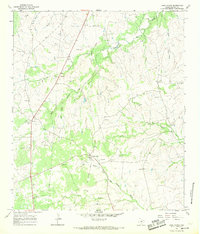
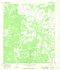 1967 Naruna1970 Print · USGSThe rural landscape of Burnet County comes into focus in the late 1960s, showing a transition between working cattle country and gravel extraction. Researchers can locate the settlement of Naruna, trace water sources like Persimmon Spring, or find landmarks such as Lookout Mountain.
 - 1967 Map of Tow, 1970 Print
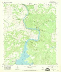 1967 Tow1970 Print · USGSThe northern shores of Lake Buchanan and the Texas Hill Country are documented in the late 1960s. Researchers can locate the Tow settlement and Tow Cem, or trace early river crossings like the Tanyard Crossing (Historic).3 unique versions available
 - 1967 Map of Dunman Mountain, 1970 Print
 1967 Dunman Mountain1970 Print · USGSThe Texas Hill Country shoreline transitions from ranching to recreation in the late sixties as Lake Lyndon B Johnson takes shape. Researchers can trace family history at Wolf Crossing Cem or explore the early layout of Sherwood Shores.2 unique versions available
 - 1967 Map of Marble Falls, 1971 Print
 1967 Marble Falls1971 Print · USGSMarble Falls and the surrounding Hill Country are captured here in the late sixties as the region's hydroelectric and quarrying industries matured. Researchers can trace the river's transformation at the Alvin Wirtz Dam or locate family history at Konvicka Cem and Fox Cem.2 unique versions available
End of results
Showing maps 1-22 of 22
Top cities of Burnet County
- Marble Falls historical maps
- Burnet historical maps
- Granite Shoals historical maps
- Meadowlakes historical maps
- Bertram historical maps
- Cottonwood Shores historical maps
See more
Frequently asked questions
- What are the different types of historical maps available for Burnet County?
- What is the oldest map of Burnet County?
- Where can I purchase historical maps of Burnet County for my home or office?
- Where can I download high-res historical maps of Burnet County?
- Are there historical topographic maps available for Burnet County?
- Is there historical aerial imagery available for Burnet County?
- Where are historical maps of Burnet County sourced from?