1897 Map of Austin
USGS Topo · Published 1897About this map
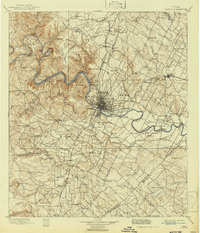
Austin appears here at the intersection of significant late-19th-century rail infrastructure and the winding course of the Colorado River. This survey, conducted by T.M. Bannon and W.B. Corse, shows a central Texas landscape transitioning from rural institutes and milling outposts toward established towns. The rail lines of the Houston and Texas Central R. R. and the International and Great Northern R. R. define the settlement patterns, connecting the capital to outliers like Manor and Pflugerville. Institutional landmarks such as Saint Edward's College and Johnson's Institute are clearly marked, alongside local industry at Anderson Mill. The topography of the Jollyville Plateau and prominent heights like Mount Bonnel frame the city, while numerous creek systems like Onion Creek and Walnut Creek drain the surrounding farm and ranch land.
Find a feature on this map
120 named features on this map. Tap any name to fly to it.
Don’t see what you’re looking for? This feature index may not catch every label — zoom into the map to look around manually.
Map Details
Editions of this 1897 Austin Map
This is the sole edition of this map. No revisions or reprints were ever made.
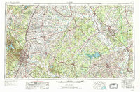
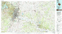
Historical Maps of Austin Through Time
6 maps found