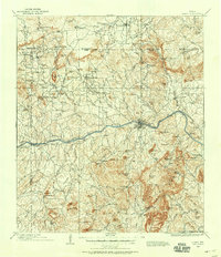
1894 Map of Llano
USGS Topo · Published 1894About this map
Llano serves as the central hub of this Central Texas landscape, surveyed during a period when the region's cattle and mining potential drew significant interest. The terrain is defined by a series of prominent peaks and massifs, most notably the massive pink granite dome of Enchanted Rock on the southern border and the distinct Pack Saddle Mountain to the east. The drainage network is dominated by the Llano River, which cuts through the center of the sheet, supported by numerous smaller waterways like Hickory Creek and Johnson Creek.
Find a feature on this map
86 named features on this map. Tap any name to fly to it.
Don’t see what you’re looking for? This feature index may not catch every label — zoom into the map to look around manually.
Map Details
Editions of this 1894 Llano Map
This is the sole edition of this map. No revisions or reprints were ever made.
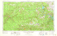
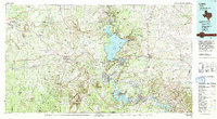
Historical Maps of Llano Through Time
10 maps found