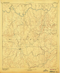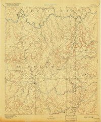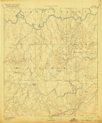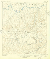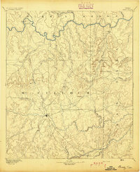
1894 Map of Brady
USGS Topo · Published 1894About this map
The Colorado River and the San Saba River define the northern and southern reaches of this central Texas territory, surveyed several years after the organization of McCulloch County. At the heart of the sheet lies Brady, serving as the central hub where regional roads converge from outlying settlements like Waldrip and Rochelle. The landscape is dominated by the distinct ridge of the Brady Mountains and prominent landmarks such as Lookout Mountain and Onion Gap, which influenced the early overland travel routes across the plateau. Small riverfront communities like Pueblo and Milburn are documented along the Colorado, providing a window into the settlement patterns of the late nineteenth century before more modern infrastructure altered the landscape. This map preserves the locations of early post offices and crossing points such as Cowboy and Voca during a formative period of ranching and rural development.
Find a feature on this map
31 named features on this map. Tap any name to fly to it.
Don’t see what you’re looking for? This feature index may not catch every label — zoom into the map to look around manually.
Map Details
Editions of this 1894 Brady Map
5 editions found