Old Maps of Islitas, Texas for Hiking & Exploration
Hike through history with 9 historic maps of Islitas. Explore old trails, ghost towns, and forgotten backroads — perfect for outdoor adventurers and local explorers.
- Rediscover forgotten places: Map out old mining camps, roads, and footpaths that no longer exist on modern maps.
- Layer with modern tools: Combine with LiDAR or satellite views to plan hikes through historical terrain.
- Made for exploration: Popular among hikers, overlanders, and local history lovers.
Use these maps to find adventure and explore the hidden past of Islitas.
Islitas, TX maps
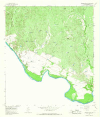
(9)- 1956 Map of Islitas
 1956 Islitas1956 Print · USGSThe riverfront north of Laredo was a hub of early twentieth-century industry and ranching along the Rio Grande. Genealogists and historians can trace family-named holdings like Tordillo Settlement and the industrial infrastructure of the Rio Grande and Eagle Pass Railroad.
 - 1956 Map of Laredo, 1960 Print
 1956 Laredo1960 Print · USGSSouth Texas in the mid-fifties reveals a landscape shaped by border commerce, military aviation, and a booming oil industry. Trace the historic Texas and Mexican RR line through Hebbronville or locate the sprawling Mirando City Oil Field and Laredo AFB.3 unique versions available
 - 1965 Map of Dolores Ranch, 1967 Print
 1965 Dolores Ranch1967 Print · USGSThe Texas-Mexico borderlands come into focus in the mid-sixties, capturing the ranching landscape along the Rio Grande. Trace family history at Darwin Cemetery or explore the infrastructure of Dolores Ranch and the Old Railroad Grade.2 unique versions available
 - 1985 Map of Laredo
 1985 Laredo1985 Print · USGSThe Rio Grande border and the expanding city of Laredo are captured in the mid-eighties as a major international transit hub. Trace the development of Del Mar, the routes of the Texas Mexican railroad, and outlying settlements like Islitas and Las Tiendas.3 unique versions available
 - 2010 Map of Dolores Ranch, 2010 Print
 2010 Dolores Ranch2010 Print · USGSCovers Islitas, including Laredo, Colombia, and other nearby areas
 - 2013 Map of Dolores Ranch, 2013 Print
 2013 Dolores Ranch2013 Print · USGSCovers Islitas, including Laredo, Colombia, and other nearby areas
 - 2016 Map of Dolores Ranch, 2016 Print
 2016 Dolores Ranch2016 Print · USGSCovers Islitas, including Laredo, Colombia, and other nearby areas
 - 2019 Map of Dolores Ranch, 2019 Print
 2019 Dolores Ranch2019 Print · USGSCovers Islitas, including Laredo, Colombia, and other nearby areas
 - 2022 Map of Dolores Ranch, 2022 Print
 2022 Dolores Ranch2022 Print · USGSThe ranchlands north of Laredo at the start of the twenty-first century remain defined by their proximity to the Rio Grande and a reliance on scattered water tanks. Researchers can trace local lineage at Islitas Cem and Darwin Cem or locate landmarks like Lovers Leap.
End of results
Showing maps 1-9 of 9
Top cities near Islitas
Frequently asked questions
- What are the different types of historical maps available for Islitas?
- What is the oldest map of Islitas?
- Where can I purchase historical maps of Islitas for my home or office?
- Where can I download high-res historical maps of Islitas?
- Are there historical topographic maps available for Islitas?
- Is there historical aerial imagery available for Islitas?
- Where are historical maps of Islitas sourced from?