Old Maps of Mackay, Wharton
Explore 9 old maps of Mackay, spanning from 1953 to today. These high-resolution historic maps reveal how streets, neighborhoods, landmarks, and natural features evolved over time — perfect for genealogy, metal detecting, research, and local history exploration.
What you can do with these maps:
- See how Mackay changed over time: Compare historical maps to modern-day views to trace roads, homesites, rail lines & more.
- View detailed metadata: Each map includes creators, publishers, year, scale, and archive source.
- Overlay maps with satellite & LiDAR: Visualize the past alongside modern tools to explore terrain & human change.
- Trusted historical sources: Maps sourced from the USGS, Library of Congress, and other archives.
- Access maps your way: View online, download high-res files, or order prints for personal or research use.
Start exploring old maps of Mackay to uncover forgotten places, hidden landmarks, and the deep history beneath your feet.
Mackay, Wharton maps
(9)- 1953 Map of Glen Flora, 1954 Print
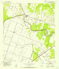 1953 Glen Flora1954 Print · USGSThe Colorado River bottoms of Wharton County appear in the early fifties as a landscape of intensive drainage and river-side settlements. Researchers can trace the rail corridors through Glen Flora and Mackay while locating old landmarks like Red Hill Church and the Sorrell School.3 unique versions available
 - 1953 Map of Seguin, 1965 Print
 1953 Seguin1965 Print · USGSSouth Texas in the early fifties shows a thriving river-and-rail economy across the Guadalupe and Colorado basins. Genealogists and historians can trace rail routes like the Southern Pacific through Seguin, locate oil wells, or find the Gary AAF near San Marcos.4 unique versions available
 - 1958 Map of Seguin
 1958 Seguin1958 Print · USGSSouth Texas in the late fifties was a network of river-valley settlements and active oilfields tied together by major rail lines. Genealogists and historians can trace family-named sites across Rabb Prairie, locate the Behring Store, or follow the Southern Pacific through Schulenburg.
 - 1994 Map of El Campo
 1994 El Campo1994 Print · USGSCoastal Texas in the mid-nineties shows a landscape deeply shaped by the energy industry and rail logistics. Researchers can trace the sprawling Sheridan Gas Field or locate historic rail stops in El Campo, Spanish Camp, and Provident City.
 - 2010 Map of Glen Flora, 2010 Print
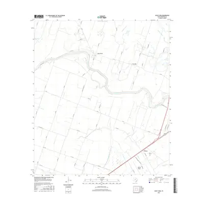
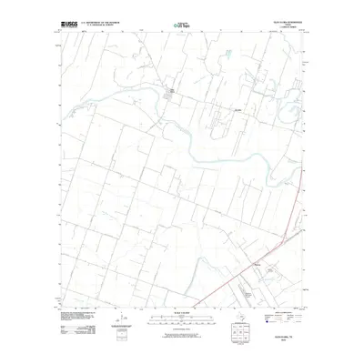 2010 Glen Flora2010 Print · USGSCovers Mackay, including Wharton, Sorrelle, and other nearby areas
 - 2013 Map of Glen Flora, 2013 Print
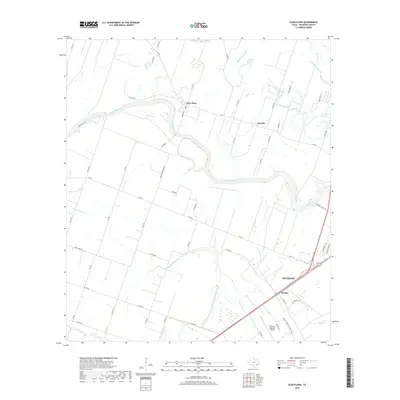
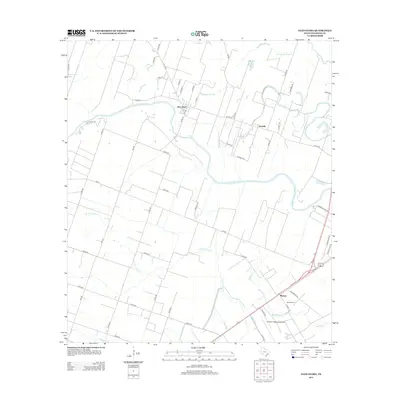 2013 Glen Flora2013 Print · USGSCovers Mackay, including Wharton, Sorrelle, and other nearby areas
 - 2016 Map of Glen Flora, 2016 Print
 2016 Glen Flora2016 Print · USGSCovers Mackay, including Wharton, Sorrelle, and other nearby areas
 - 2019 Map of Glen Flora, 2019 Print
 2019 Glen Flora2019 Print · USGSCovers Mackay, including Wharton, Sorrelle, and other nearby areas
 - 2022 Map of Glen Flora, 2022 Print
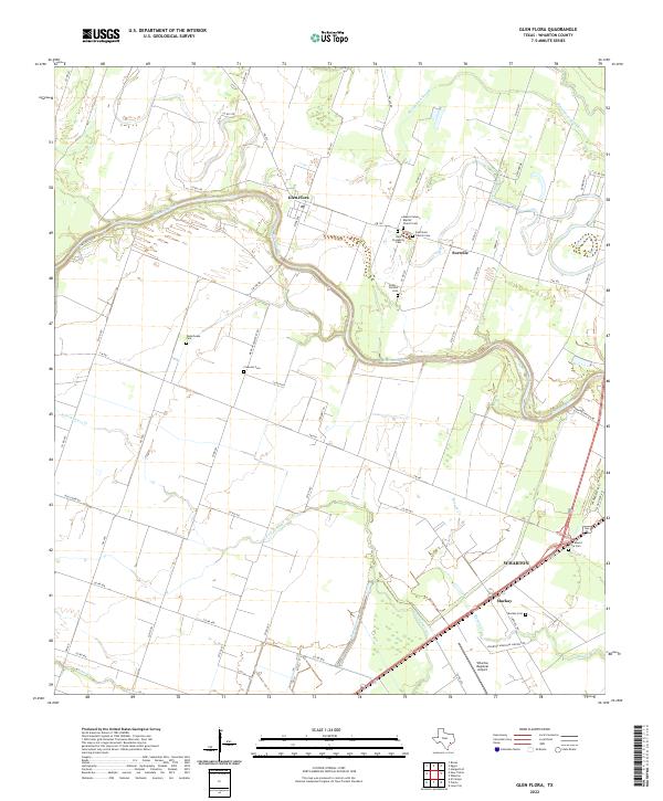 2022 Glen Flora2022 Print · USGSWharton and the Colorado River bottomlands are captured here in a period of modern agricultural and civic continuity. Genealogists can trace family heritage through numerous rural sites like Mount Calvary Baptist Church Cem, Crescent Cem, and Mackay Cem.
End of results
Showing maps 1-9 of 9
Top cities near Mackay
- Rosenberg historical maps
- El Campo historical maps
- Wharton historical maps
- Beasley historical maps
- Kendleton historical maps
Frequently asked questions
- What are the different types of historical maps available for Mackay?
- What is the oldest map of Mackay?
- Where can I purchase historical maps of Mackay for my home or office?
- Where can I download high-res historical maps of Mackay?
- Are there historical topographic maps available for Mackay?
- Is there historical aerial imagery available for Mackay?
- Where are historical maps of Mackay sourced from?