Old Maps of Zapata, Texas for Metal Detecting
Plan your next treasure hunt with 13 historic maps of Zapata. Find old homesites, ghost towns, trails, and gathering spots that may be lost to time — perfect for identifying promising metal detecting locations.
- Locate forgotten sites: Uncover places like long-lost settlements, abandoned rail lines, or gathering spots.
- Plan better hunts: Use map overlays combined with LiDAR or satellite views to narrow in on historically rich areas.
- Made for detectorists: Thousands of hobbyists use these maps to discover relics, coins, and hidden history.
Use these historic maps to boost your research and find new opportunities beneath the surface of Zapata.
Zapata, TX maps
(13)- 1949 Map of Mc Allen, 1954 Print
 1949 Mc Allen1954 Print · USGSThe Rio Grande Valley at mid-century reveals a bustling international corridor of citrus groves, rail lines, and growing border towns. Genealogists and historians can trace the Missouri Pacific RR through McAllen or locate rural landmarks like the Santa Fe School and Arkansas City.
 - 1954 Map of McAllen
 1954 McAllen1954 Print · USGSCovers Zapata, including Reynosa, McAllen, and other nearby areas
 - 1956 Map of Zapata
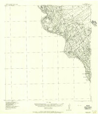 1956 Zapata1956 Print · USGSThe ranching country of Zapata County along the Rio Grande is documented here in the mid-1950s. Researchers can trace ancestral lands at Ramireno Ranch and Boleño, or locate the U S Customhouse near the river crossing.
 - 1957 Map of Mc Allen, 1962 Print
 1957 Mc Allen1962 Print · USGSThe South Texas borderlands emerge in the late fifties as a hub of energy production and military activity. Researchers can trace the river economy through Rio Grande City, find the Brewster School, and locate the Moore Air Force Base.2 unique versions available
 - 1962 Map of McAllen
 1962 McAllen1962 Print · USGSThe Lower Rio Grande Valley in the mid-twentieth century shows a complex landscape of irrigation, oil production, and border commerce. Genealogists and historians can trace family roots through riverside towns like Zapata, Roma-Los Saenz, and Hidalgo, or locate landmarks like Santa Elena Ch and Moore Air Force Base.
 - 1979 Map of Zapata
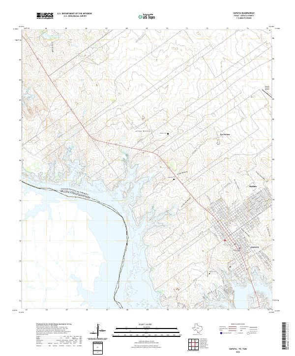
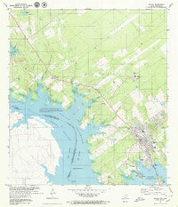 1979 Zapata1979 Print · USGSThe Texas-Mexico borderlands at the edge of the Rio Grande are captured here in the late seventies as Zapata grew along the reservoir. Genealogists can locate family landmarks like Zapata Cemetery and Ranchito Cem or trace the early layout of El Sauz.
 - 1983 Map of Mc Allen, 1984 Print
 1983 Mc Allen1984 Print · USGSThe Lower Rio Grande Valley is captured here during the early 1980s, showcasing the intense cross-border connectivity and agricultural expansion of the era. Researchers can trace the sprawling irrigation networks around Mc Allen and Mission, or locate landmarks like the Zapata Aircraft Control and Warning Station and Falcon State Park.
 - 1985 Map of Zapata
 1985 Zapata1985 Print · USGSThe Rio Grande borderlands in the mid-eighties show a landscape transformed by the waters of the Falcon Reservoir. Genealogists and historians can trace the growth of Zapata and locate border communities like Lopeño, Salineño, and Falcon Village.2 unique versions available
 - 2010 Map of Zapata, 2010 Print
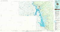
 2010 Zapata2010 Print · USGSCovers Zapata, including Cuellar Colonia, Falcon Estates Colonia, and other nearby areas
 - 2012 Map of Zapata, 2012 Print
 2012 Zapata2012 Print · USGSCovers Zapata, including Cuellar Colonia, Falcon Estates Colonia, and other nearby areas
 - 2016 Map of Zapata, 2016 Print
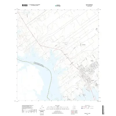
 2016 Zapata2016 Print · USGSCovers Zapata, including Cuellar Colonia, Falcon Estates Colonia, and other nearby areas
 - 2019 Map of Zapata, 2019 Print
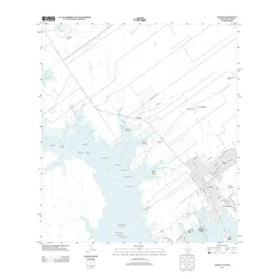
 2019 Zapata2019 Print · USGSCovers Zapata, including Cuellar Colonia, Falcon Estates Colonia, and other nearby areas
 - 2022 Map of Zapata, 2022 Print
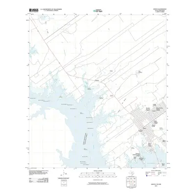
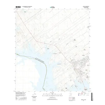
 2022 Zapata2022 Print · USGSThe South Texas borderlands near the Rio Grande are captured here during the early twenty-first century. Genealogists can locate family landmarks like Zapata Cem or Uribeno Cem while tracing the street grids of Zapata and Medina.
End of results
Showing maps 1-13 of 13
Frequently asked questions
- What are the different types of historical maps available for Zapata?
- What is the oldest map of Zapata?
- Where can I purchase historical maps of Zapata for my home or office?
- Where can I download high-res historical maps of Zapata?
- Are there historical topographic maps available for Zapata?
- Is there historical aerial imagery available for Zapata?
- Where are historical maps of Zapata sourced from?