1900s (20th Century) Maps of Draper, Utah
Explore 19 historic maps of Draper from the 1900s (20th Century). These maps offer a rare glimpse into what life looked like during the 1900s — showing old roads, neighborhoods, homes, and landmarks that have changed or disappeared over time.
Whether you're researching your family's past, planning a metal detecting trip, or studying how Draper's landscape evolved across the 1900s, these high-resolution maps are a powerful tool for exploring the history of this region.
- Focus on a specific era: All maps on this page are from the 1900s, giving you a focused view of this time period.
- See what’s changed: Compare century-old streets, trails, and buildings to today's modern landscape using overlays and satellite layers.
- Research with precision: Use these maps for genealogy, historical research, land use analysis, or educational projects.
- View, download, or print: Maps are fully viewable online in high resolution, and can be downloaded or printed for your own records.
Start exploring Draper's history through authentic maps from the 1900s. This is your window into the past.
Draper, UT maps
(19)- 1925 Map of Ft. Douglas
 1925 Ft. Douglas1925 Print · USGSThe Wasatch Range in the mid-1920s shows a landscape of mining camps and early mountain tourism. Genealogists and researchers can trace the old paths of the Lincoln Highway and locate vanished stops like Gogorza, Kimballs, and the Pacific Mine.
 - 1928 Map of Ft. Douglas
 1928 Ft. Douglas1928 Print · USGSIn the mid-1920s, the high country east of Salt Lake was a hive of mining and early canyon tourism. Trace old claim sites like the Pacific Mine or visit early retreats such as Pinecrest Inn and the YWCA Camp during the mining era.2 unique versions available
 - 1951 Map of Jordan Narrows, 1952 Print
 1951 Jordan Narrows1952 Print · USGSThe Jordan River valley at the Salt Lake and Utah County border was a hub of irrigation and rail in the early fifties. Genealogists and local historians can trace the foundations of Bluffdale, the boundaries of Camp Williams, and the site of the Utah State Prison.6 unique versions available
 - 1951 Map of Lehi, 1953 Print
 1951 Lehi1953 Print · USGSThe northern Utah County valley in the early fifties reveals a landscape of expanding towns and intricate irrigation. Genealogists can trace family sites from Lehi to Alpine, including the American Fk Training Sch and the Pioneer Mem Cem.5 unique versions available
 - 1951 Map of Midvale, 1953 Print
 1951 Midvale1953 Print · USGSThe Salt Lake Valley in the early fifties shows a landscape of busy rail corridors and irrigation canals before the onset of modern suburban sprawl. Trace the industrial heritage of the Sugar Factory or locate family roots near Jordan High Sch and the Midvale rail sidings.
 - 1952 Map of Draper, 1954 Print
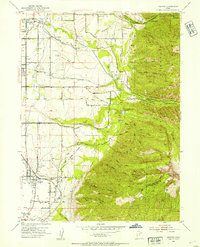 1952 Draper1954 Print · USGSThe Salt Lake Valley at the start of the fifties reveals a landscape of irrigation canals, early private airfields, and rail spurs. Genealogists and local historians can trace the foundations of Draper, Union, and Sandy, or locate the Union Cemetery and the Historic Mon Temple Granite Quarry.2 unique versions available
 - 1954 Map of Salt Lake City, 1964 Print
 1954 Salt Lake City1964 Print · USGSThe Wasatch Front and Uinta Mountains are captured here in the mid-fifties, showing the industrial heart of Utah and its high mountain wilderness. Researchers can locate vanished infrastructure and landmarks like the Geneva Steel Plant, Bingham Canyon Mine, and the Utah State Prison.4 unique versions available
 - 1958 Map of Salt Lake City
 1958 Salt Lake City1958 Print · USGSThe Wasatch Front and Uinta Basin are captured during a period of significant post-war growth and industrial development. Researchers can trace the mid-century rail lines of the Bamberger RR and locate sites like the Kiegley Limestone Quarry and Camp Williams Military Reservation.
 - 1960 Map of Salt Lake City
 1960 Salt Lake City1960 Print · USGSThe Wasatch Front and High Uintas are captured mid-century as the Salt Lake Valley underwent significant postwar expansion. Genealogists and historians can trace rail lines like the Union Pacific and locate established landmarks such as Fort Douglas, Camp Williams, and the Bingham Canyon Mine.
 - 1963 Map of Midvale, 1964 Print
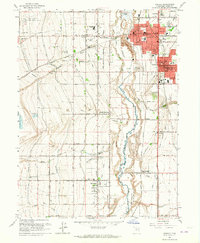 1963 Midvale1964 Print · USGSThe Salt Lake Valley undergoes a mid-century transformation as suburban growth reaches into agricultural corridors along the Jordan River. Genealogists and historians can trace family plots at Wite Fort Cem or study the industrial rail infrastructure serving the Sugar Refinery.3 unique versions available
 - 1963 Map of Draper, 1964 Print
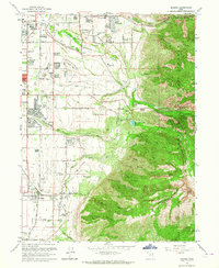 1963 Draper1964 Print · USGSThe Salt Lake Valley undergoes rapid change in the early sixties as residential growth reaches toward the Wasatch range. Genealogists and historians can trace family locations near Draper and Butlerville, or locate the Temple Granite Quarry and early airfields like Alta Airpark.3 unique versions available
 - 1980 Map of Salt Lake City
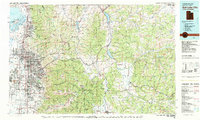 1980 Salt Lake City1980 Print · USGSSalt Lake City and the surrounding Wasatch Range are shown in the early eighties during a period of rapid suburban growth. Genealogists and historians can trace old mining operations like the Ontario Mine and Wasatch Mine or follow the path of the Union Pacific through the canyons.3 unique versions available
 - 1986 Map of Provo
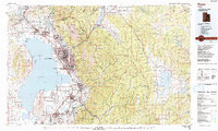 1986 Provo1986 Print · USGSThe Utah Valley during the mid-eighties shows a bustling corridor of growth between the mountains and Utah Lake. Genealogists and historians can trace the rail lines of the Union Pacific RR through settlements like Springville, Spanish Fork, and Payson.
 - 1993 Map of Jordan Narrows
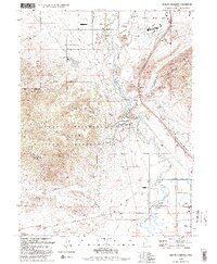 1993 Jordan Narrows1993 Print · USGSSalt Lake County in the early 1990s shows a unique convergence of heavy infrastructure and frontier history near the Jordan Narrows. Researchers can locate the Rockwell Station Pony Express Historical Marker, the Camp Williams grounds, and the Bluffdale Cemetery.
 - 1994 Map of Lehi
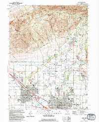 1994 Lehi1994 Print · USGSIn the mid-1990s, the northern Utah Valley was a landscape of expanding towns and complex irrigation. Genealogists and local historians can trace the foundations of Lehi and Alpine, locating landmarks like Lehi Cem and the Utah State Training School.
 - 1998 Map of Lehi, 2000 Print
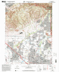 1998 Lehi2000 Print · USGSNorthern Utah Valley undergoes a period of rapid suburban growth in the late nineties as residential borders expand toward the mountains. Genealogists and local historians can trace family plots in the Lehi Cem or locate community hubs like Sego Lily Sch and the Utah State Developmental Center.
 - 1998 Map of Draper, 2001 Print
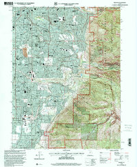 1998 Draper2001 Print · USGSSandy City and Draper are shown during a period of rapid suburban expansion in the late nineties, right up to the edge of the wilderness. Researchers can trace the development of local neighborhoods alongside landmarks like Union Cem, Granite, and Mellen Sand Spur.
 - 1999 Map of Jordan Narrows, 2001 Print
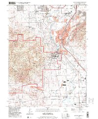 1999 Jordan Narrows2001 Print · USGSThe Jordan Narrows area at the turn of the millennium shows a landscape defined by military training and massive water infrastructure. Trace local history at the Bluffdale City Cemetery or follow the Old Railroad Grade near Camp Williams.
 - 1999 Map of Midvale, 2001 Print
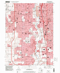 1999 Midvale2001 Print · USGSThe Salt Lake Valley at the turn of the millennium reveals a landscape of rapid suburban growth and major public institutions. Genealogists and local historians can trace family locations near the South Jordan Cemetery or find early school sites like Oquirrh Sch and Welby Sch.
End of results
Showing maps 1-19 of 19
Top cities near Draper
- Salt Lake City historical maps
- West Valley City historical maps
- West Jordan historical maps
- Provo historical maps
- Orem historical maps
- Sandy historical maps
See more
Top neighborhoods of Draper
- Draperville historical maps
- Somerville in Draper historical maps
- Burningham Industrial historical maps
- Draper Commercial Parkway historical maps
- Riverton Siding historical maps
- Draper Old Farm historical maps
See more
Frequently asked questions
- What are the different types of historical maps available for Draper?
- What is the oldest map of Draper?
- Where can I purchase historical maps of Draper for my home or office?
- Where can I download high-res historical maps of Draper?
- Are there historical topographic maps available for Draper?
- Is there historical aerial imagery available for Draper?
- Where are historical maps of Draper sourced from?