1900s (20th Century) Maps of Burbank, Utah
Explore 5 historic maps of Burbank from the 1900s (20th Century). These maps offer a rare glimpse into what life looked like during the 1900s — showing old roads, neighborhoods, homes, and landmarks that have changed or disappeared over time.
Whether you're researching your family's past, planning a metal detecting trip, or studying how Burbank's landscape evolved across the 1900s, these high-resolution maps are a powerful tool for exploring the history of this region.
- Focus on a specific era: All maps on this page are from the 1900s, giving you a focused view of this time period.
- See what’s changed: Compare century-old streets, trails, and buildings to today's modern landscape using overlays and satellite layers.
- Research with precision: Use these maps for genealogy, historical research, land use analysis, or educational projects.
- View, download, or print: Maps are fully viewable online in high resolution, and can be downloaded or printed for your own records.
Start exploring Burbank's history through authentic maps from the 1900s. This is your window into the past.
Burbank, UT maps
(5)- 1953 Map of Richfield, 1963 Print
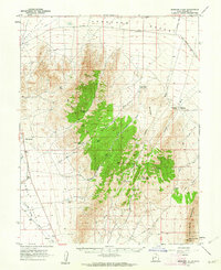
 1953 Richfield1963 Print · USGSCentral Utah in the early fifties reveals a complex geography of high plateaus and desert basins tied together by the Union Pacific rail lines. Genealogists and historians can trace family roots in Richfield or Kanosh and locate remote operations like the Blue Star Mine or Newhouse.3 unique versions available
 - 1958 Map of Richfield
 1958 Richfield1958 Print · USGSCentral Utah in the late fifties shows a landscape of mountain forests and desert basins connected by the Union Pacific Railroad. Genealogists and historians can trace rail stops at Nada Station, mines like the Blue Star Mine, and tribal lands of the Paiute Indian Reservation.2 unique versions available
 - 1960 Map of Burbank Hills, 1962 Print
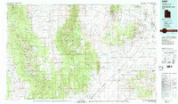
 1960 Burbank Hills1962 Print · USGSBurbank Hills and the Ferguson Desert come into focus during the early sixties, showing a landscape shaped by high-desert ranching and travel. Trace the routes of the Ferguson Trail and Cowboy Jeep Trail or locate remote water sources like Davies Well and Clay Spring.2 unique versions available
 - 1980 Map of Wah Wah Mts. North, 1984 Print
 1980 Wah Wah Mts. North1984 Print · USGSSouthwestern Utah's high desert was a landscape of remote mining claims and railroad outposts during the late twentieth century. Researchers can trace historic operations like the Carbonate Mine and Magnolia Mine, or locate early valley settlements such as Lund and Milford.2 unique versions available
 - 1991 Map of Cedar Pass
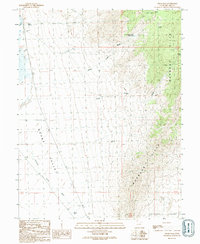 1991 Cedar Pass1991 Print · USGSSnake Valley and the Burbank Hills are mapped here in the early nineties, showing a landscape defined by ranching and water rights. Researchers can trace the layout of desert infrastructure like Heckman Well, the Lake Ditch, and the high crossing at Cedar Pass.
End of results
Showing maps 1-5 of 5
Frequently asked questions
- What are the different types of historical maps available for Burbank?
- What is the oldest map of Burbank?
- Where can I purchase historical maps of Burbank for my home or office?
- Where can I download high-res historical maps of Burbank?
- Are there historical topographic maps available for Burbank?
- Is there historical aerial imagery available for Burbank?
- Where are historical maps of Burbank sourced from?