Old Maps of Randolph, Utah for Metal Detecting
Plan your next treasure hunt with 7 historic maps of Randolph. Find old homesites, ghost towns, trails, and gathering spots that may be lost to time — perfect for identifying promising metal detecting locations.
- Locate forgotten sites: Uncover places like long-lost settlements, abandoned rail lines, or gathering spots.
- Plan better hunts: Use map overlays combined with LiDAR or satellite views to narrow in on historically rich areas.
- Made for detectorists: Thousands of hobbyists use these maps to discover relics, coins, and hidden history.
Use these historic maps to boost your research and find new opportunities beneath the surface of Randolph.
Randolph, UT maps
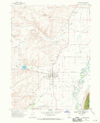
(7)- 1912 Map of Randolph
 1912 Randolph1912 Print · USGSThe high valley ranching country of the Utah-Wyoming border is captured here in the early twentieth century. Genealogists and historians can trace family land holdings such as Rex Ranch or Sixmile Ranch and find old routes like the Ogden Road.3 unique versions available
 - 1954 Map of Ogden, 1967 Print
 1954 Ogden1967 Print · USGSThe northern Utah corridor and Wyoming borderlands are captured here in the mid-1950s, showing the region's transition from mountain wilderness to settled valleys. Researchers can trace historic institutions like Utah State University or locate vanished points like Church Butte Station and the Trappist Monastery.3 unique versions available
 - 1958 Map of Ogden
 1958 Ogden1958 Print · USGSNorthern Utah and southwestern Wyoming are captured here during a period of steady growth and military expansion. You can trace the Union Pacific rail lines and early road networks connecting Ogden and Logan to Bear Lake and Evanston.
 - 1960 Map of Ogden
 1960 Ogden1960 Print · USGSIn the mid-1950s, this region of the American West balanced military expansion with frontier history along the Union Pacific RR. Genealogists and historians can trace old settlements like Fort Bridger, the residential growth of Washington Terrace, and industrial sites from the Hill AFB complex to the coal mines of Kemmerer.
 - 1968 Map of Randolph, 1970 Print
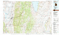
 1968 Randolph1970 Print · USGSRich County ranching and water history come alive in this late 1960s study of the Randolph area. Genealogists and historians can trace the town's footprint from the Cem and South Rich High Sch to the Randolph Camp Historical Mon.2 unique versions available
 - 1984 Map of Logan, 1985 Print
 1984 Logan1985 Print · USGSNorthern Utah and its borderlands with Idaho and Wyoming are shown here in the mid-1980s as the Cache Valley communities grew. Researchers can trace the Union Pacific rail lines and find legacy sites like College Ward, Pickleville, and Utah State University.3 unique versions available
 - 2023 Map of Randolph, 2023 Print
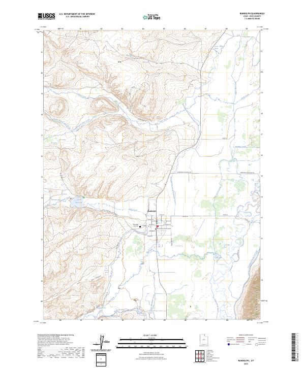 2023 Randolph2023 Print · USGSRandolph and the Bear River valley are shown in the early 2020s amidst an extensive network of historic canals and springs. Researchers can trace local lineage and land use through landmarks like the Randolph City Cem, the Rich County Court House, and the Little Creek Reservoir.
End of results
Showing maps 1-7 of 7
Top cities near Randolph
Frequently asked questions
- What are the different types of historical maps available for Randolph?
- What is the oldest map of Randolph?
- Where can I purchase historical maps of Randolph for my home or office?
- Where can I download high-res historical maps of Randolph?
- Are there historical topographic maps available for Randolph?
- Is there historical aerial imagery available for Randolph?
- Where are historical maps of Randolph sourced from?