2020s Maps of Kearns, Utah
Explore 4 historic maps of Kearns from the 2020s. These maps offer a rare glimpse into what life looked like during the 2020s — showing old roads, neighborhoods, homes, and landmarks that have changed or disappeared over time.
Whether you're researching your family's past, planning a metal detecting trip, or studying how Kearns's landscape evolved across the 2020s, these high-resolution maps are a powerful tool for exploring the history of this region.
- Focus on a specific era: All maps on this page are from the 2020s, giving you a focused view of this time period.
- See what’s changed: Compare century-old streets, trails, and buildings to today's modern landscape using overlays and satellite layers.
- Research with precision: Use these maps for genealogy, historical research, land use analysis, or educational projects.
- View, download, or print: Maps are fully viewable online in high resolution, and can be downloaded or printed for your own records.
Start exploring Kearns's history through authentic maps from the 2020s. This is your window into the past.
Kearns, UT maps
(4)- 2020 Map of Salt Lake City South, 2020 Print
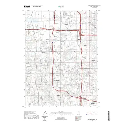 2020 Salt Lake City South2020 Print · USGSCovers Kearns, including Salt Lake City, West Valley City, and other nearby areas
 - 2020 Map of Magna, 2020 Print
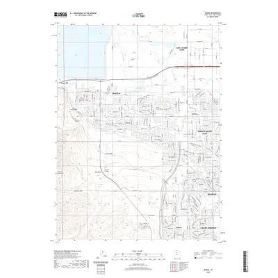 2020 Magna2020 Print · USGSCovers Kearns, including Salt Lake City, West Valley City, and other nearby areas
 - 2023 Map of Magna, 2023 Print
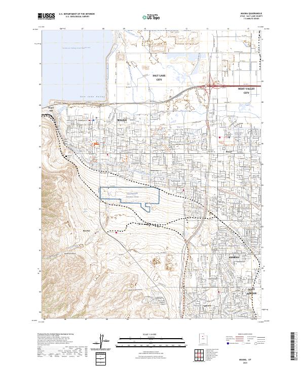 2023 Magna2023 Print · USGSThe western edge of the Salt Lake Valley is captured here during a period of significant suburban expansion and industrial persistence. Genealogists and local historians can locate Pleasant Green Cem and trace the influence of the Magna Mill and the historic Utah and Salt Lake Canal across the landscape.
 - 2023 Map of Salt Lake City South, 2023 Print
 2023 Salt Lake City South2023 Print · USGSThe Salt Lake Valley in the early 2020s shows a landscape defined by its historic canal systems and rapid urban growth. Researchers can trace local landmarks from South Valley Regional Airport to the campus of SLCC and the grounds of Redwood Memorial Cem.
End of results
Showing maps 1-4 of 4
Top cities near Kearns
- Salt Lake City historical maps
- West Valley City historical maps
- West Jordan historical maps
- Sandy historical maps
- Lehi historical maps
- South Jordan historical maps
See more
Top neighborhoods of Kearns
- Linford Acres historical maps
- Park Wood historical maps
- Walnut Hills historical maps
- Westview Terrace historical maps
- Creekview historical maps
- Hoffman Heights historical maps
See more
Frequently asked questions
- What are the different types of historical maps available for Kearns?
- What is the oldest map of Kearns?
- Where can I purchase historical maps of Kearns for my home or office?
- Where can I download high-res historical maps of Kearns?
- Are there historical topographic maps available for Kearns?
- Is there historical aerial imagery available for Kearns?
- Where are historical maps of Kearns sourced from?