Old Maps of Riverton, Utah for Metal Detecting
Plan your next treasure hunt with 30 historic maps of Riverton. Find old homesites, ghost towns, trails, and gathering spots that may be lost to time — perfect for identifying promising metal detecting locations.
- Locate forgotten sites: Uncover places like long-lost settlements, abandoned rail lines, or gathering spots.
- Plan better hunts: Use map overlays combined with LiDAR or satellite views to narrow in on historically rich areas.
- Made for detectorists: Thousands of hobbyists use these maps to discover relics, coins, and hidden history.
Use these historic maps to boost your research and find new opportunities beneath the surface of Riverton.
Riverton, UT maps
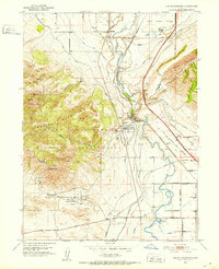
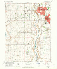
(30)- 1885 Map of Salt Lake
 1885 Salt Lake1885 Print · USGSThe Wasatch Front and surrounding high valleys appear here in the mid-1880s during a period of rapid mining and rail expansion. Genealogists and historians can trace early town sites and mining camps including Alta, Silver City, and the military grounds of Fort Douglass.7 unique versions available
 - 1885 Map of Tooele Valley
 1885 Tooele Valley1885 Print · USGSThe valleys and ranges west of the Wasatch are captured here in the mid-1880s, showcasing the early mining and rail infrastructure of the region. Genealogists can trace early settlements like Grantsville, Ophir, and Stockton, or the route of the Utah and Nevada R. R.6 unique versions available
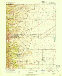
 - 1915 Map of Fairfield, 1957 Print
 1915 Fairfield1957 Print · USGSThe Oquirrh Mountains and Cedar Valley come alive in this early twentieth-century survey of Utah's mining and military landscapes. Genealogists and historians can trace rail stops at Fairfield Sta, mining claims at Queen Mine, and the National Cemetery.
 - 1917 Map of Fairfield
 1917 Fairfield1917 Print · USGSThe Oquirrh Mountains and Cedar Valley appear here just before the close of the first World War. Genealogists and industrial historians can trace the mining networks of Ophir, Mercur, and the Chloride Point Mine alongside the early Fairfield settlement.2 unique versions available
 - 1925 Map of Ft. Douglas
 1925 Ft. Douglas1925 Print · USGSThe Wasatch Range in the mid-1920s shows a landscape of mining camps and early mountain tourism. Genealogists and researchers can trace the old paths of the Lincoln Highway and locate vanished stops like Gogorza, Kimballs, and the Pacific Mine.
 - 1928 Map of Ft. Douglas
 1928 Ft. Douglas1928 Print · USGSIn the mid-1920s, the high country east of Salt Lake was a hive of mining and early canyon tourism. Trace old claim sites like the Pacific Mine or visit early retreats such as Pinecrest Inn and the YWCA Camp during the mining era.2 unique versions available
 - 1951 Map of Jordan Narrows, 1952 Print
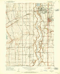
 1951 Jordan Narrows1952 Print · USGSThe Jordan River valley at the Salt Lake and Utah County border was a hub of irrigation and rail in the early fifties. Genealogists and local historians can trace the foundations of Bluffdale, the boundaries of Camp Williams, and the site of the Utah State Prison.6 unique versions available
 - 1951 Map of Midvale, 1953 Print
 1951 Midvale1953 Print · USGSThe Salt Lake Valley in the early fifties shows a landscape of busy rail corridors and irrigation canals before the onset of modern suburban sprawl. Trace the industrial heritage of the Sugar Factory or locate family roots near Jordan High Sch and the Midvale rail sidings.
 - 1952 Map of Lark, 1954 Print
 1952 Lark1954 Print · USGSThe mining and farming communities of the Oquirrh foothills are captured here in the early fifties, documenting the height of the regional copper era. Local researchers can trace family landmarks like Bingham High Sch, the Herriman Cem, and several named mine portals including the Butterfield Tunnel.5 unique versions available
 - 1953 Map of Tooele, 1968 Print
 1953 Tooele1968 Print · USGSTooele County is shown here in the 1950s, a vast landscape transitioning between the industrial growth of the Salt Lake Valley and isolated military testing grounds. Researchers can trace the routes of the Western Pacific railroad and locate historic outposts like Iosepa Ranch and St John Station.3 unique versions available
 - 1954 Map of Tickville Spring, 1956 Print
 1954 Tickville Spring1956 Print · USGSThe border of Salt Lake and Utah Counties in the mid-1950s was defined by large-scale land management and natural terrain. Genealogists and historians can trace old water systems and access routes like the Cedar Fort Ditch, Butterfield Tunnel, and Tickville Spring.4 unique versions available
 - 1954 Map of Salt Lake City, 1964 Print
 1954 Salt Lake City1964 Print · USGSThe Wasatch Front and Uinta Mountains are captured here in the mid-fifties, showing the industrial heart of Utah and its high mountain wilderness. Researchers can locate vanished infrastructure and landmarks like the Geneva Steel Plant, Bingham Canyon Mine, and the Utah State Prison.4 unique versions available
 - 1955 Map of Tooele, 1958 Print
 1955 Tooele1958 Print · USGSTooele County and the Great Salt Lake are captured here during the mid-fifties, an era of burgeoning military testing and industrial mining. Researchers can trace the rail sidings at Salduro Station, the grounds of the Deseret Chemical Corps Depot, and the International Smelting Co facilities.3 unique versions available
 - 1958 Map of Salt Lake City
 1958 Salt Lake City1958 Print · USGSThe Wasatch Front and Uinta Basin are captured during a period of significant post-war growth and industrial development. Researchers can trace the mid-century rail lines of the Bamberger RR and locate sites like the Kiegley Limestone Quarry and Camp Williams Military Reservation.
 - 1960 Map of Salt Lake City
 1960 Salt Lake City1960 Print · USGSThe Wasatch Front and High Uintas are captured mid-century as the Salt Lake Valley underwent significant postwar expansion. Genealogists and historians can trace rail lines like the Union Pacific and locate established landmarks such as Fort Douglas, Camp Williams, and the Bingham Canyon Mine.
 - 1963 Map of Midvale, 1964 Print
 1963 Midvale1964 Print · USGSThe Salt Lake Valley undergoes a mid-century transformation as suburban growth reaches into agricultural corridors along the Jordan River. Genealogists and historians can trace family plots at Wite Fort Cem or study the industrial rail infrastructure serving the Sugar Refinery.3 unique versions available
 - 1979 Map of Rush Valley
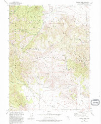
 1979 Rush Valley1979 Print · USGSTooele and Utah Counties during the late seventies reveal a unique transition from historic mining and ranching to modern military operations. Researchers can trace the Union Pacific Railroad past historic sites like Fairfield and mining camps such as Ophir.2 unique versions available
 - 1979 Map of Tooele, 1980 Print
 1979 Tooele1980 Print · USGSTooele and the eastern Oquirrh foothills appear here in the late seventies, showing a landscape defined by massive industrial works and military sites. Researchers can trace the rail corridors of the Western Pacific or locate the historic Monarch Mine and the vast Open Pit Mine near Bingham.
 - 1980 Map of Salt Lake City
 1980 Salt Lake City1980 Print · USGSSalt Lake City and the surrounding Wasatch Range are shown in the early eighties during a period of rapid suburban growth. Genealogists and historians can trace old mining operations like the Ontario Mine and Wasatch Mine or follow the path of the Union Pacific through the canyons.3 unique versions available
 - 1986 Map of Provo
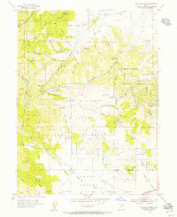
 1986 Provo1986 Print · USGSThe Utah Valley during the mid-eighties shows a bustling corridor of growth between the mountains and Utah Lake. Genealogists and historians can trace the rail lines of the Union Pacific RR through settlements like Springville, Spanish Fork, and Payson.
 - 1993 Map of Jordan Narrows
 1993 Jordan Narrows1993 Print · USGSSalt Lake County in the early 1990s shows a unique convergence of heavy infrastructure and frontier history near the Jordan Narrows. Researchers can locate the Rockwell Station Pony Express Historical Marker, the Camp Williams grounds, and the Bluffdale Cemetery.
 - 1993 Map of Tickville Spring
 1993 Tickville Spring1993 Print · USGSThe Oquirrh and Traverse Mountains meet in the 1990s at the Camp Williams State Military Reservation. Researchers can trace old mining prospects, the Butterfield Tunnel, and county lines near Tickville Spring and Step Mtn.2 unique versions available
 - 1997 Map of Tickville Spring, 2001 Print
 1997 Tickville Spring2001 Print · USGSThe foothills of the Oquirrh Mountains meet the military landscape of the late nineties, showing the transition from public parks to restricted ranges. Trace the boundaries of Camp Williams and locate family landmarks like Tickville Spring and Shaggy Peak.
 - 1999 Map of Copperton, 2001 Print
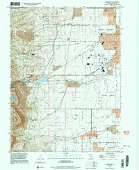 1999 Copperton2001 Print · USGSThe southwestern Salt Lake Valley was rapidly suburbanizing at the end of the century, even as the massive copper operations remained active. Genealogists and local historians can trace the early footprints of Herriman and Copperton, locating sites like the Bingham City Cem and Fort Herriman Historical Marker.
 - 1999 Map of Jordan Narrows, 2001 Print
 1999 Jordan Narrows2001 Print · USGSThe Jordan Narrows area at the turn of the millennium shows a landscape defined by military training and massive water infrastructure. Trace local history at the Bluffdale City Cemetery or follow the Old Railroad Grade near Camp Williams.
Showing maps 1-25 of 30
Top cities near Riverton
- Salt Lake City historical maps
- West Valley City historical maps
- West Jordan historical maps
- Orem historical maps
- Sandy historical maps
- Lehi historical maps
See more
Top neighborhoods of Riverton
- D and D Ideal Acres historical maps
- Freeman Butterfield historical maps
- Country Lane historical maps
- Hamilton Acres historical maps
- Mountain View Subdivision Number 10 historical maps
- Mountain View Subdivision Number 11 historical maps
See more
Frequently asked questions
- What are the different types of historical maps available for Riverton?
- What is the oldest map of Riverton?
- Where can I purchase historical maps of Riverton for my home or office?
- Where can I download high-res historical maps of Riverton?
- Are there historical topographic maps available for Riverton?
- Is there historical aerial imagery available for Riverton?
- Where are historical maps of Riverton sourced from?