Old Maps of Alpine, Utah for Genealogy
Trace your family roots with 23 historic maps of Alpine. These high-res maps reveal old neighborhoods, homesites, landmarks, and streets — helping you uncover where your ancestors lived and how the area evolved over time.
- Explore historic neighborhoods: Identify where your relatives may have lived in the 1800s or 1900s.
- Compare maps over time: Trace the changes in streets, buildings, and landmarks for multi-generational research.
- Perfect for genealogy & ancestry research: Used by family historians and researchers to map out lineage and migration.
These maps are an incredible resource for exploring your personal connection to Alpine's past.
Alpine, UT maps
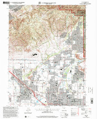
(23)- 1885 Map of Salt Lake
 1885 Salt Lake1885 Print · USGSThe Wasatch Front and surrounding high valleys appear here in the mid-1880s during a period of rapid mining and rail expansion. Genealogists and historians can trace early town sites and mining camps including Alta, Silver City, and the military grounds of Fort Douglass.7 unique versions available
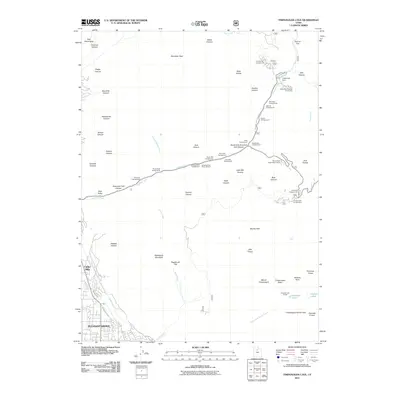
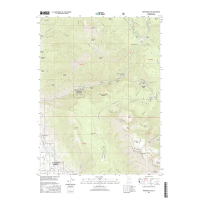
 - 1948 Map of Timpanogos Cave, 1957 Print
 1948 Timpanogos Cave1957 Print · USGSThe Wasatch peaks and deep canyons above Pleasant Grove were being actively managed for both water and recreation in the late 1940s. Genealogists and hikers can trace historic routes like the Alpine Scenic Highway and find landmark sites like Mutual Dell and the Timpooneke Guard Sta.4 unique versions available
 - 1948 Map of Orem, 1959 Print
 1948 Orem1959 Print · USGSThe Utah Valley at the end of the 1940s showcases a unique blend of heavy industry and high-mountain wilderness. Local historians can trace the development of Orem and Pleasant Grove or locate the Steel Plant and Lincoln Jr HS near Utah Lake.2 unique versions available
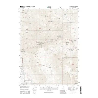
 - 1950 Map of Timpanogos Cave
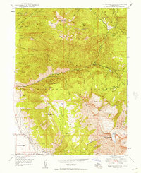
 1950 Timpanogos Cave1950 Print · USGSThe high Wasatch Range comes into sharp focus during the mid-twentieth century, centered on the dramatic American Fork Canyon. Geologists and local historians can trace early mountain infrastructure including the Salt Lake City Aqueduct, Mutual Dell, and Timpooneke Guard Sta.
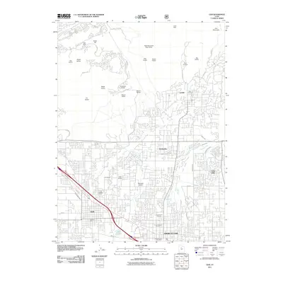
 - 1951 Map of Lehi, 1953 Print
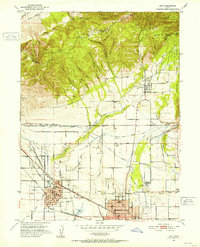 1951 Lehi1953 Print · USGSThe northern Utah County valley in the early fifties reveals a landscape of expanding towns and intricate irrigation. Genealogists can trace family sites from Lehi to Alpine, including the American Fk Training Sch and the Pioneer Mem Cem.5 unique versions available
 - 1954 Map of Salt Lake City, 1964 Print
 1954 Salt Lake City1964 Print · USGSThe Wasatch Front and Uinta Mountains are captured here in the mid-fifties, showing the industrial heart of Utah and its high mountain wilderness. Researchers can locate vanished infrastructure and landmarks like the Geneva Steel Plant, Bingham Canyon Mine, and the Utah State Prison.4 unique versions available
 - 1958 Map of Salt Lake City
 1958 Salt Lake City1958 Print · USGSThe Wasatch Front and Uinta Basin are captured during a period of significant post-war growth and industrial development. Researchers can trace the mid-century rail lines of the Bamberger RR and locate sites like the Kiegley Limestone Quarry and Camp Williams Military Reservation.
 - 1960 Map of Salt Lake City
 1960 Salt Lake City1960 Print · USGSThe Wasatch Front and High Uintas are captured mid-century as the Salt Lake Valley underwent significant postwar expansion. Genealogists and historians can trace rail lines like the Union Pacific and locate established landmarks such as Fort Douglas, Camp Williams, and the Bingham Canyon Mine.
 - 1986 Map of Provo
 1986 Provo1986 Print · USGSThe Utah Valley during the mid-eighties shows a bustling corridor of growth between the mountains and Utah Lake. Genealogists and historians can trace the rail lines of the Union Pacific RR through settlements like Springville, Spanish Fork, and Payson.
 - 1993 Map of Timpanogos Cave
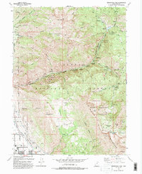 1993 Timpanogos Cave1993 Print · USGSThe foothills of the Wasatch Range come alive in the early nineties as residential growth in Pleasant Grove and Cedar Hills reaches toward the canyon mouths. Researchers can trace the path of the Salt Lake City Aqueduct or find mountain landmarks like Emerald Lake and Timpanogos Cave National Monument.2 unique versions available
 - 1994 Map of Lehi
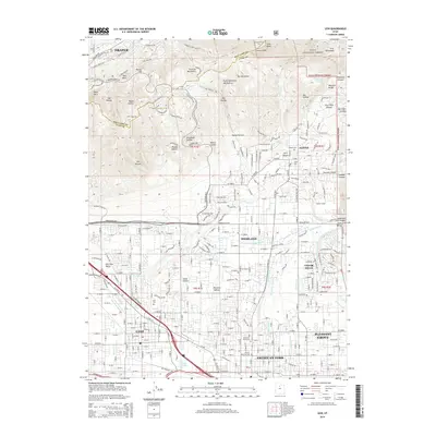
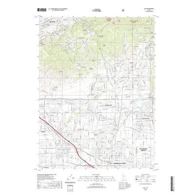
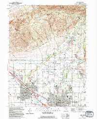 1994 Lehi1994 Print · USGSIn the mid-1990s, the northern Utah Valley was a landscape of expanding towns and complex irrigation. Genealogists and local historians can trace the foundations of Lehi and Alpine, locating landmarks like Lehi Cem and the Utah State Training School.
 - 1998 Map of Lehi, 2000 Print
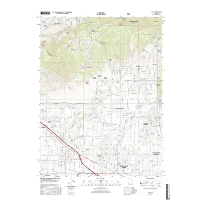
 1998 Lehi2000 Print · USGSNorthern Utah Valley undergoes a period of rapid suburban growth in the late nineties as residential borders expand toward the mountains. Genealogists and local historians can trace family plots in the Lehi Cem or locate community hubs like Sego Lily Sch and the Utah State Developmental Center.
 - 1998 Map of Timpanogos Cave, 2000 Print
 1998 Timpanogos Cave2000 Print · USGSIn the late 1990s, the northern Utah County foothills show a landscape of high-alpine wilderness meeting rapid suburban growth. Trace the wild terrain of Mount Timpanogos alongside developed landmarks like the Jordan Aqueduct and Pleasant Grove.
 - 2011 Map of Timpanogos Cave, 2011 Print
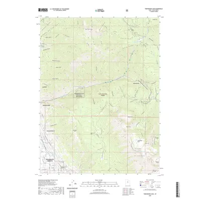
 2011 Timpanogos Cave2011 Print · USGSCovers Alpine, including Pleasant Grove, Highland, and other nearby areas
 - 2011 Map of Lehi, 2011 Print
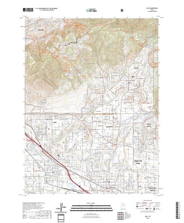
 2011 Lehi2011 Print · USGSCovers Alpine, including Lehi, Draper, and other nearby areas
 - 2014 Map of Timpanogos Cave, 2014 Print
 2014 Timpanogos Cave2014 Print · USGSCovers Alpine, including Pleasant Grove, Highland, and other nearby areas
 - 2014 Map of Lehi, 2014 Print
 2014 Lehi2014 Print · USGSCovers Alpine, including Lehi, Draper, and other nearby areas
 - 2017 Map of Lehi, 2017 Print
 2017 Lehi2017 Print · USGSCovers Alpine, including Lehi, Draper, and other nearby areas
 - 2017 Map of Timpanogos Cave, 2017 Print
 2017 Timpanogos Cave2017 Print · USGSCovers Alpine, including Pleasant Grove, Highland, and other nearby areas
 - 2020 Map of Lehi, 2020 Print
 2020 Lehi2020 Print · USGSCovers Alpine, including Lehi, Draper, and other nearby areas
 - 2020 Map of Timpanogos Cave, 2020 Print
 2020 Timpanogos Cave2020 Print · USGSCovers Alpine, including Pleasant Grove, Highland, and other nearby areas
 - 2023 Map of Lehi, 2023 Print
 2023 Lehi2023 Print · USGSThe northern Utah Valley comes into focus in the early 2020s, showing the intersection of suburban expansion and historic irrigation. Trace family connections at the Lehi City Cem or follow the path of the Murdock Canal and Bull River Ditch.
 - 2023 Map of Timpanogos Cave, 2023 Print
 2023 Timpanogos Cave2023 Print · USGSNorthern Utah County as it appeared recently, where valley settlements give way to the Wasatch high country. Trace the path of the Alpine Scenic Highway through American Fork Canyon to the Timpanogos Cave National Monument.
End of results
Showing maps 1-23 of 23
Top cities near Alpine
- West Valley City historical maps
- West Jordan historical maps
- Provo historical maps
- Orem historical maps
- Sandy historical maps
- Lehi historical maps
See more
Frequently asked questions
- What are the different types of historical maps available for Alpine?
- What is the oldest map of Alpine?
- Where can I purchase historical maps of Alpine for my home or office?
- Where can I download high-res historical maps of Alpine?
- Are there historical topographic maps available for Alpine?
- Is there historical aerial imagery available for Alpine?
- Where are historical maps of Alpine sourced from?