1990s Maps of White Hills, Eagle Mountain
Explore 2 historic maps of White Hills from the 1990s. These maps offer a rare glimpse into what life looked like during the 1990s — showing old roads, neighborhoods, homes, and landmarks that have changed or disappeared over time.
Whether you're researching your family's past, planning a metal detecting trip, or studying how White Hills's landscape evolved across the 1990s, these high-resolution maps are a powerful tool for exploring the history of this region.
- Focus on a specific era: All maps on this page are from the 1990s, giving you a focused view of this time period.
- See what’s changed: Compare century-old streets, trails, and buildings to today's modern landscape using overlays and satellite layers.
- Research with precision: Use these maps for genealogy, historical research, land use analysis, or educational projects.
- View, download, or print: Maps are fully viewable online in high resolution, and can be downloaded or printed for your own records.
Start exploring White Hills's history through authentic maps from the 1990s. This is your window into the past.
White Hills, Eagle Mountain maps
(2)- 1993 Map of Cedar Fort
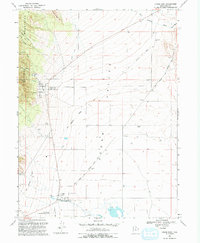 1993 Cedar Fort1993 Print · USGSCedar Valley is shown here in the late twentieth century, preserved as a corridor of frontier transportation and military history. Genealogists and historians can trace the Pony Express and Overland Stage Route through Fairfield and locate the historic Stage Coach Inn.
 - 1997 Map of Cedar Fort, 2001 Print
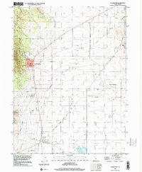 1997 Cedar Fort2001 Print · USGSCedar Valley and the Oquirrh Mountains foothills are captured in the late nineties as modern residential growth begins to meet deep pioneer history. You can trace the Historic Pony Express National Trail through Fairfield or locate the old Camp Floyd State Historical Site.
End of results
Showing maps 1-2 of 2
Frequently asked questions
- What are the different types of historical maps available for White Hills?
- What is the oldest map of White Hills?
- Where can I purchase historical maps of White Hills for my home or office?
- Where can I download high-res historical maps of White Hills?
- Are there historical topographic maps available for White Hills?
- Is there historical aerial imagery available for White Hills?
- Where are historical maps of White Hills sourced from?