2000s (21st Century) Maps of Pines, Utah
Explore 6 historic maps of Pines from the 2000s (21st Century). These maps offer a rare glimpse into what life looked like during the 2000s — showing old roads, neighborhoods, homes, and landmarks that have changed or disappeared over time.
Whether you're researching your family's past, planning a metal detecting trip, or studying how Pines's landscape evolved across the 2000s, these high-resolution maps are a powerful tool for exploring the history of this region.
- Focus on a specific era: All maps on this page are from the 2000s, giving you a focused view of this time period.
- See what’s changed: Compare century-old streets, trails, and buildings to today's modern landscape using overlays and satellite layers.
- Research with precision: Use these maps for genealogy, historical research, land use analysis, or educational projects.
- View, download, or print: Maps are fully viewable online in high resolution, and can be downloaded or printed for your own records.
Start exploring Pines's history through authentic maps from the 2000s. This is your window into the past.
Pines, UT maps
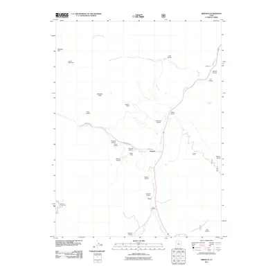
(6)- 2001 Map of Birdseye, 2004 Print
 2001 Birdseye2004 Print · USGSThe Thistle Creek valley in southern Utah County at the turn of the millennium shows a landscape of mountain forests and quiet settlements. Researchers can trace the industrial footprint of the Birdseye Quarry and Asphaltum (Site) or locate family landmarks like Nielsen Knoll.
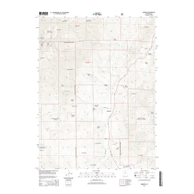
 - 2011 Map of Birdseye, 2011 Print
 2011 Birdseye2011 Print · USGSCovers Pines, including Birdseye, Utah County, and other nearby areas
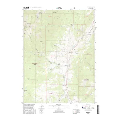
 - 2014 Map of Birdseye, 2014 Print
 2014 Birdseye2014 Print · USGSCovers Pines, including Birdseye, Utah County, and other nearby areas
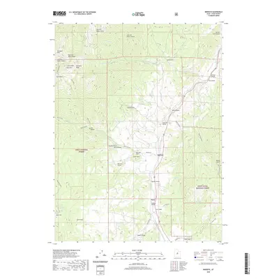
 - 2017 Map of Birdseye, 2017 Print
 2017 Birdseye2017 Print · USGSCovers Pines, including Birdseye, Utah County, and other nearby areas
 - 2020 Map of Birdseye, 2020 Print
 2020 Birdseye2020 Print · USGSCovers Pines, including Birdseye, Utah County, and other nearby areas
 - 2023 Map of Birdseye, 2023 Print
 2023 Birdseye2023 Print · USGSThe high Wasatch Range backcountry comes into focus here in the 2020s, centered on the valley corridor of Thistle Creek. Researchers can trace the rugged boundaries of the Uinta National Forest and locate specific sites like Birdseye, Pines, and the high-elevation Soap Flat.
End of results
Showing maps 1-6 of 6
Top cities near Pines
- Spanish Fork historical maps
- Payson historical maps
- Mapleton historical maps
- Salem historical maps
- Elk Ridge historical maps
- Woodland Hills historical maps
Frequently asked questions
- What are the different types of historical maps available for Pines?
- What is the oldest map of Pines?
- Where can I purchase historical maps of Pines for my home or office?
- Where can I download high-res historical maps of Pines?
- Are there historical topographic maps available for Pines?
- Is there historical aerial imagery available for Pines?
- Where are historical maps of Pines sourced from?